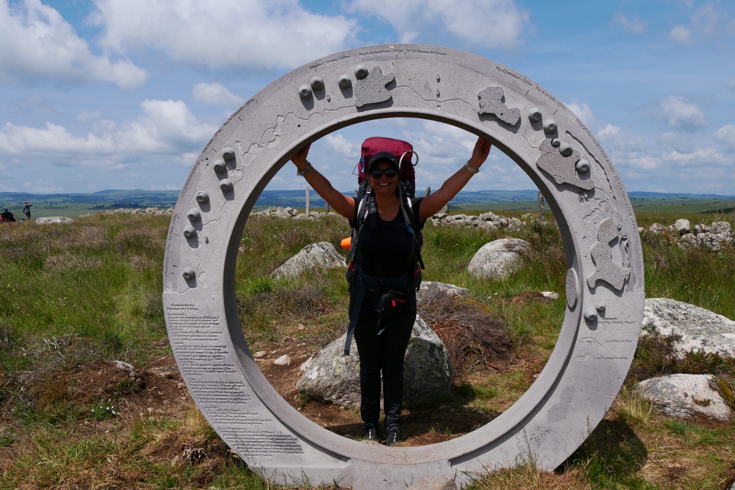
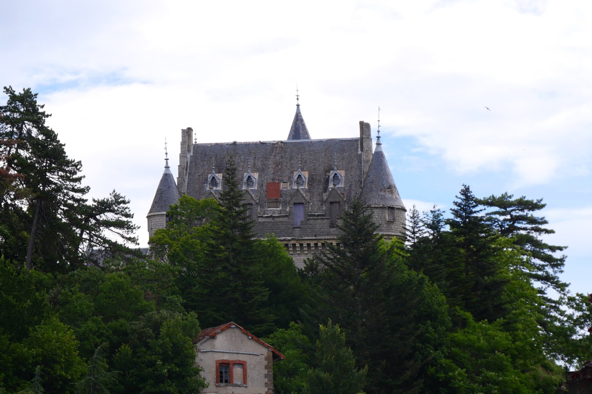
The Saint-Guilhem Trek: 143 Miles Through Southern France

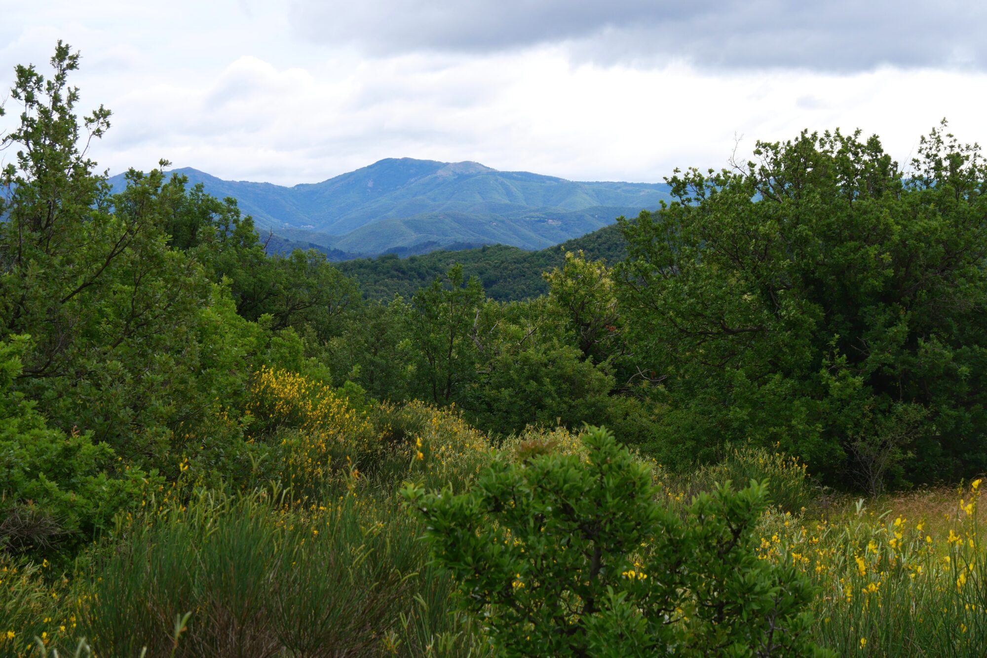
Like every year, we felt the urge (and the need) to go on a trek. After our first experience with a “long-distance” hike on the Itinérêve trail in Dordogne, we were eager to try something similar again. That’s how I came across the Saint-Guilhem Trail — a 149-mile route between Aumont-Aubrac and Saint-Guilhem-le-Désert. It looked lightly traveled and passed through beautiful, varied landscapes.
After doing some research, I started planning our route, fully aware there would probably be some surprises or changes along the way — as is always the case with trekking — and luckily, there were 😉 !

- Avant le départ
- J1: Aumont-Aubrac – Cascade du Déroc
- J2 Cascade du Déroc – Bois des Salces
- J3 Les Salces – Banassac
- J4 Banassac – Champerboux
- J5 Champerboux – Hures
- J6 Hures – Meyrueis
- J7 Meyrueis – Espérou
- J8 Espérou – Avèze
- J9 Avèze – Blandas
- J10 Blandas – La Vacquerie
- J11 (FIN) La Vacquerie – Saint-Guilhem-Le-Désert
- Alors, ce trek ?
- Infos pratiques
Before the Trek
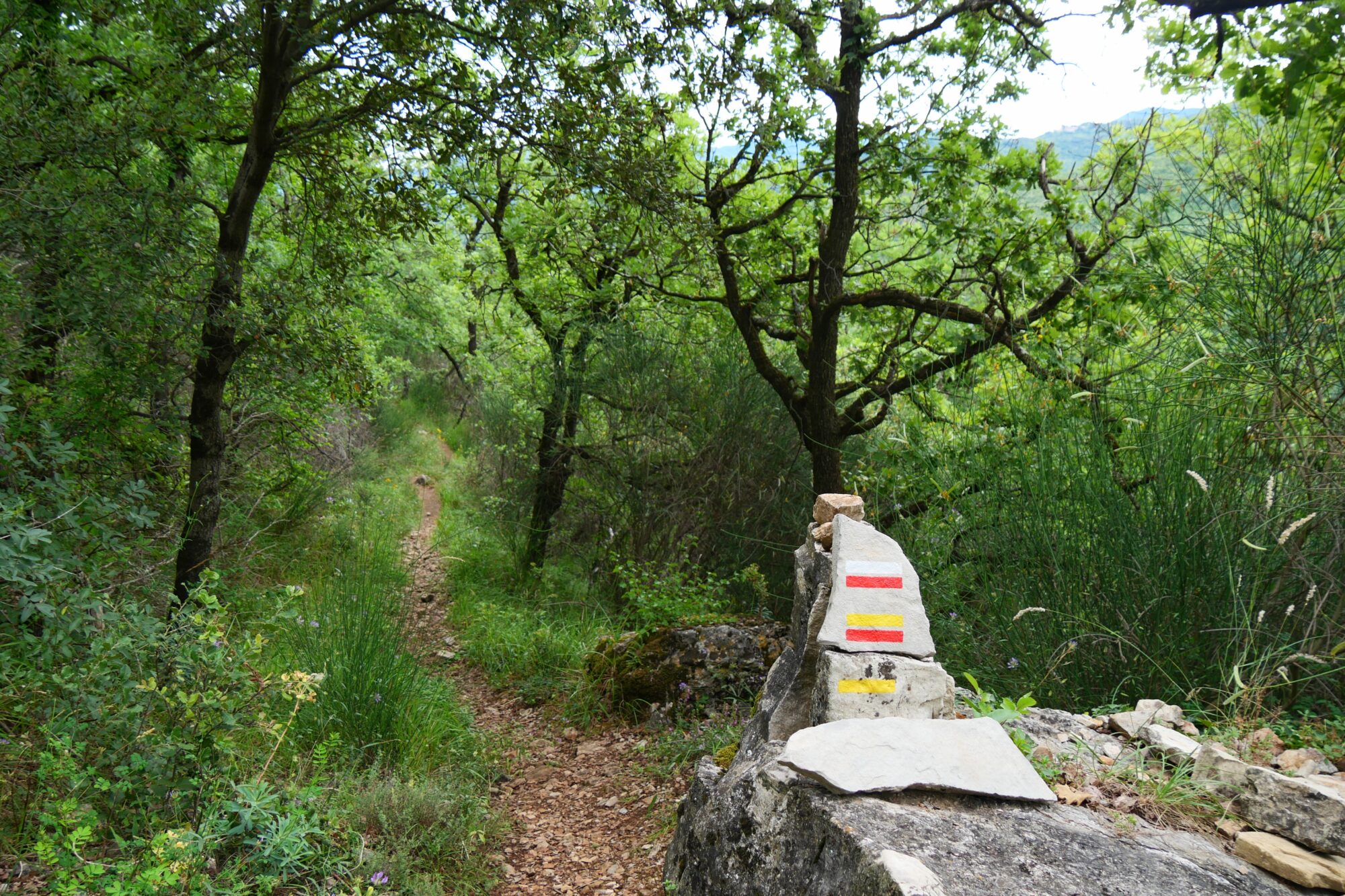
Même si un trek c’est beaucoup d’imprévus ça nécessite une bonne préparation en amont, surtout quand on bivouaque et qu’on porte un gros sac ! Pour ça, je suis allée sur le site internet du chemin et j’ai acheté le bouquin Topo-Guides de FFRandonnée. Ces livres sont bien faits mais ont un seul gros défaut ils ne donnent pas les dénivelés, ce qui a une énorme importance pour estimer la difficulté du trek et ainsi prévoir ses étapes. Je les ajoute donc en me servant, le plus souvent, des traces GPS en ligne.

Vert: variante prise – Jaune: variante possible
From there, I had to try to map out the stages to get an idea of how many days it would take, and therefore how much food we’d need and where we could resupply. It also helped to identify potential camping spots—especially since water can be scarce on this trail—and locate accommodations. Thanks to the Géonautrices website, I knew that camping wouldn’t be easy on this route due to limited water sources and tricky terrain (fences, rocks, etc.). So, I marked some municipal campgrounds and a mountain hut to keep things as simple as possible.
Halfway through, I planned a rest day as a reward and to recover 😊 just a short 9.3 miles walk and a night in a hotel 😉 !

Once the stages were roughly planned, all that was left was to prepare the food and pack the bagwhere everything was carefully weighed ! It might sound over the top, but after your first trek (and often the first mistake of carrying a pack that’s too heavy), you quickly realize that weight is one of the most important factors. With experience, we’ve equipped ourselves (and continue to do so) with quality, lightweight gear, check the practical info section for a detailed list.
So, we set off on June 23rd, aiming to arrive by July 3rd, 2023, to avoid the summer crowds and intense heat (which didn’t quite work out on the heat part 😉).
Day 1: Aumont-Aubrac – Cascade du Déroc

First day, first change 😉! We had planned to start the trek the evening before, after the drive, with about six miles to cover, but at the last minute, the weather forecast called for a big storm and heavy rain. So, we arrived the day before as planned but stayed at the Hôtel des Prunières in Aumont-Aubrac.
The next morning, after a good breakfast and surprised to see so many hikers passing by (the beginning of this trek shares the same route as the Camino de Santiago), we caught up on the miles we missed the day before by taking a shuttle arranged for the Camino hikers. It dropped us off at a spot called Les 4 Chemins, letting us skip about 5 miles.

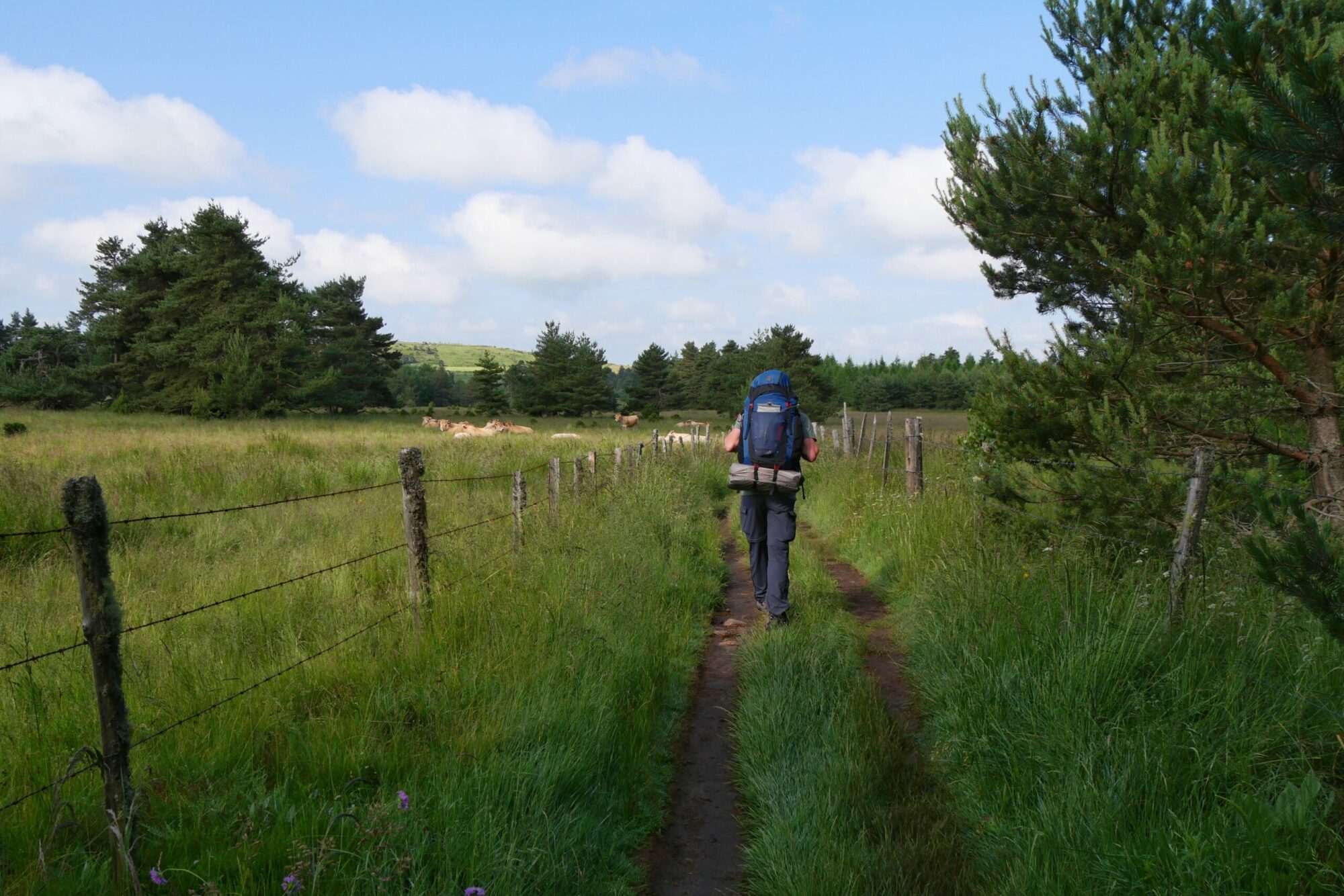
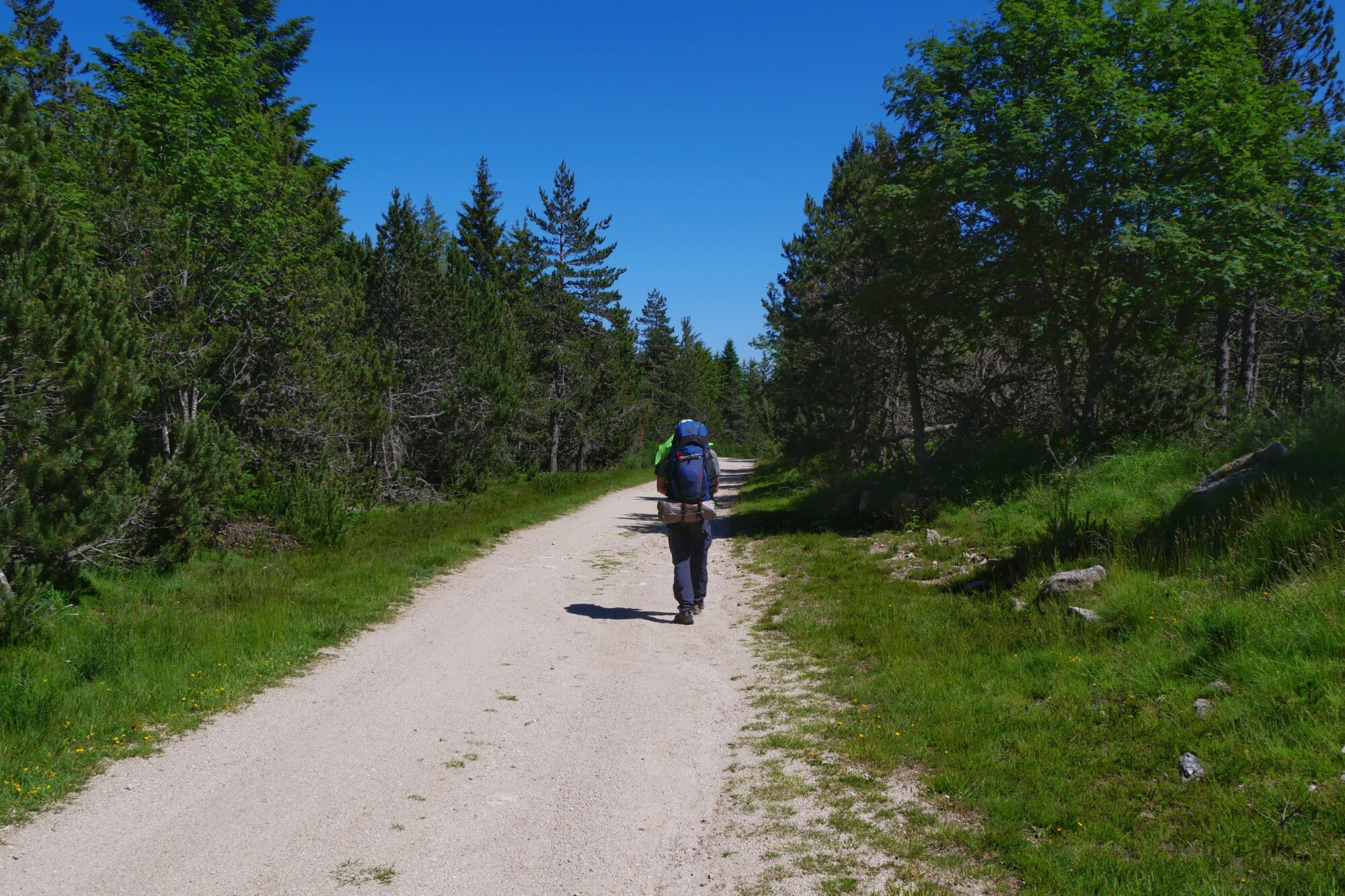
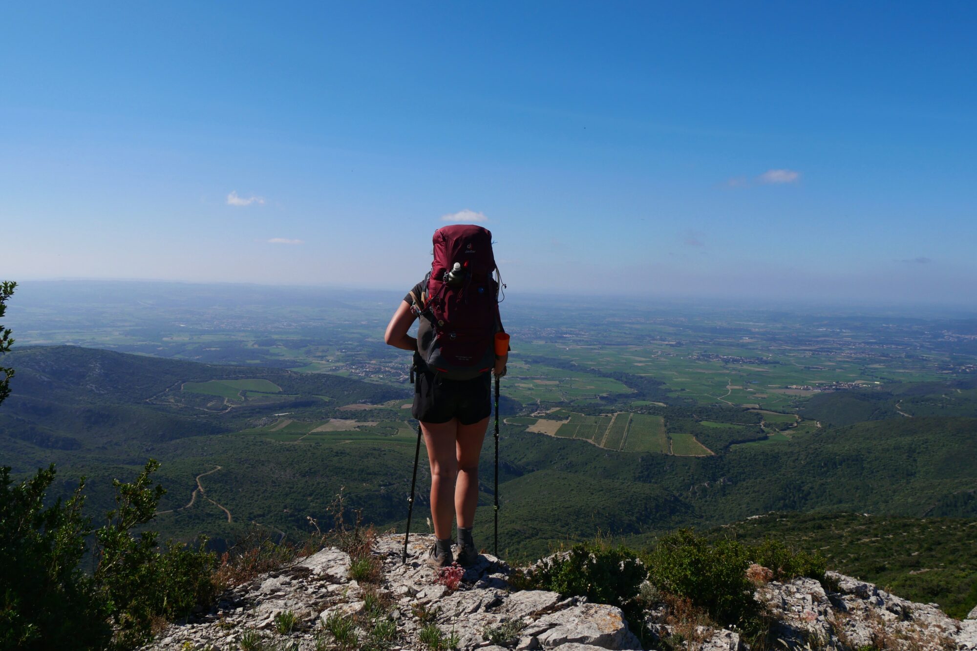
So we set off immediately feeling all the familiar sensations of carrying a heavy backpack, 13 kg for me and 15 kg for my partner. The relationship with your backpack on a trek is a bit like a rollercoaster between love and hate 😉 ! It is our home, we know it inside and out, everything has its place, and without it, we have nothing. At the same time, it is our biggest burden. But honestly, even though we are happy to take it off whenever we can, we really do love it because it becomes a true companion and you have to admit, today’s backpacks are pretty well made.

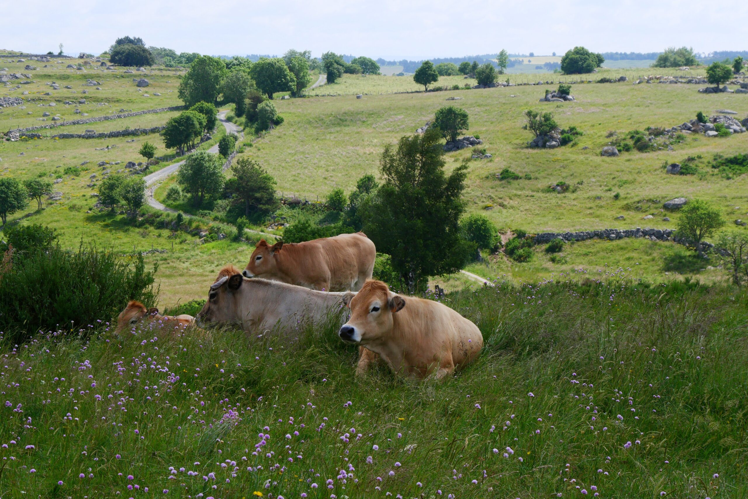
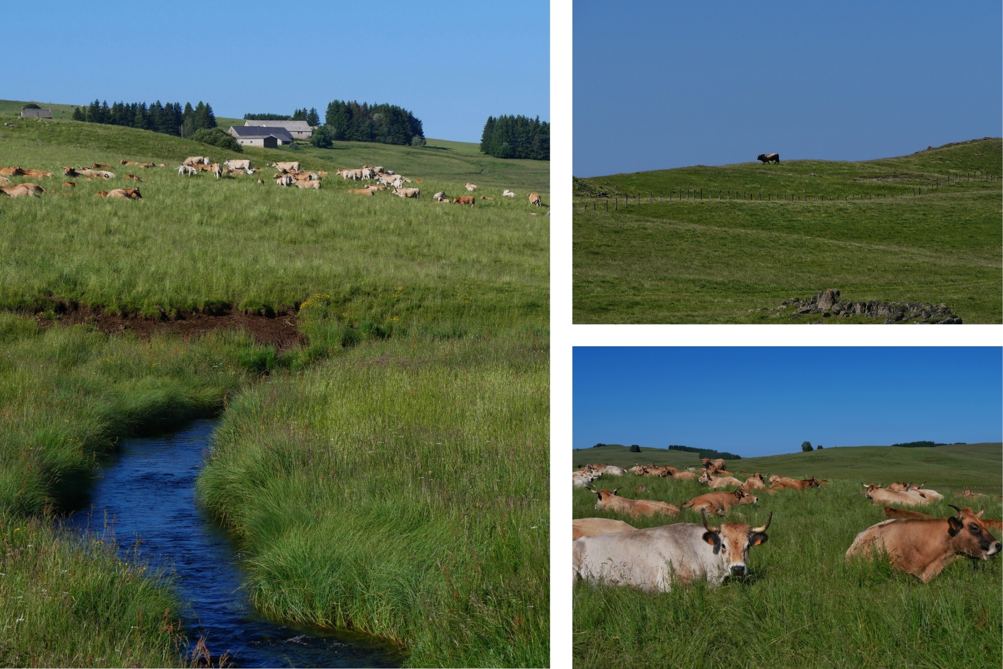
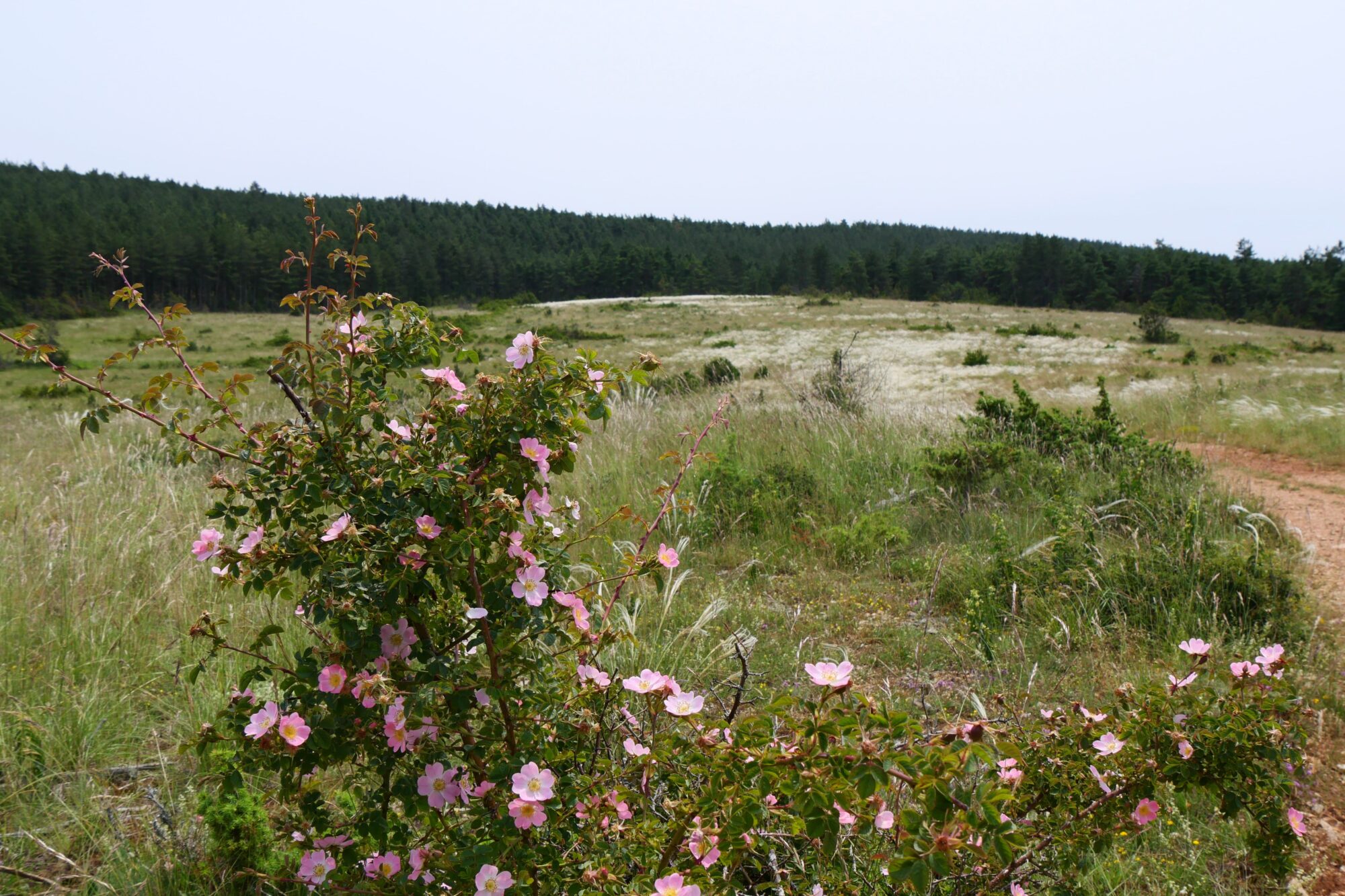
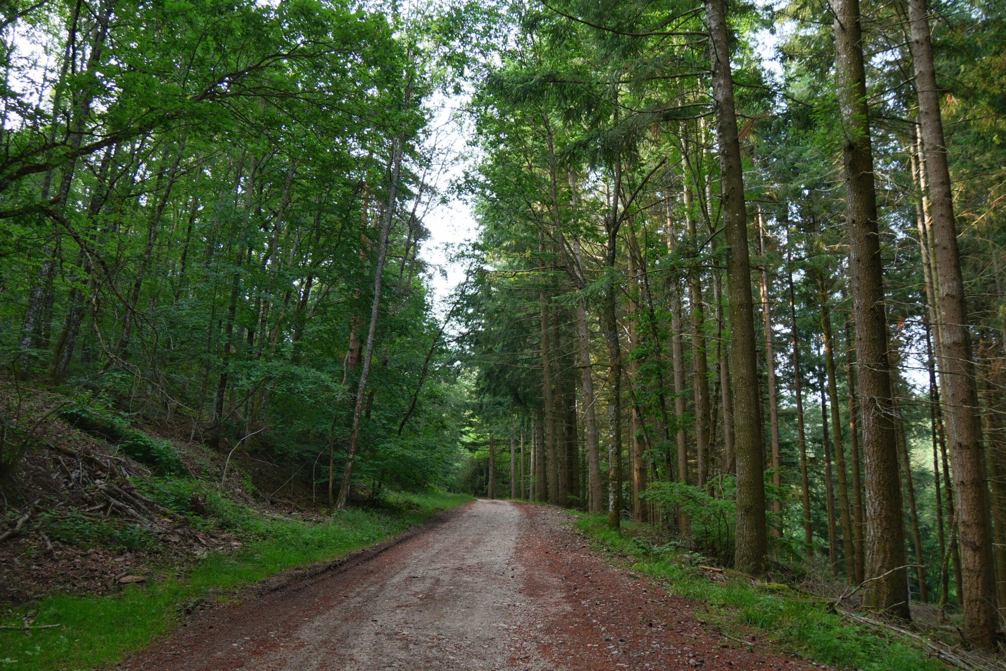
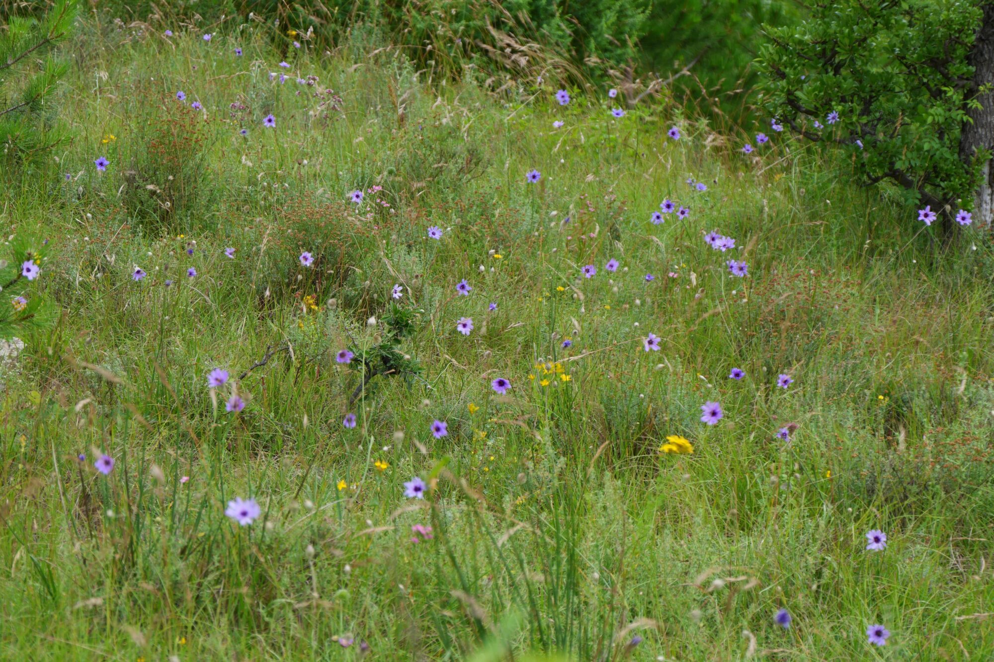
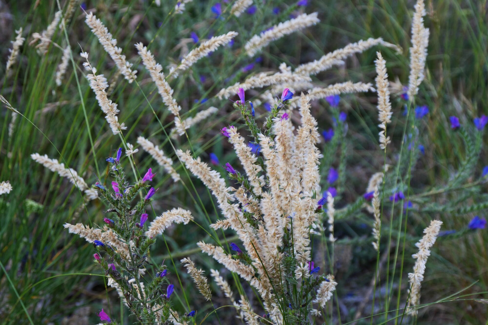
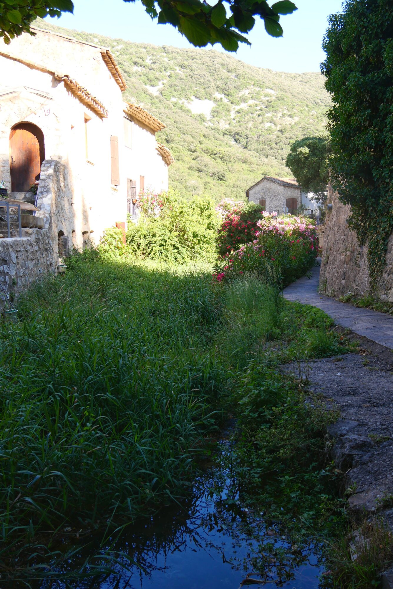
We started on a beautiful trail surrounded by flowers and cows 😉! I was amazed by the sheer number and variety of flowers, and little did I know this was just a preview of what was to come. For our lunch break, we aimed for the Marchastel bridge hoping to dip our feet in the water, but unfortunately, the river wasn’t accessible.

A little side note: over time, we noticed there’s nothing better than dipping our feet in cool water during breaks to almost reset them 😉. So we settled down halfway along the trail next to some cows. Our first picnic with our supplies: bread, saucisson, cheese, and chips!
After a short break (compared to the ones on the following days 😉), we set off again and took a beautiful trail that gained us some elevation amid the Aubrac plateaus.

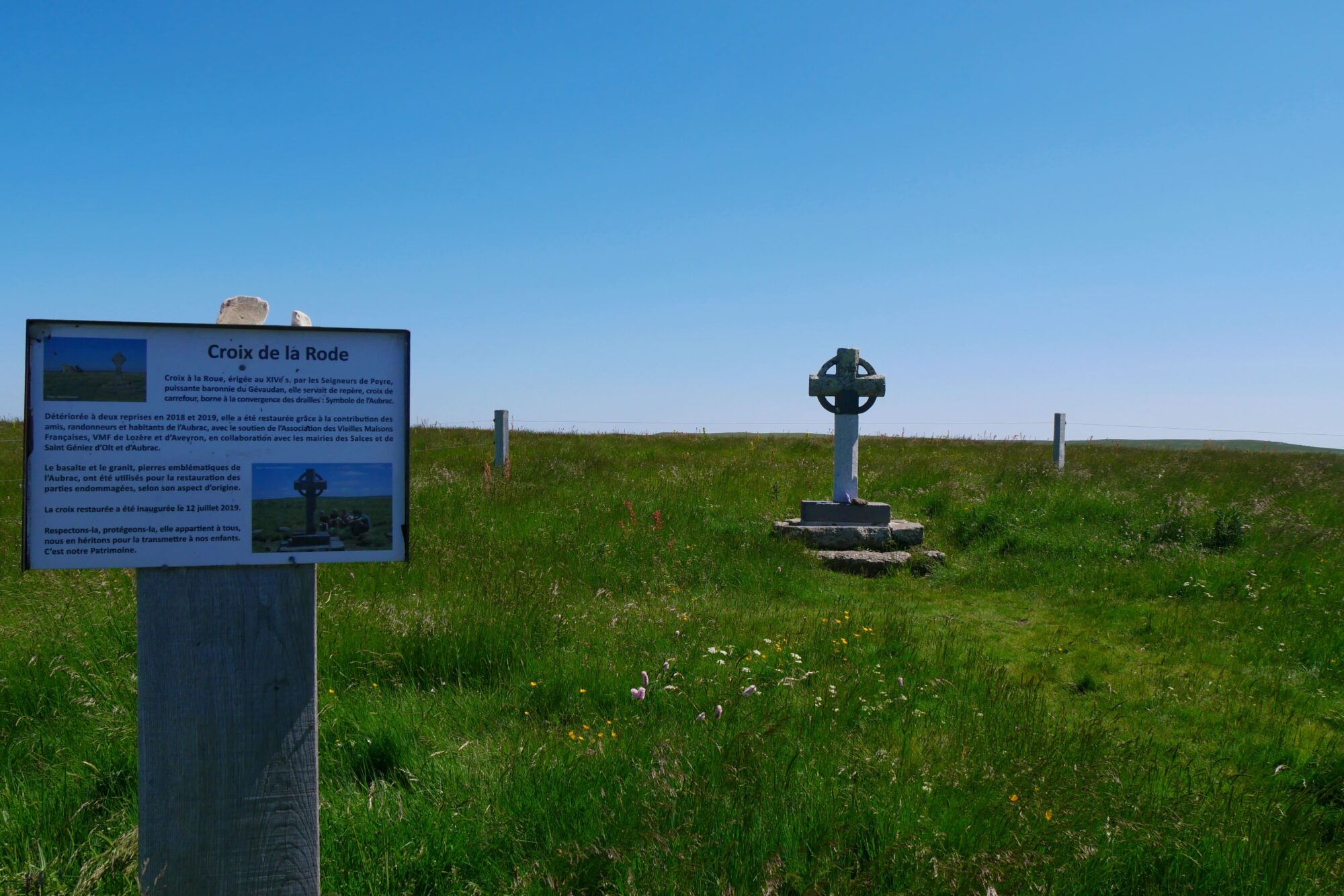
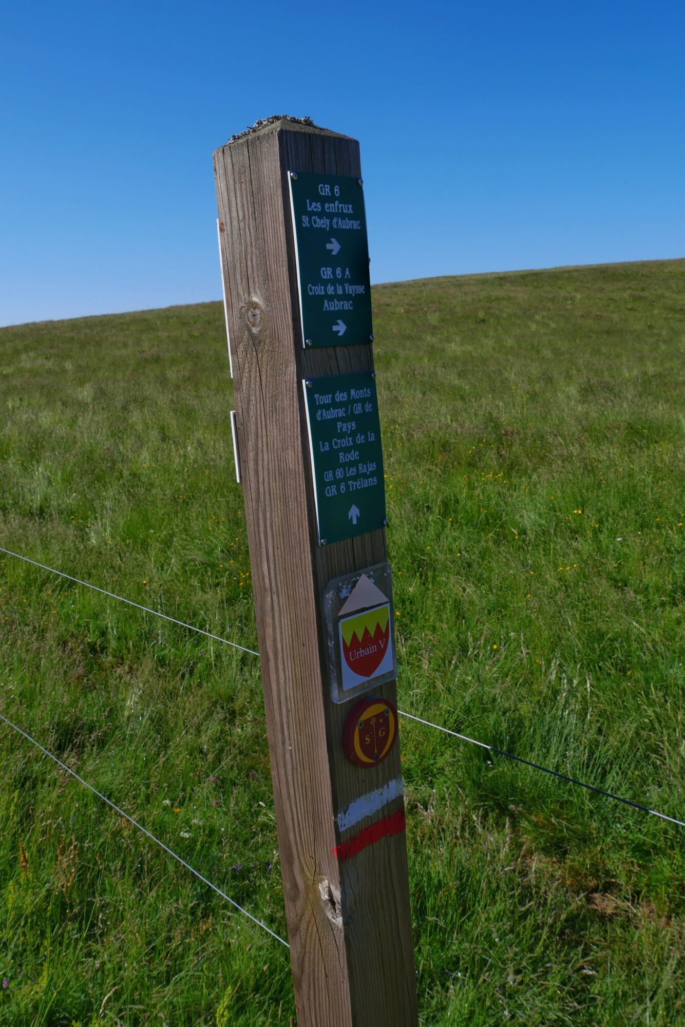
After 3 miles without any difficulties, we arrived in Nasbinals. There, we decided to leave the Saint-Guilhem trail and take the Urbain V route instead. This choice was motivated by two reasons: first, it saved us about 9.3 miles, and second, it would allow us to see the Déroc waterfall.

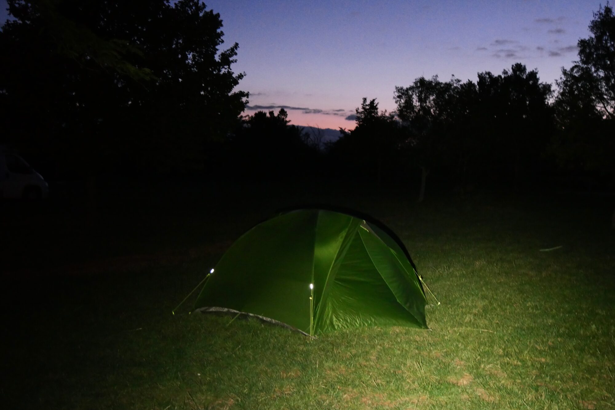
Since the beginning of the trek follows the Camino de Santiago, we had come across quite a few hikers, but from that point on, the trail became much wilder. We hesitated for a while about setting up our tent at the edge of a field before the waterfall, but in the end, we decided to push on and reach it.
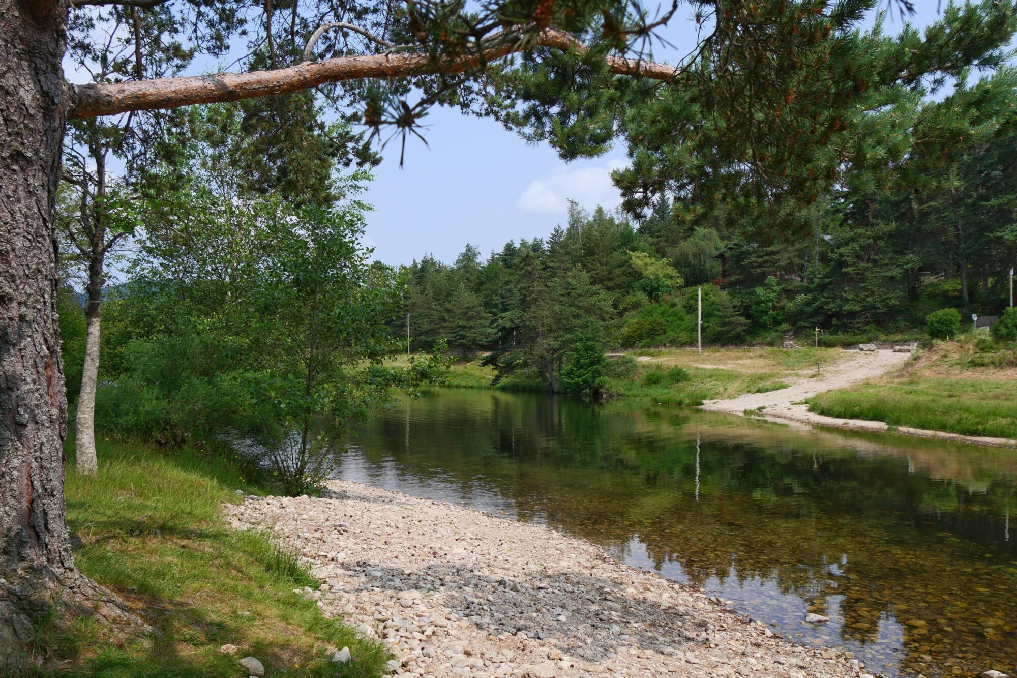
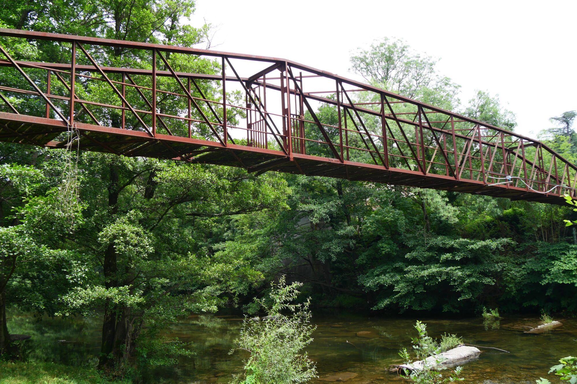
The waterfall is truly beautiful. The trail leading down is a bit rough, but once you get to the bottom, it is stunning. A small meadow, the river, and you can walk right up to the base of the falls where there are some really pretty rock formations. So we decided to camp here for the night, and since it was still early, we waited until nightfall to set up the tent.
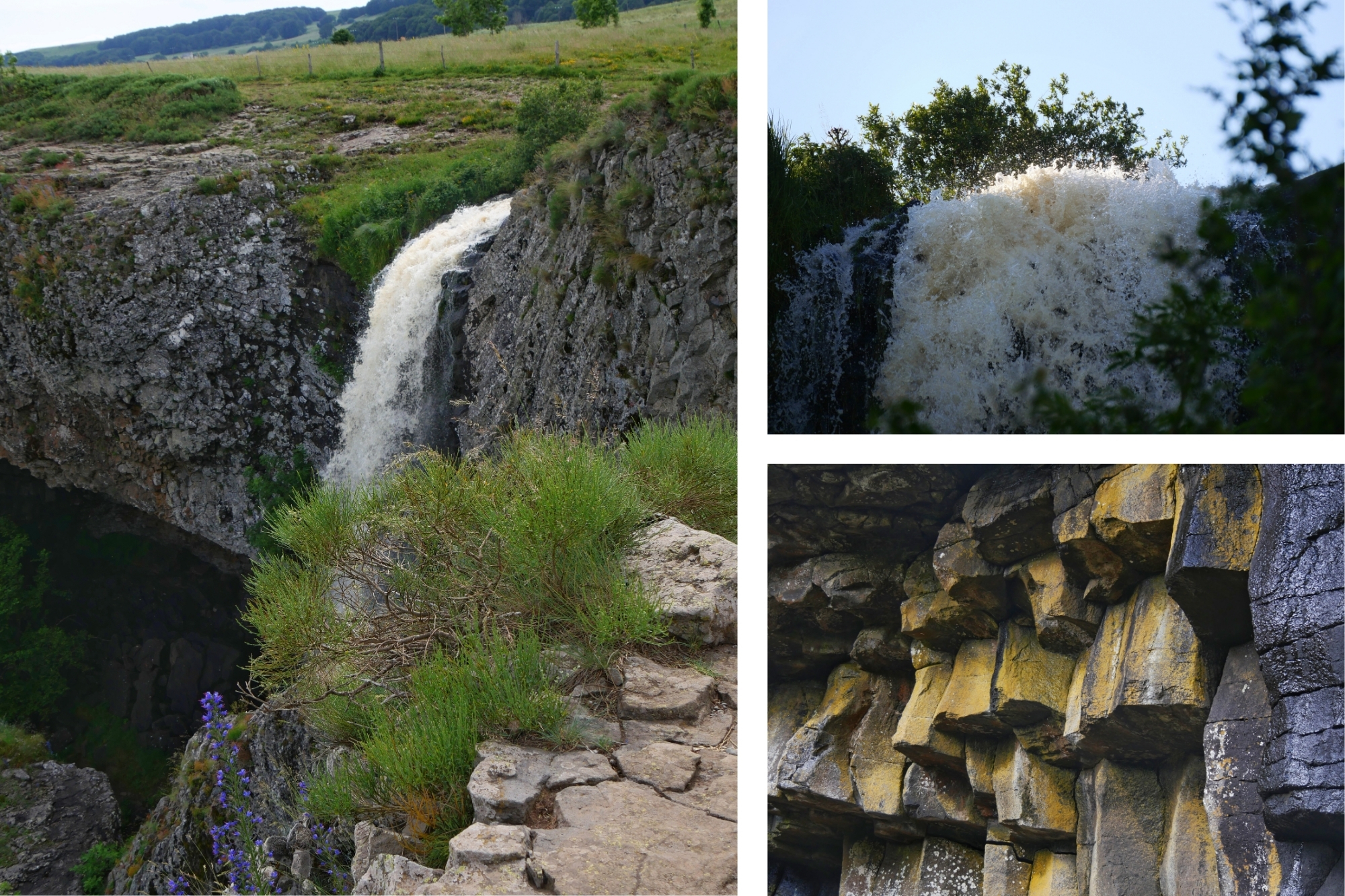
In the meantime, we enjoyed the river water and had our first freeze-dried dinners of the trip: spaghetti Bolognese for both of us. All the info about food can be found in the Practical Info section.

Summary of the day: first mile, cows, flowers, a waterfall, and our first wild camp. 5h40 of hiking (2h30 of breaks), 12.1 miles, 1,076 ft elevation gain / 1,004 ft descent.
Day 2 Cascade du Déroc – Bois des Salces
First wake-up and first rough night 😉. As usual, it is hard to sleep well in a tent, especially in the first few days, and we had not expected how loud it would be sleeping near a waterfall. During the day, you do not hear the sound the same way. We packed up the tent quickly at sunrise, since that is the rule for wild camping, and had breakfast on a rock: tea, peach-flavored energy drink instead of juice, BelVitas, and freeze-dried scrambled eggs. Then we threw the beast back on our backs 😉 and let’s go. The first few miles were on pavement, tough on the feet, but luckily it was a quiet little country road.

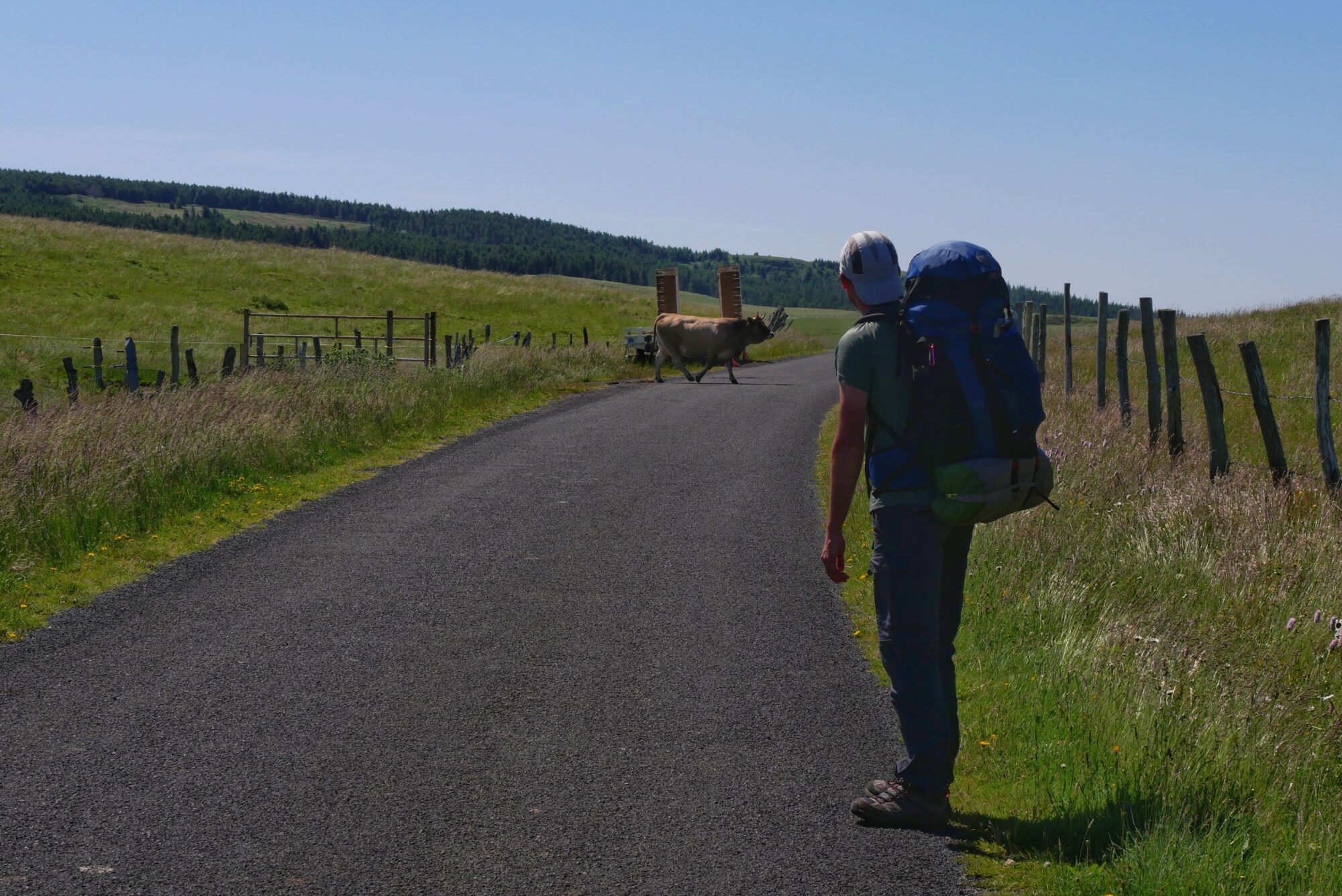
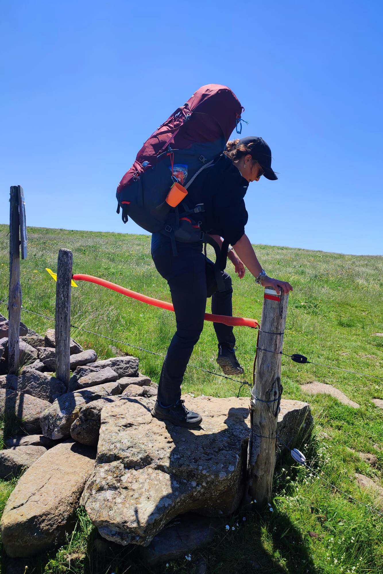
Then we took a trail, and after passing a cattle gate, we arrived in a beautiful landscape of endless meadows, with lovely cows and their handsome Mr. Bull 🙂.
A beautiful trail through vast green landscapes, a true feeling of freedom! Just like the day before, the sun was shining, but since the wind was quite strong, we didn’t realize we were getting sunburned 😉!

We came out of the fields and started a long, very long stretch of road about 5 miles. We rejoined the Saint Guilhem Trail near a beautiful peat bog and continued along the road, where we took our morning break with some seed packets and bars.

After letting a runaway cow pass 😉 we finally turned onto a trail that once again led us through wide open meadows.
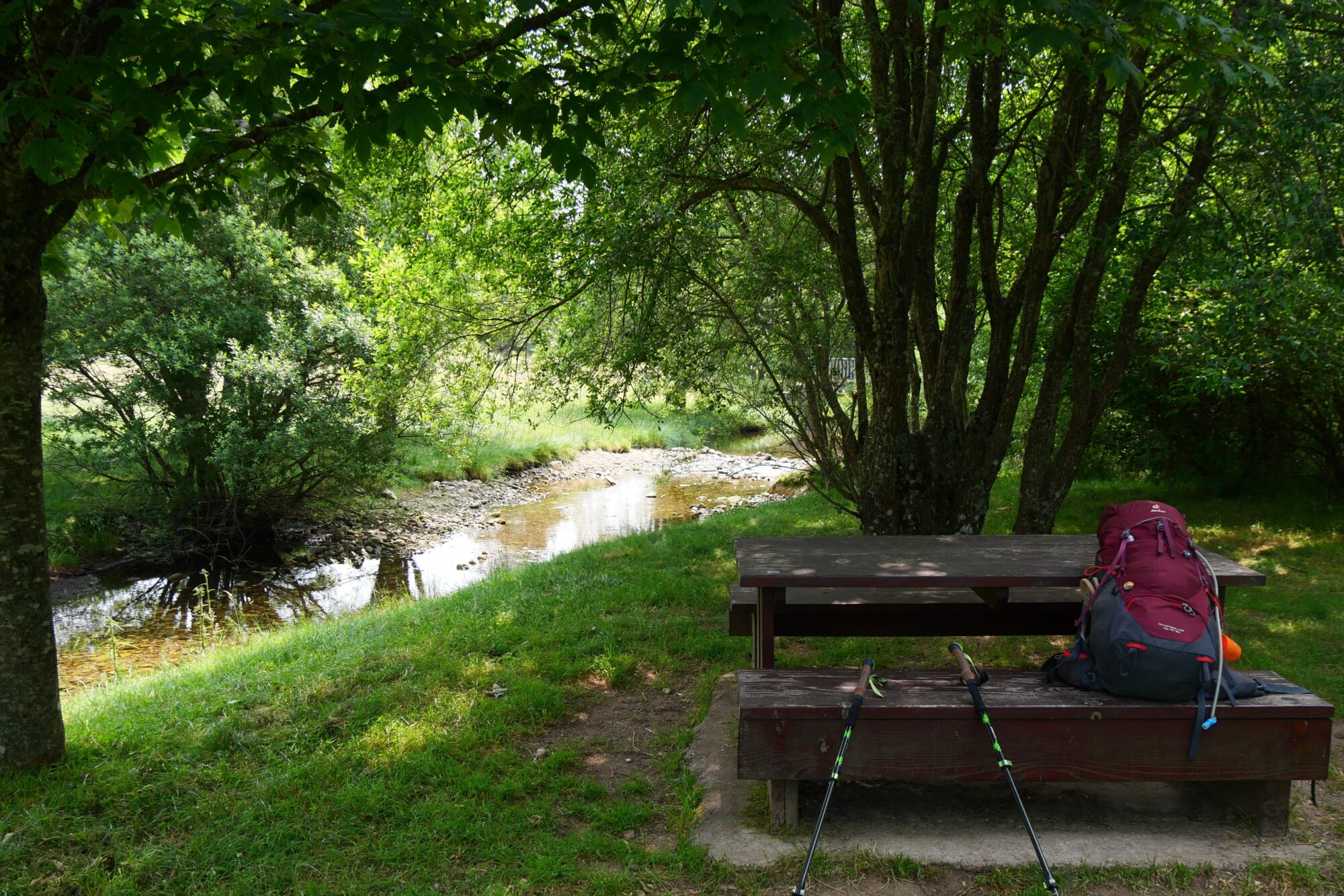
We took our lunch break there, by a small stream where our poor tired feet could rest, and we were able to dry the tent that was damp from the morning dew. The only downside was that there was no shade, so we wrapped ourselves up from head to toe with whatever we had 😉. We also met our first fellow hiker of the day, who was carrying a tent as well.

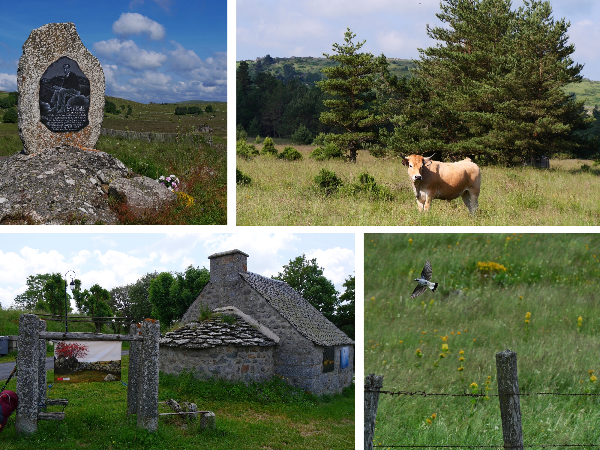
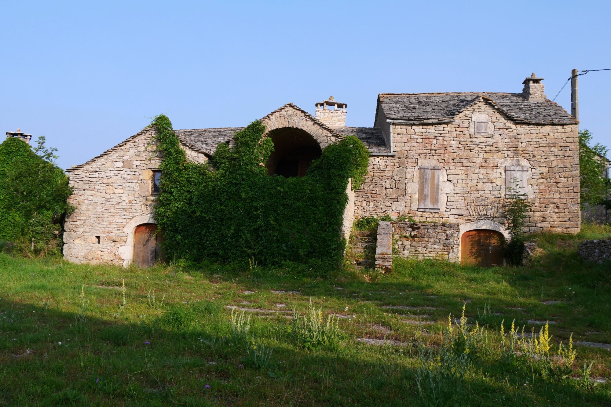
After the break, we continued through the meadows until we reached the well-known Rajas refuge. It’s a lovely stone house set in the middle of nature, where you can spend the night. It’s a common stop for hikers on the Saint Guilhem Trail, but we still had a few more miles to go, so we aimed for the forest up ahead to find a spot for our bivouac.

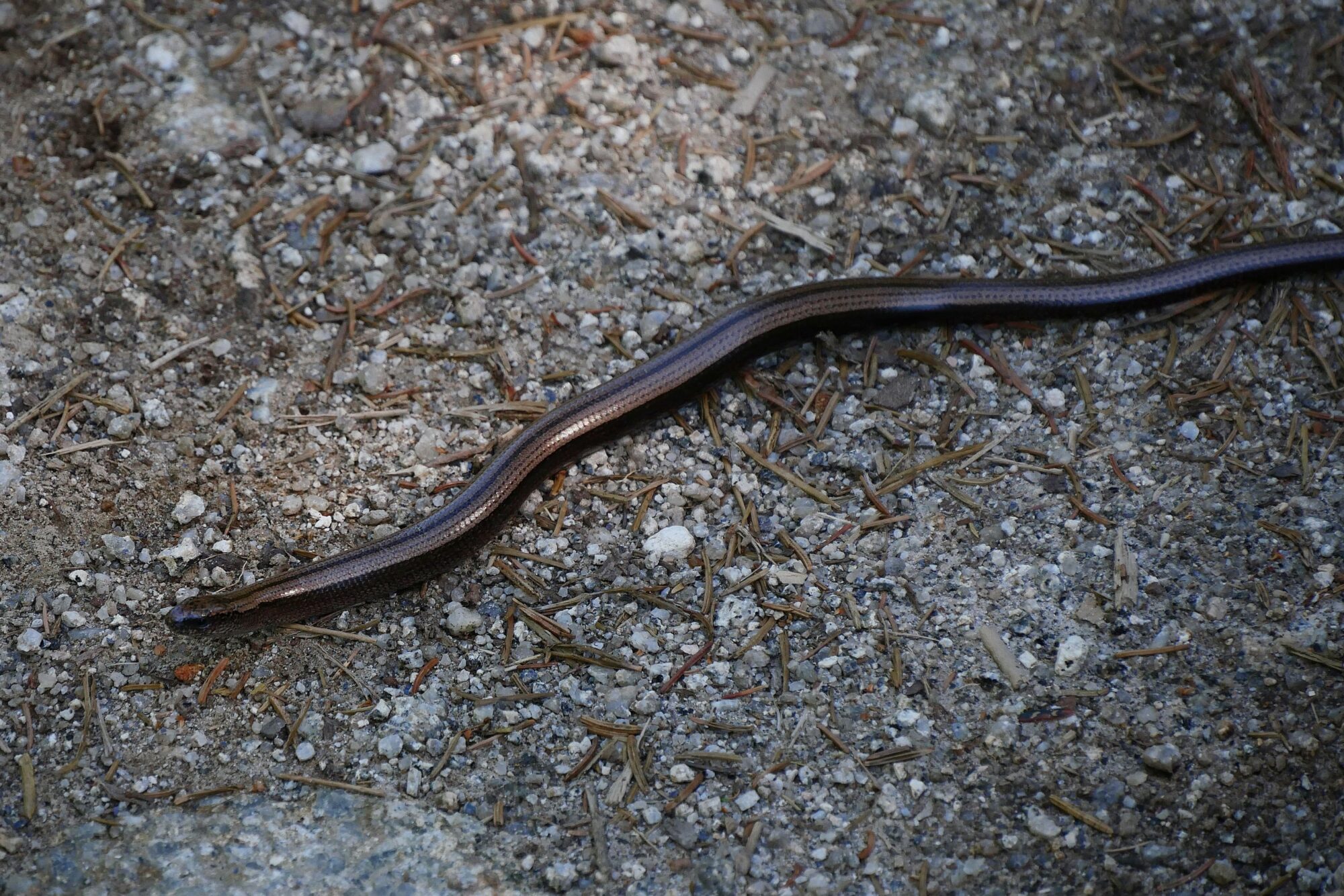
Before entering the woods, we had a big snack break in the shade, then set off again for the last hour of the walk. On the way, we met an adorable orvet, and then looked for a place to pitch our tent. I had hoped to find a stream with what I’d seen on Google maps, but unfortunately there was nothing. It’s a good thing we’d filled up in a stream beforehand, because water runs out very quickly in a bivouac, between evening and morning meals.
We like to stop our hiking days not too late so we can calmly set up our camp and simply enjoy being in nature. We found a quiet little spot at the edge of a field and like most of the time we dozed off for a bit especially since I hit a big slump that my partner helped me get through by making his magic potion an electrolyte drink 😉. It was the first time we brought some and it was a great idea.
After our evening meal in a pine forest, we went to bed. A roe deer barked good night 😉.

Summary of the day: more cows, the beautiful Aubrac plains, a slow worm, and a great bivouac. 5h40 of hiking (2h of breaks), 13 miles, 1,410 ft elevation gain / 882 ft descent.
Day 3 Les Salces – Banassac
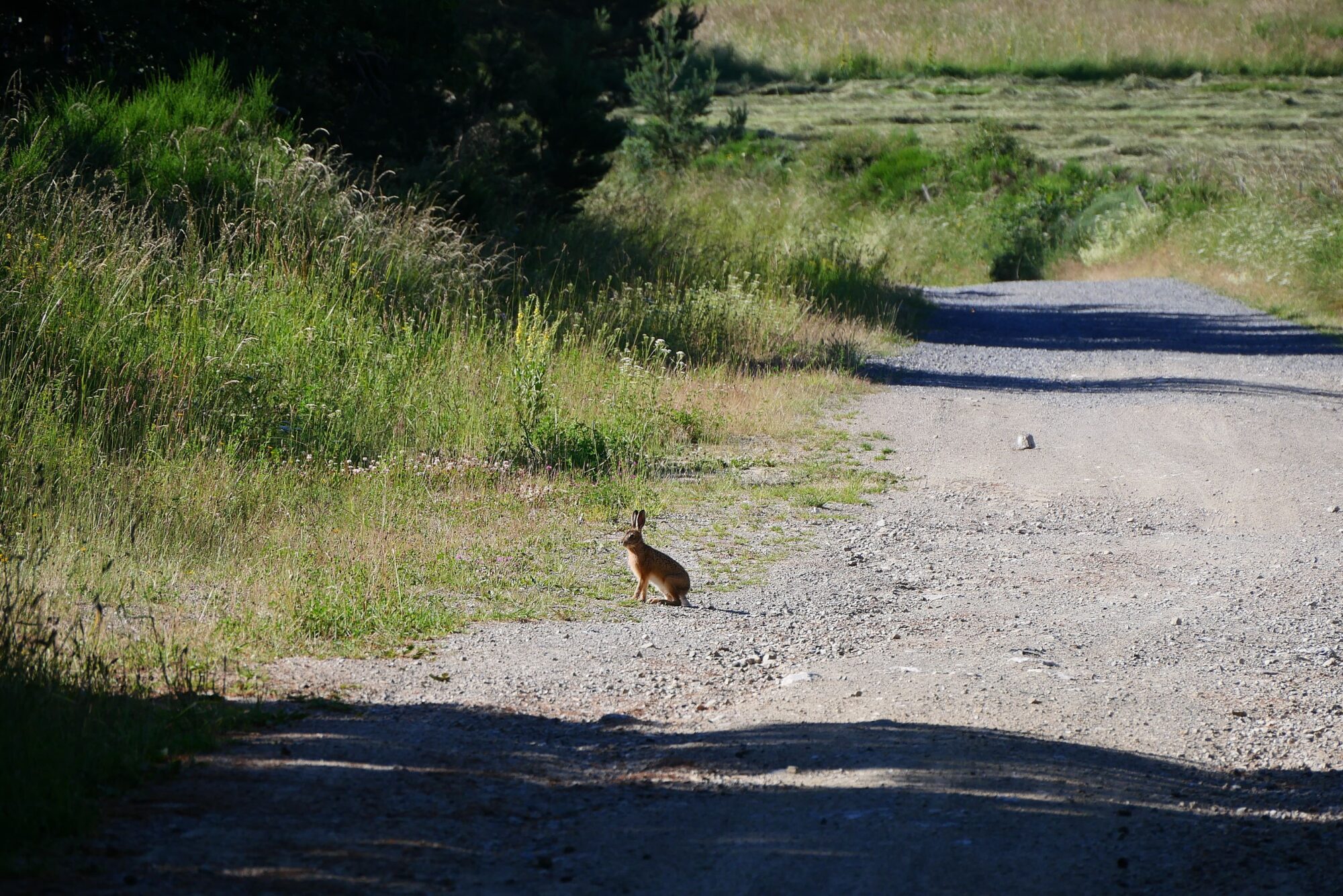
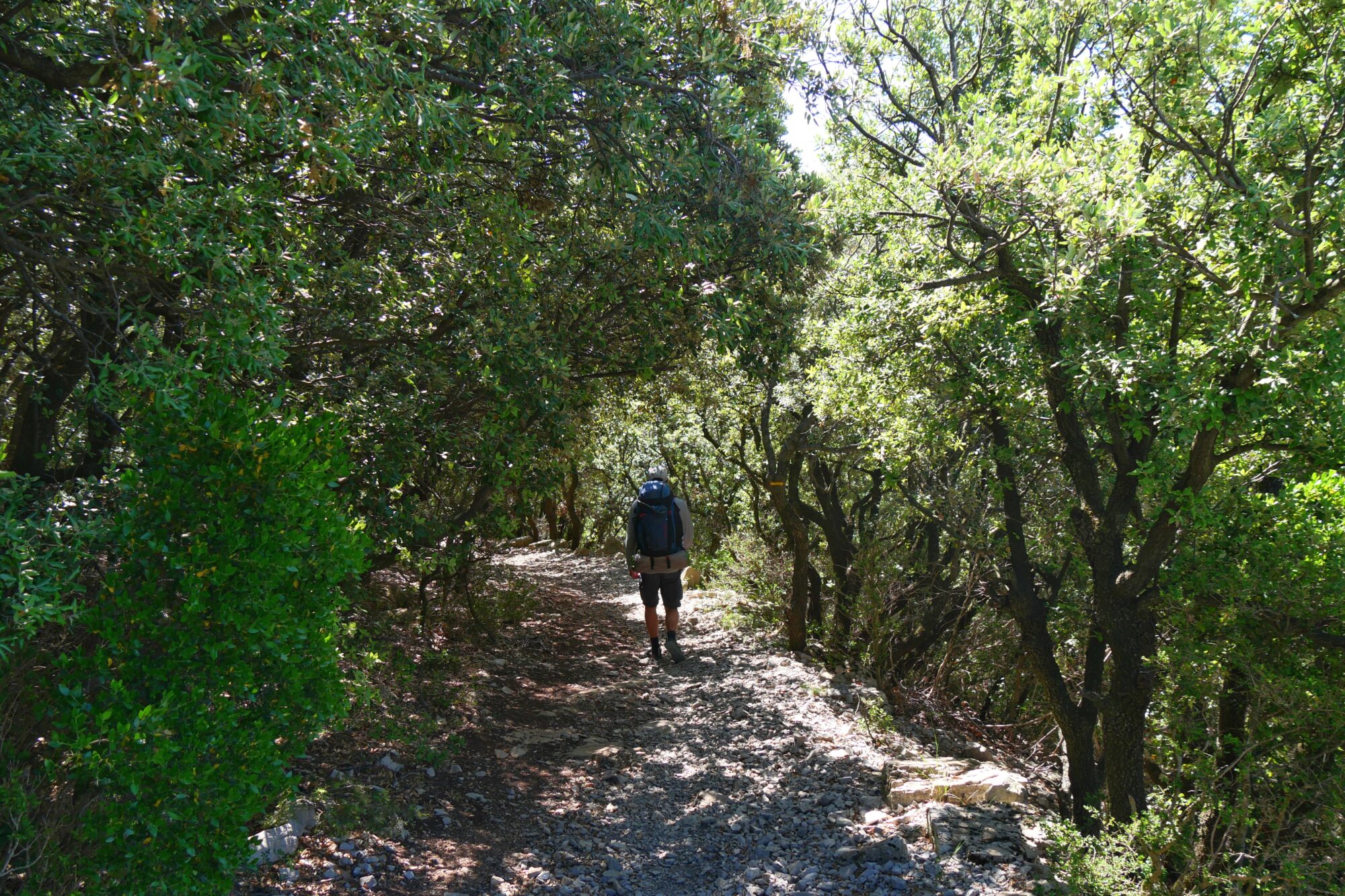
The second night was a bit complicated, as we were awakened by music, no doubt from a fiesta at the little restaurant we came across before entering the woods, and my partner was also bothered by a clod of earth too large to fit under his mattress. By the time we had eaten and tidied up, we took off a little late at 8 a.m. and continued the previous day’s route through the woods. We enjoyed this shaded section, as the sun was already beating down, and we came across our first rabbit 😊.

We had a goal for the day to reach Saint-Germain-du-Teil before noon to get supplies for our lunch since the convenience store closed at noon. Since we had a limited time to cover the 6.5 miles between us and our lunch stop, we took short breaks and I found myself running on empty 😉 just before arriving, especially with the heat, which would become our worst enemy on this trek! In the end, after a little mix-up just a few steps from the finish, which always makes things more fun!
We arrived twenty minutes before closing at the 8 à 8 where we saw the hiker from the day before. Originally we planned to do our shopping and leave right away but that was before we found the perfect spot for lunch 😉. In fact, we had noticed in the middle of the village a beautiful picnic table in the shade of a lovely tree with, cherry on top, public toilets and fresh water. The temptation was too great 😉 simple joys on a trek !!

So we were able to raid the convenience store knowing we’d only have to carry our food a few meters! We enjoyed bread, ham, tabbouleh, fruit, and pastries! After that good meal, we set up our mattress in the grass, rested, and that’s how three hours went by! I have to say we also wanted to avoid leaving in the blazing sun (a good excuse 😉).
In the end we had to motivate ourselves to keep going because we still had about 5.6 miles to cover before the end of the day and this time it was at a campground. Needless to say the second part was really tough with the heat! We faced a pretty discouraging climb 😉 right after leaving Saint-Germain and then crossed some fields.

We had another happy moment when we came across water flowing right in the middle of the path. I was so hot that I lay down in it 😉. We crossed a small hamlet then took a trail along a field where we had our last break under a tree.

Just afterwards, we came across a couple who were doing the Tour des Monts d’Aubrac trek and who were also staying at the campground. They had just come from there and told us we were almost there… Then, as we got tired, we couldn’t decide whether to follow the signs or the GPS track on our phone. We ended up walking along a rather dangerous secondary road in the heat of the day, not knowing if we’d be able to get to the campsite by that road. Typically the kind of moment on a trek when you wonder what you’re doing there and your nerves are put to the test! We finally arrived at the La Mothe campground in Banassac, exhausted but happy! We were able to pitch our tent on a lovely, spacious spot by the river. This campground was memorable for us because of its owners, the highlight being the swimming pool where they told us: “we’re not sure about the chlorine, but go ahead and if your hair turns orange, get out” 😉!!! We’re still laughing about it today, but in the end we didn’t try the pool, as we were already pretty sunburnt 😉, but we did enjoy our first shower!

It was also the chance for our first pleasant chats with the couple of hikers we met earlier as well as two friendly gentlemen who were crossing part of France but by bike. I really enjoy these kinds of encounters where we only talk about our experiences the special magic of these adventures and share tips about gear or other things. A beautiful way to end the day!

Summary of the day: a resupply, a dream lunch spot, a scorching sun, unforgettable campground hosts, and a shower. 5h30 of hiking (4h of breaks), 12.7 miles, 738 feet elevation gain / 6608 feet descent.
Day 4 Banassac – Champerboux
he start of the fourth day came after a good night’s sleep at least on my side because my hiking partner had a little problem with his mattress deflating in the middle of the night a valve left slightly open (we’re still trying to find the culprit 😉). Our morning goal was to be at the opening of the convenience store in La Canourgue two miles from Banassac. Once again we took a bit too long and left late. The section between the two villages isn’t the most pleasant since you follow the road the whole time. When we arrived in La Canourgue a very pretty village, a small disappointment the store was closed. Luckily after wandering for a few minutes we smelled some fresh pastries and found a bakery. After buying enough for a second breakfast 😉 and lunch we got back on the road.

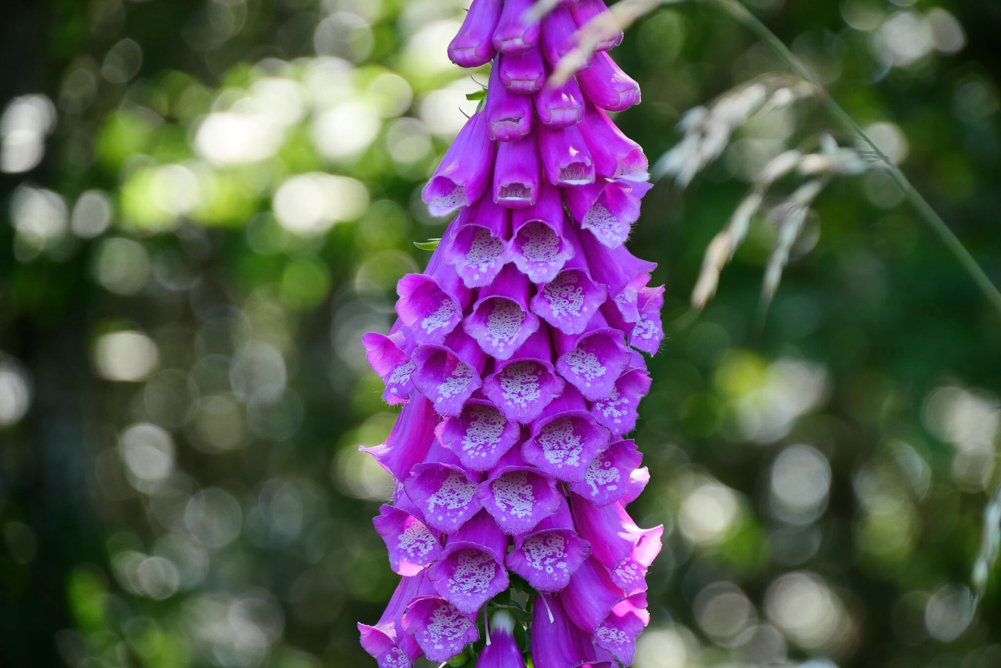
Leaving the village a tough climb awaited us and it was definitely one of the hardest parts of this trek for me. Luckily there were lots of flowers along the trail to give me a boost. Sometimes it is hard to explain why some sections feel so difficult while others which are more demanding in theory go more smoothly. It is certainly a combination of several factors fatigue morale the weather and so on.
Then the trail became easier and we took a break in a pretty flower-filled clearing. That’s when three women passed by and we met our first fellow hikers on the Saint-Guilhem trail. After chatting a bit we realized we would be sleeping at the same place.

Then we continued calmly, alternating between trails and short stretches on small roads.
After lunch on a pretty stone table set in the woods, we started looking for water. We hadn’t seen any anywhere until then.

We were pinning all our hopes on the hamlet of Gazy but found nothing. With no other choice, we decided to knock on a house door to ask for water. It’s important to know that we are quite flexible when it comes to water because we have filtered bottles that allow us to refill from streams, rivers, and so on. But on this GR trail it is indeed sometimes difficult to find water especially for hikers who need water that is directly drinkable.

After refilling we hit the road again. We ran into our three fellow hikers several times, discovered our first beautiful “angel’s hair” plants and mostly played with the sun. The sun was beating down so hard that on one stretch of road we stopped at every little patch of tree shade about every 330 feet 😉!

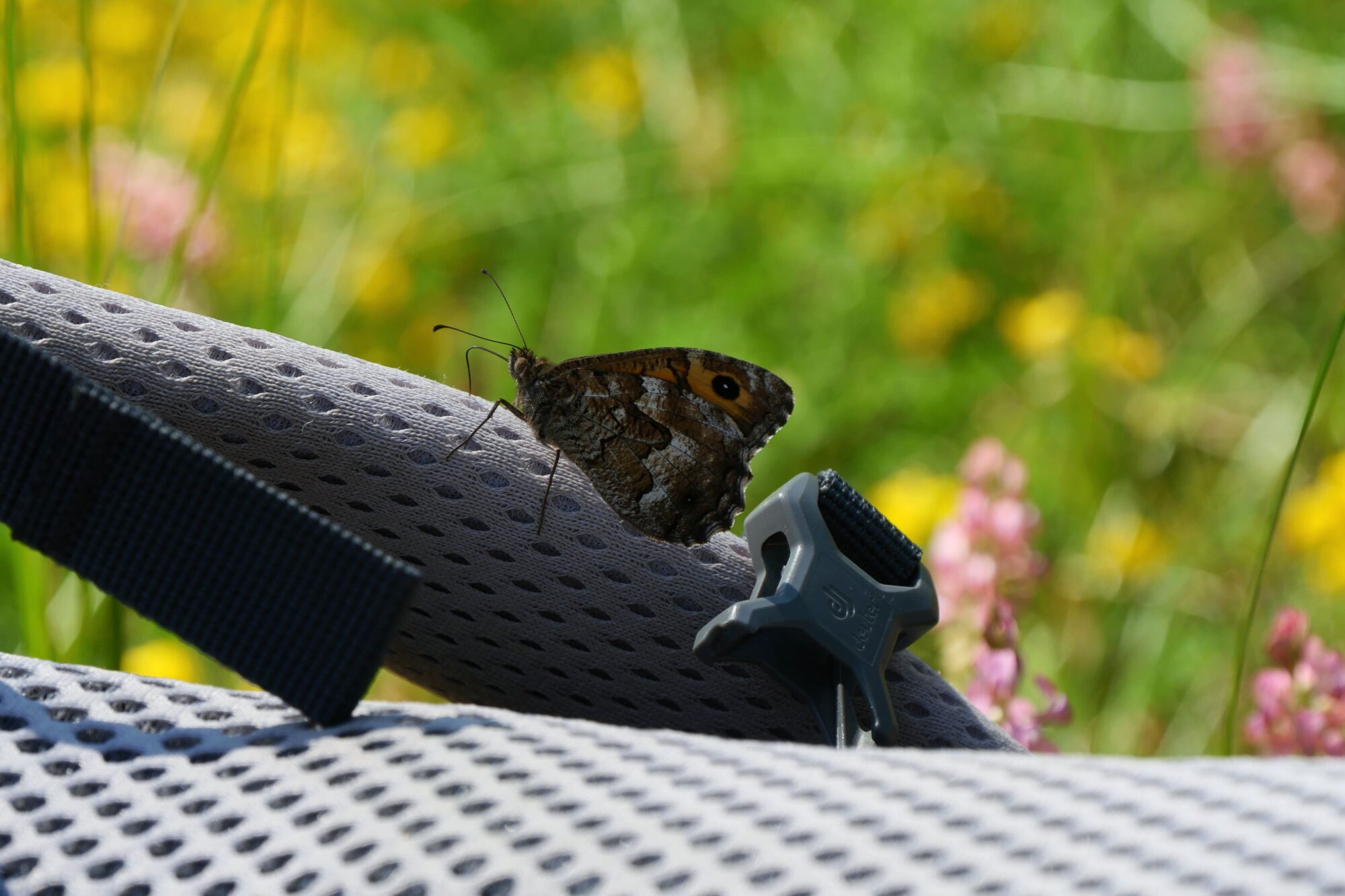
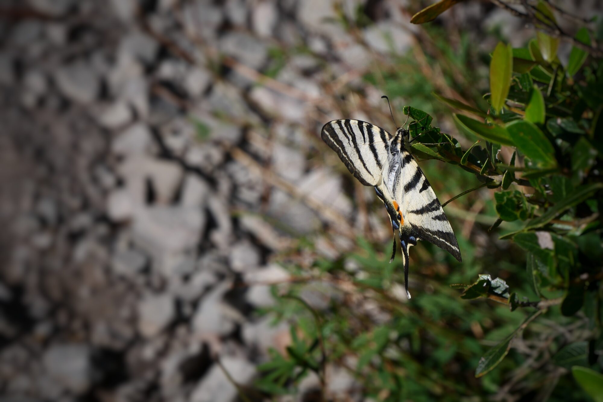
About 2.5 miles from the finish we took a long break in the forest lying right on the path surrounded by beautiful flowers and friendly butterflies that fell in love with my boyfriend 😉!

Our three fellow hikers passed us at that moment, telling us they had thought from afar that we were a dead animal and a bird 😉. We never figured out which one of us was the dead animal 😉! As often happens, the last miles were really tough and we arrived at the hostel completely wiped out.

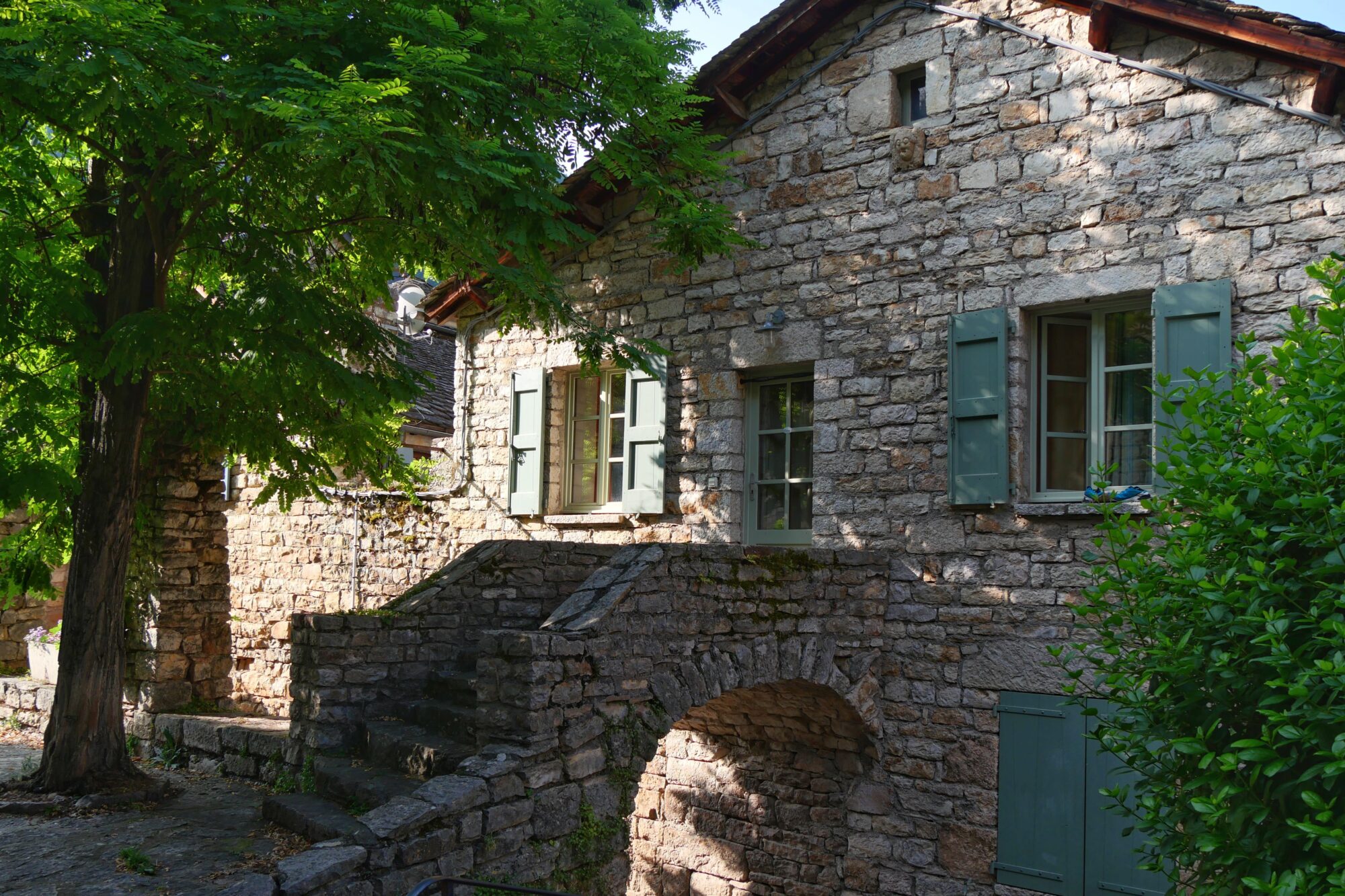
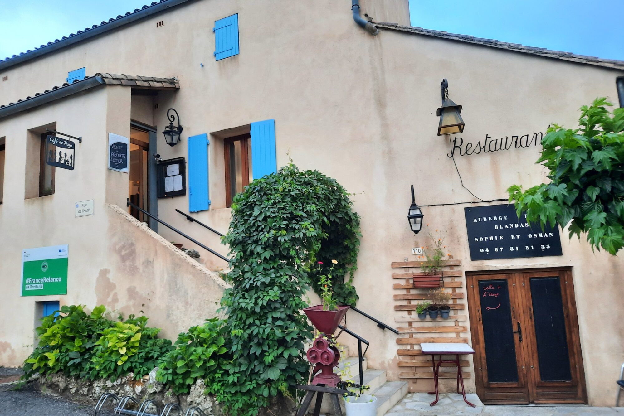
The hikers were already there and Sophie, the owner of the hostel, showed us our room. Luckily we didn’t have to share it. We would have been embarrassed if other people had arrived, given the smell coming from all our stuff 😉!

We were super happy about this first night on solid ground, to be able to wash up, sleep in a bed and not have to set up the tent. We enjoyed the kitchen and the products Sophie provided, including some good honey. We did some laundry, played Connect Four, watched a beautiful sunset and had dinner with our fellow hikers. We learned they were old school friends and that every year they go on a trek together while their biker husbands go on a motorcycle trip!

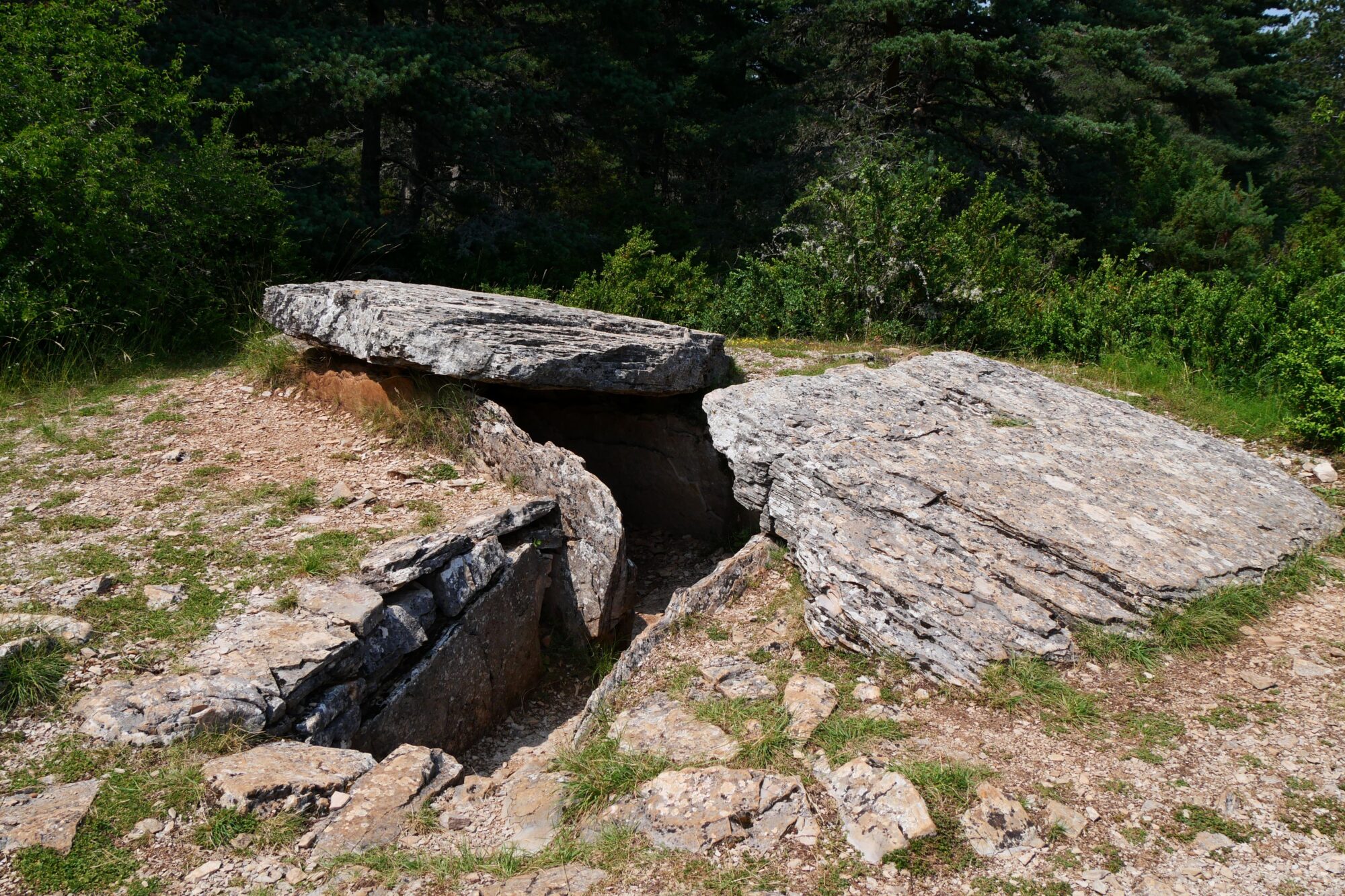
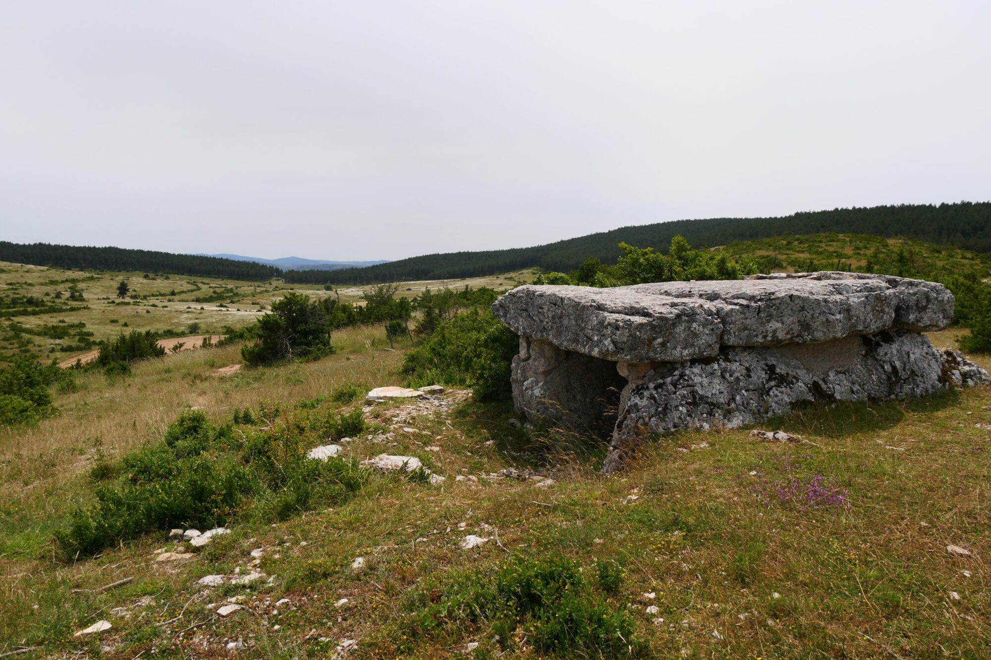
Summary of the day: a brutal climb, flowers, dolmens, blazing sun, three fellow hikers, a beautiful sunset, a night in a guesthouse. 6h30 of hiking (2h30 of breaks), 15.5 miles, 2,257 feet elevation gain / 919 feet descent.
Day 5 Champerboux – Hures

After a good night’s sleep in a real bed and a great breakfast with Sophie’s homemade bread and jam, we set off valiantly… but that wasn’t counting on forgetting my sunglasses 😉! Fortunately, I realized it after a 5-minute walk and my darling was kind enough to go back and get them.
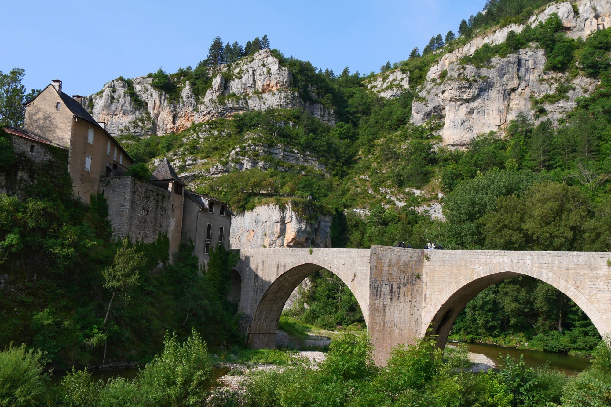
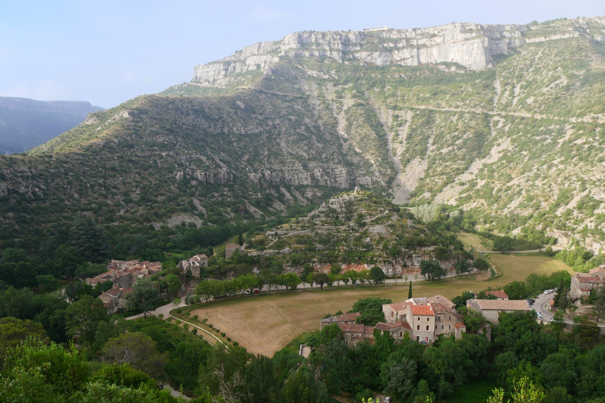
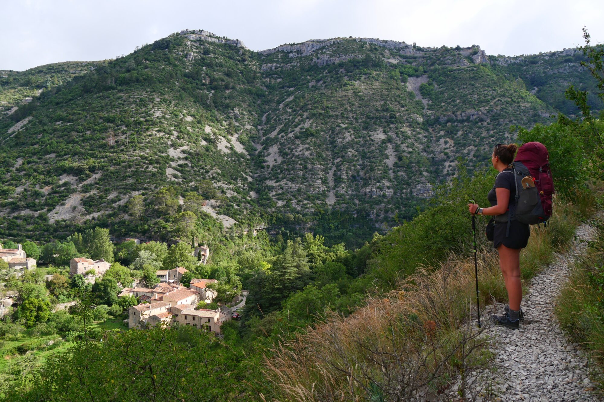
After this false start, we set off downhill for 4,7 miles to the magnificent village of Saint-Enimie. We spent the next 2 hours overtaking our co-randonneurs all the way to the village.

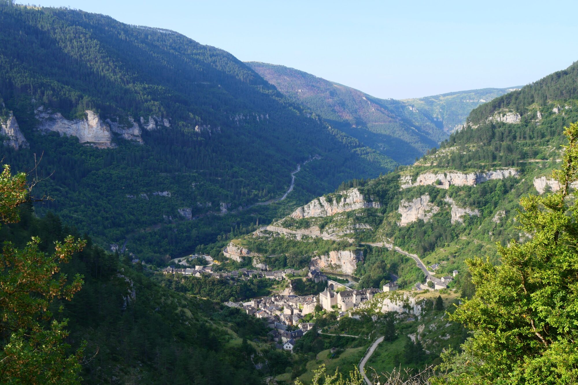
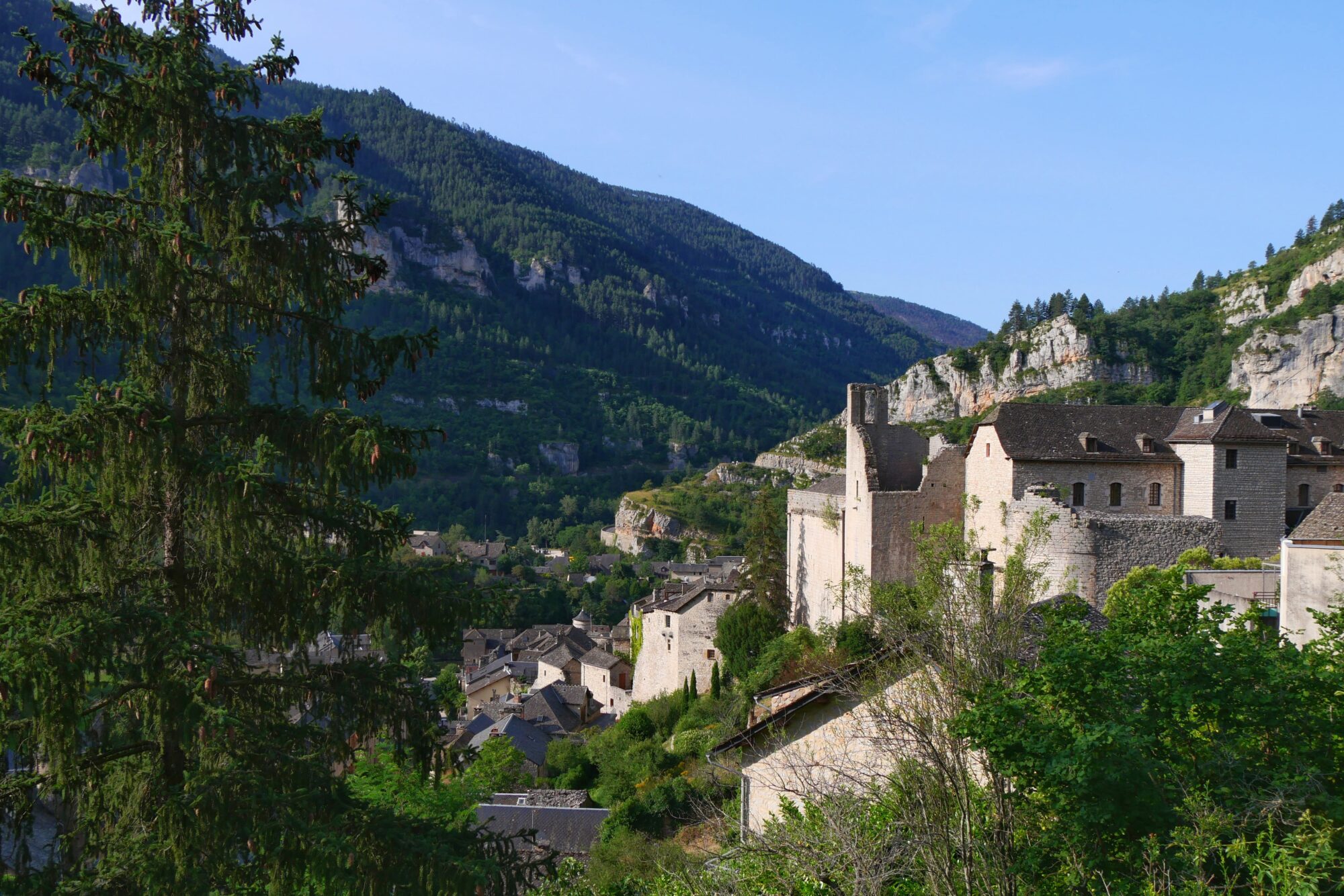
The last descent is made with a beautiful view of the village, before arriving in its pretty streets. We realized how lucky we were to be able to visit this beautiful village virtually on our own.
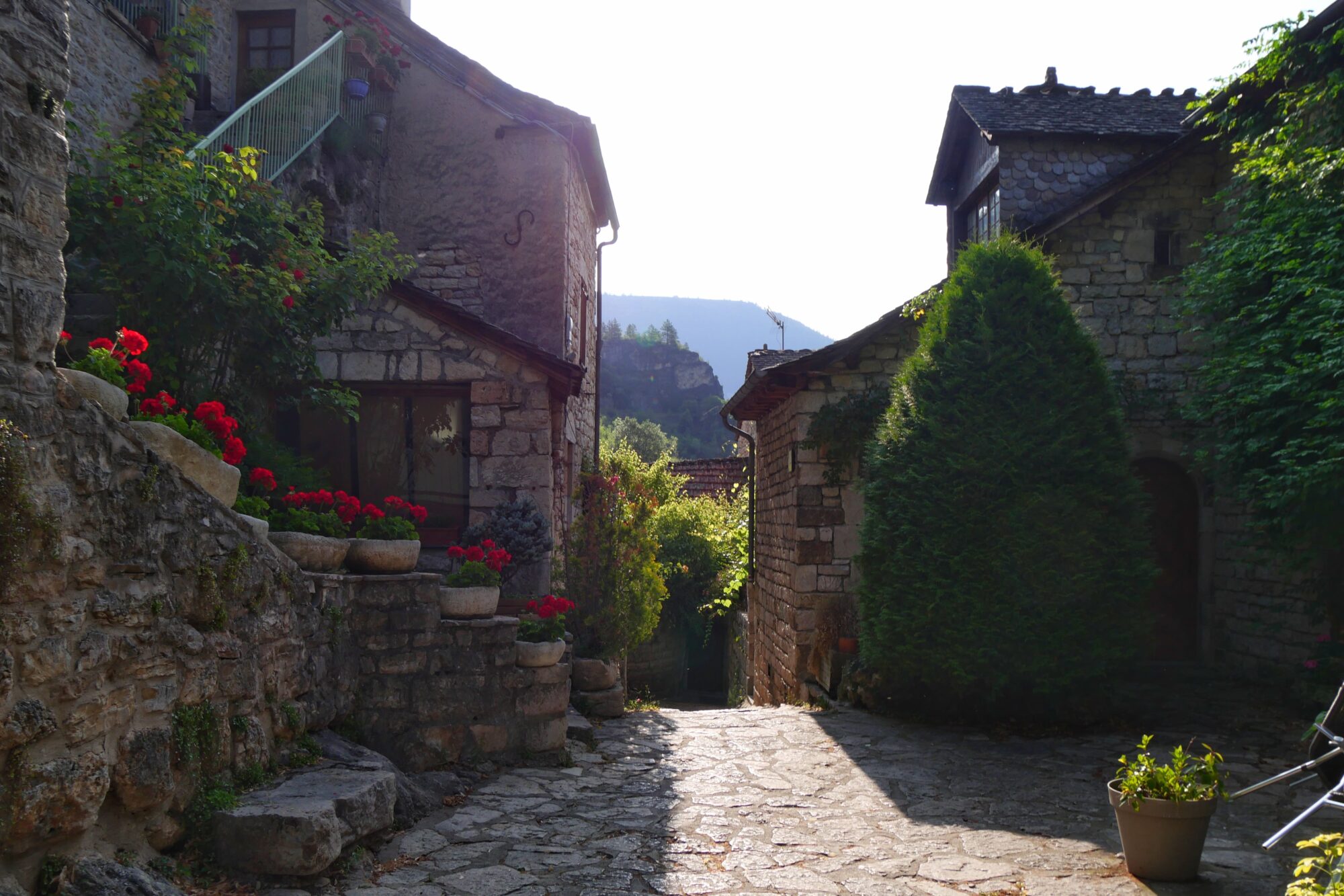
We made a little stop in the church to perform my ritual, which is to light a candle for my “sky” grandma in every place I travel. I love the idea of a light shining for her all over the world, and it’s also a way of taking her with me wherever I go 😊.

We took advantage of the village to stock up on supplies (pastries, pizzas, quiches, chips and fruit) and take our morning break, our feet in the water of the Lot.
At 10 a.m., we set off again and had to climb everything we’d come down with (1,804 feet of elevation gain over 3.7 miles), but as the climb was mostly in the forest, and therefore protected from the sun, we didn’t suffer particularly. In fact, it was on this day that we started getting up very early, before 6 a.m., to try and get some respite from the heat 😉!

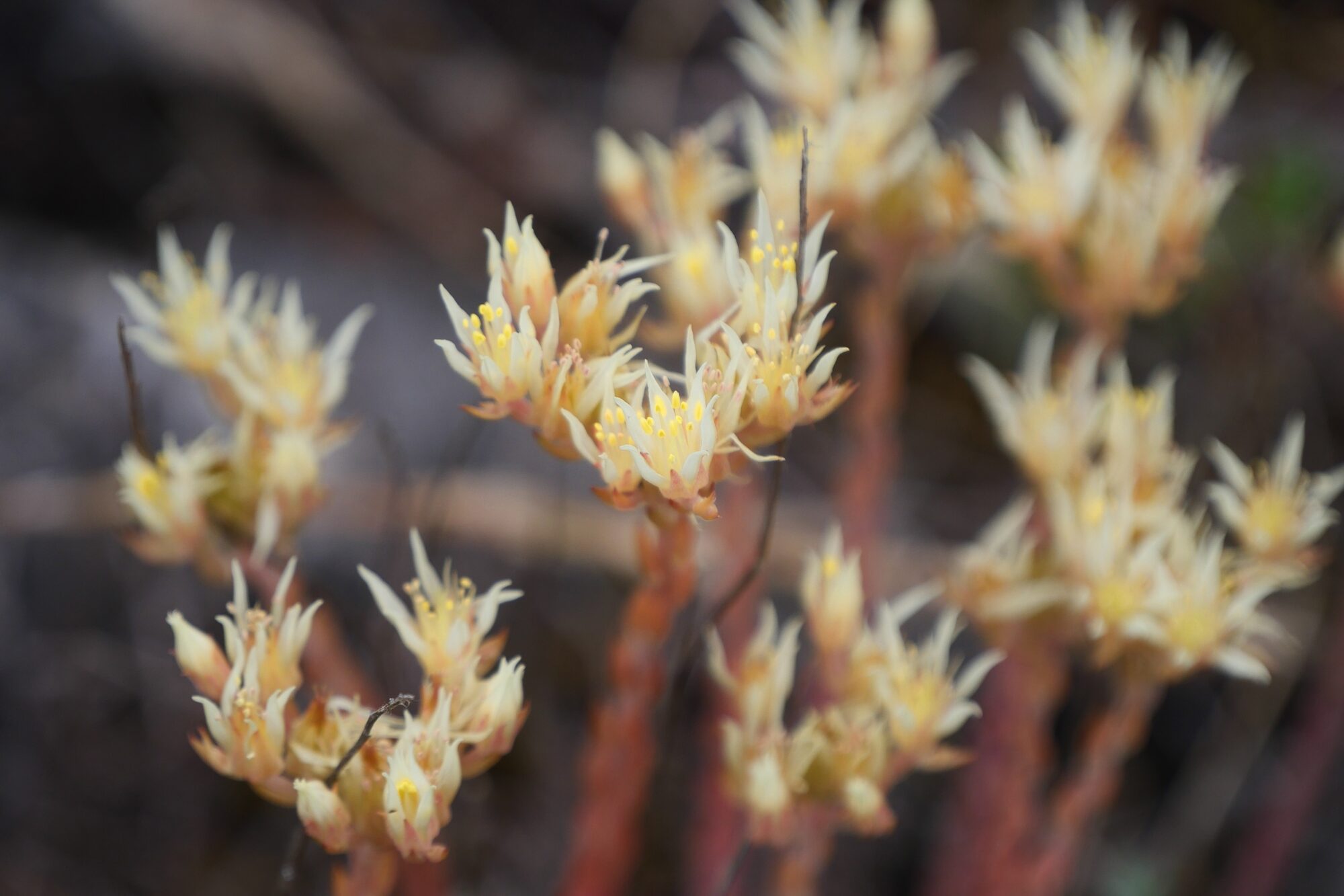
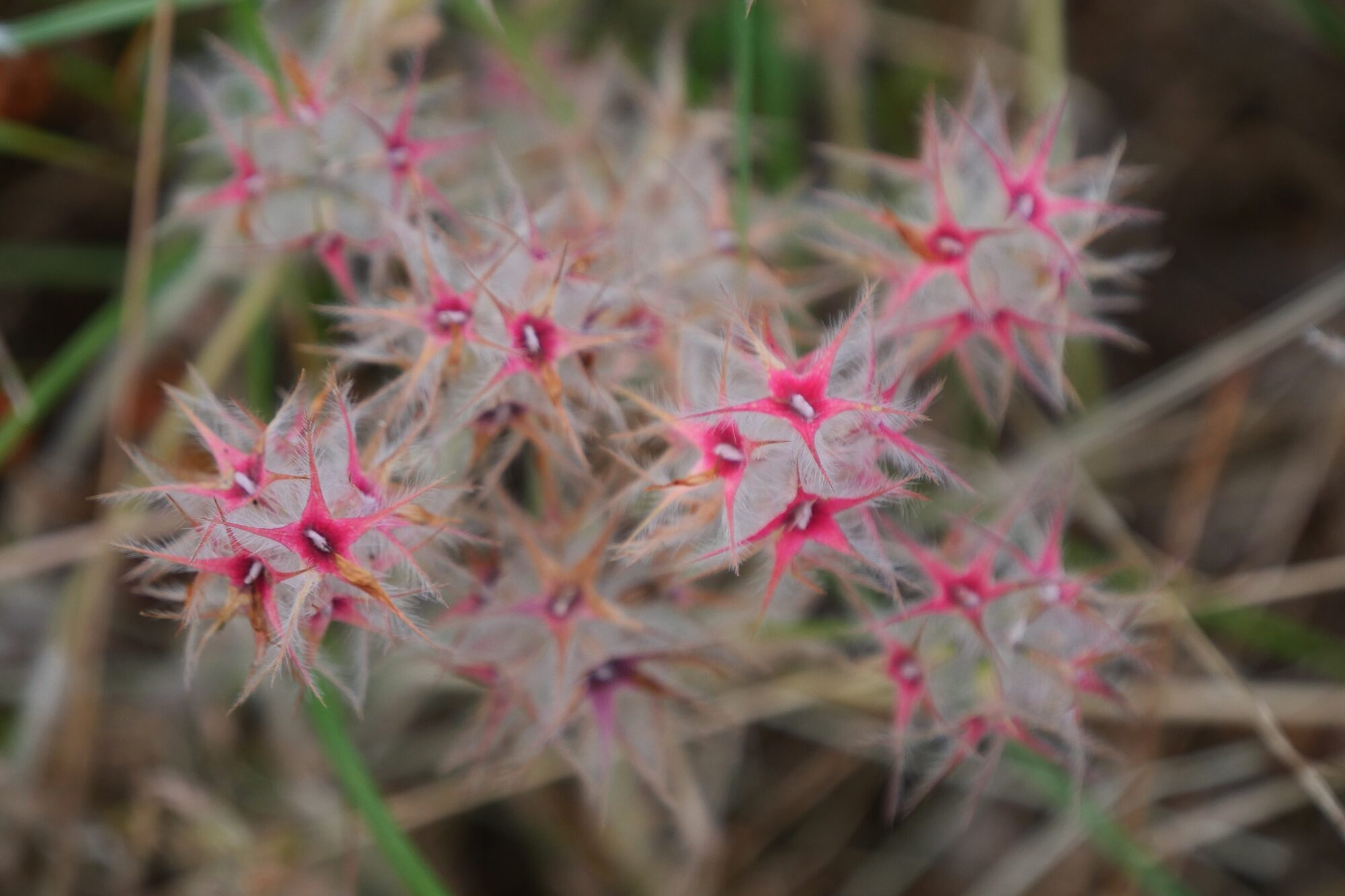
We passed through some magnificent landscapes, all the more so with angel hair! I’ve developed a real passion for these flowers, and had no idea that this was a foretaste of the immense silver fields we were to see the next day on the Causse Méjean!


We took two breaks, including one at 4:30 p.m. lying on the path beside an unfortunate puddle in the woods, playing hide-and-seek with the sun! 😉 ! My tendonitis (from my trek on the Itinérêve) was starting to flare up, which was stressing me out a bit, and my darling discovered that the cause of his foot pain was a little anti-theft device hidden under the insole of his shoe – always check it from now on! 😉 !
After this break we still had 4,4 miles to go, aiming for the woods after the Buffre to find a bivouac, and before that we had to cross the village of Mas de Val.

It was in this village that we experienced one of our greatest joys of the trek. We hadn’t found any water since Saint Enimie and were beginning to worry. Arriving in this tiny “deserted” village, we miraculously came across a magnificent slate sign with a hand-painted map indicating, among other things, a watering place. We took a closer look at the map and realized that the fountain was right behind us, a moment of pure euphoria the likes of which you can only experience on a trek 😊!

As an added bonus, a picnic table was signposted a few yards away, so we were only too happy to find a good place to rest and decided to change our habits and dine here. So we prepared our own freeze-dried meals, which we enjoyed in a state of total bliss. Many thanks again to the village of Mas de Val for this little gesture that changes everything when you’re walking! We had about 1,9 miles to go, and it was at 8pm that we set off again.
We particularly enjoyed this last hour walking in the calm and cool of the end of the day. It’s my favorite time of day to hike at home, because you can feel time slowing down, everything is calmer, the animals are coming out and there’s this beautiful light with such a special atmosphere. We passed through a pretty forest, a small village already asleep, came across a deer, admired pretty colorful fields and arrived in the woods where we wanted to pitch our tent.

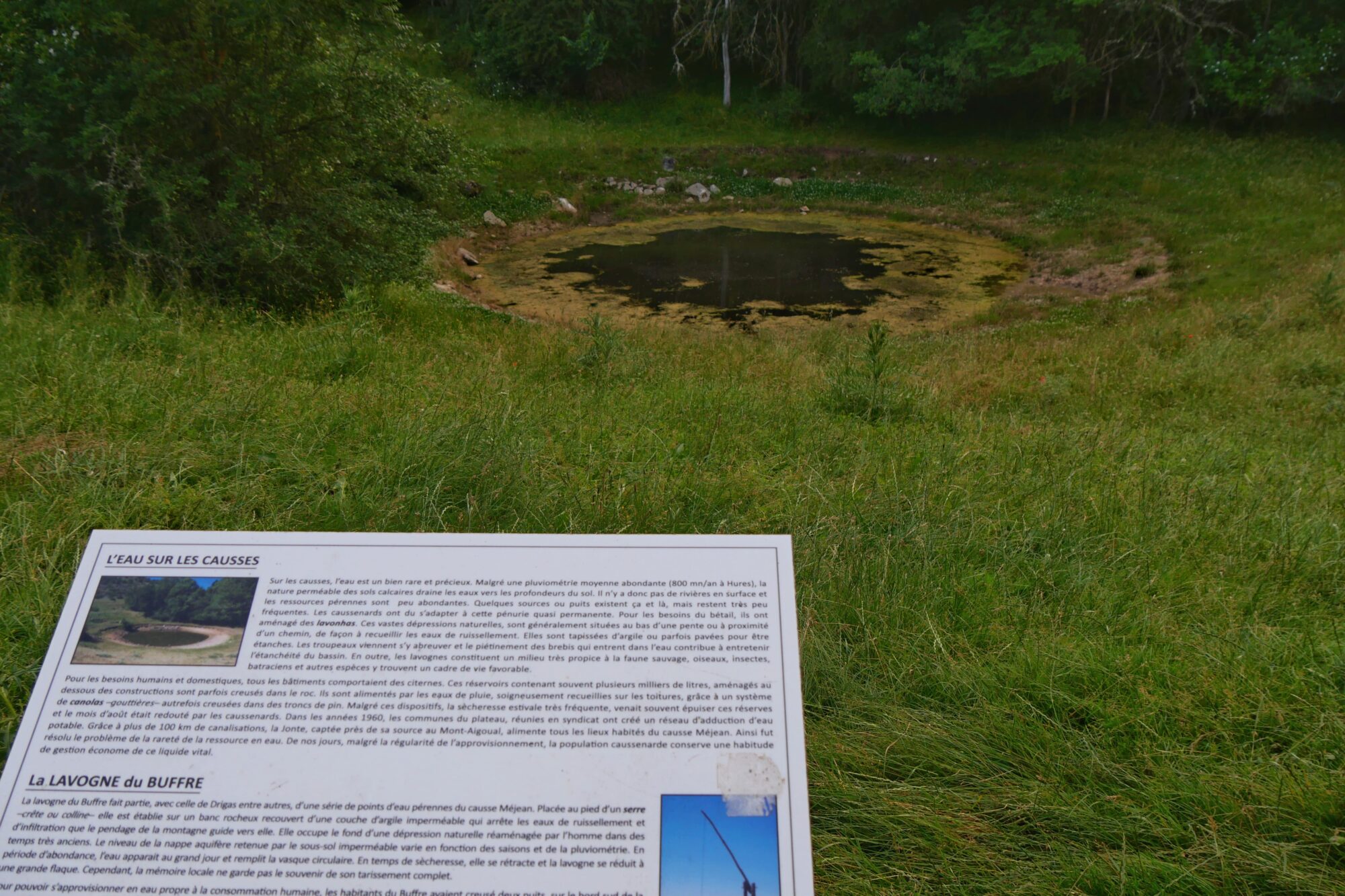
We passed by a lavogne, then the trail climbed steeply into the forest and we realized that it was going to be very difficult to find a flat area.
After an exhausting search, especially for my energetic co-randonneur, we finally found a little spot in the forest below the path, where we could pitch our tent.

Summary of the day: a beautiful village, stunning landscapes, intense heat, a miraculous fountain, an evening hike, a deer, and a final wild camp. 7h30 of hiking (6h of breaks), 15.8 miles, 2,444 feet elevation gain / 2,477 feet descent.
D6 Hures – Meyrueis

As on the previous day, we woke up very early: we had to cross the Causse Méjean and we knew that shade would be scarce. What’s more, it was our long-awaited “rest day” at the hotel, which meant we’d be more than halfway there!! So we started by finishing the previous day’s climb in the woods, and could see that we couldn’t have found a better place to bivouac higher up.


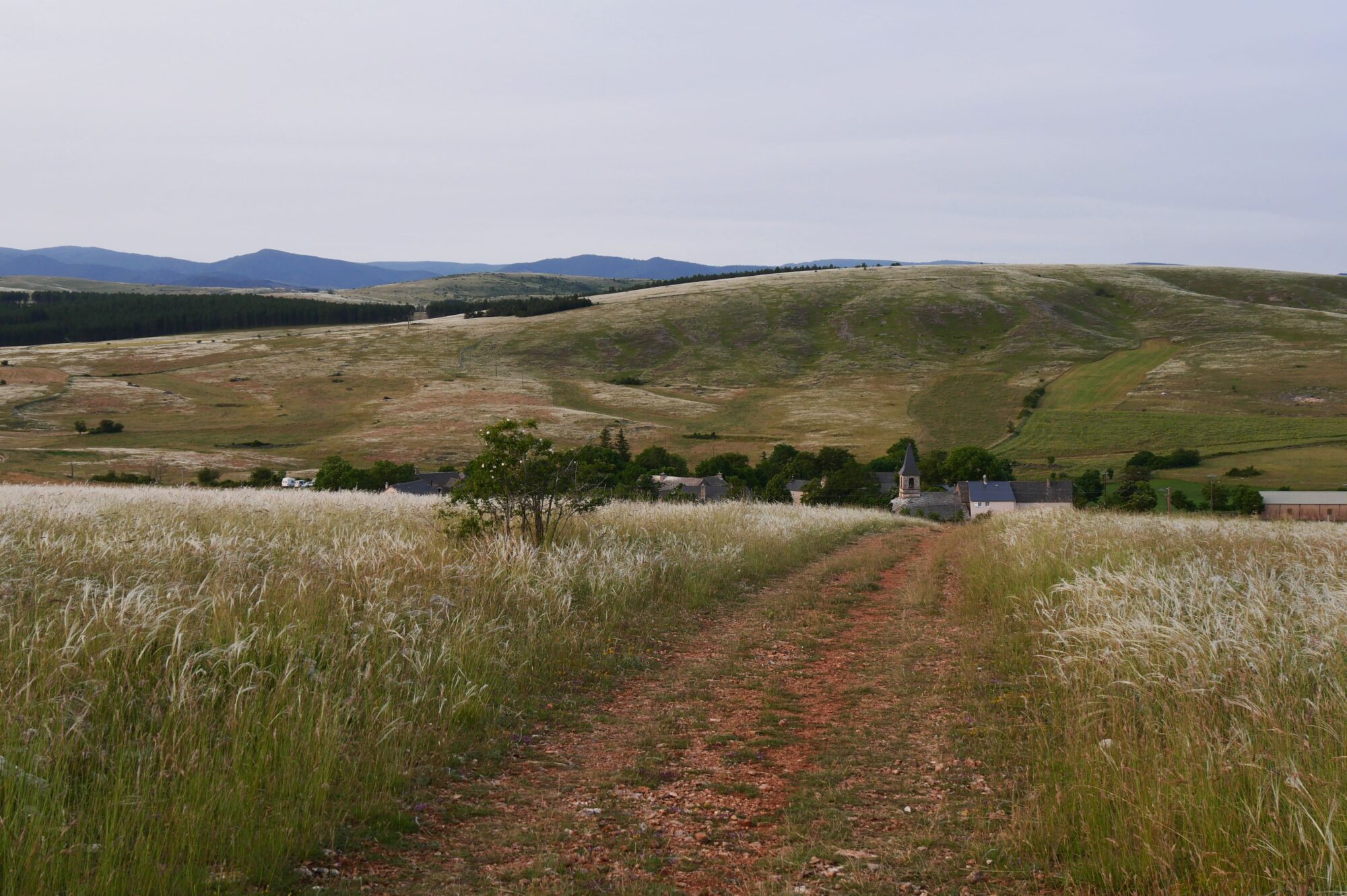
Leaving the woods, we began a descent across the fields to the village of Hures, bathed in the golden light of sunrise.
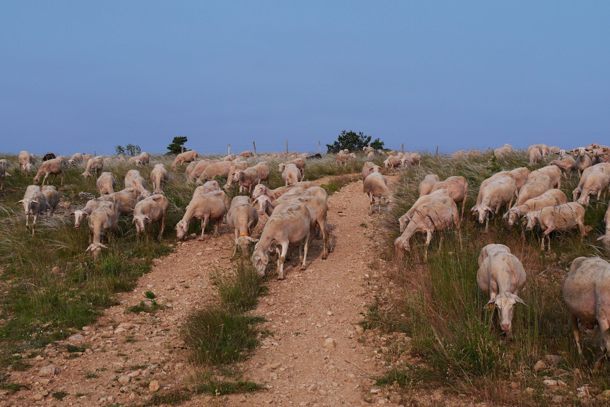
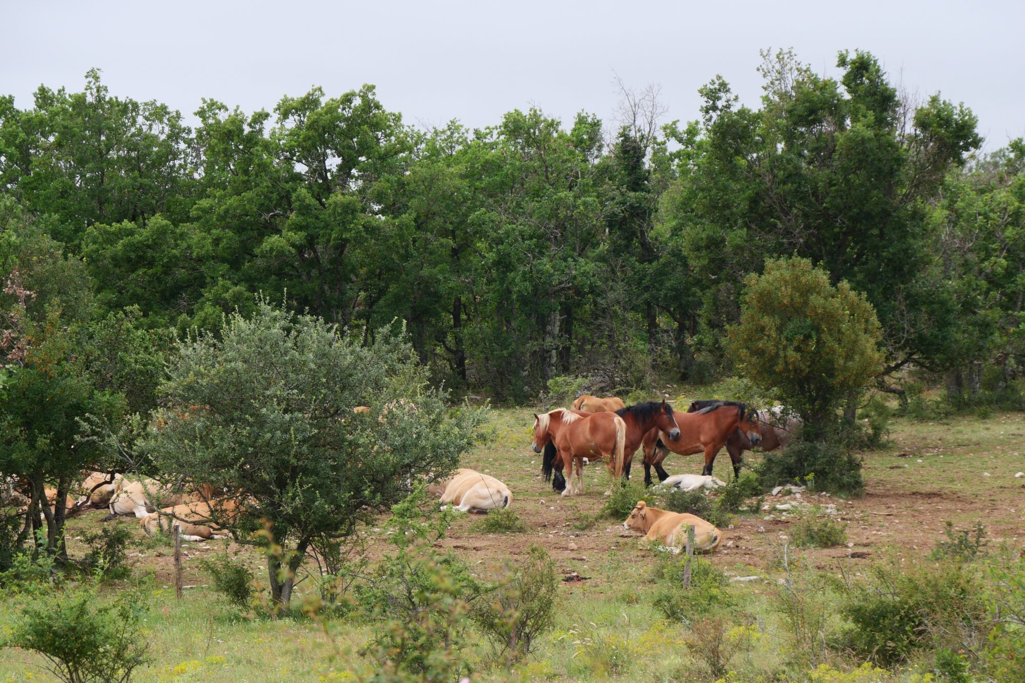
Future hikers beware: we didn’t find the fountain in Hures, but later learned that there was one next to a house in the village. This is also where you can make a detour to see the wild Przewalski horses. On our way out of the village, we came across a shepherd taking his flock of sheep out, and after cuddling his adorable dog, we realized that the sheep also wanted to be petted 😉, a nice way to start the day. 😊.
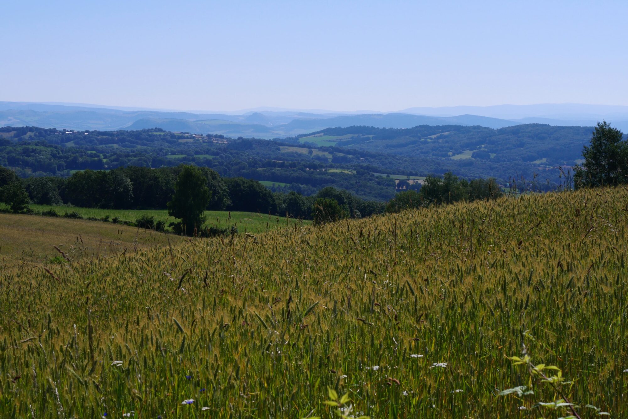
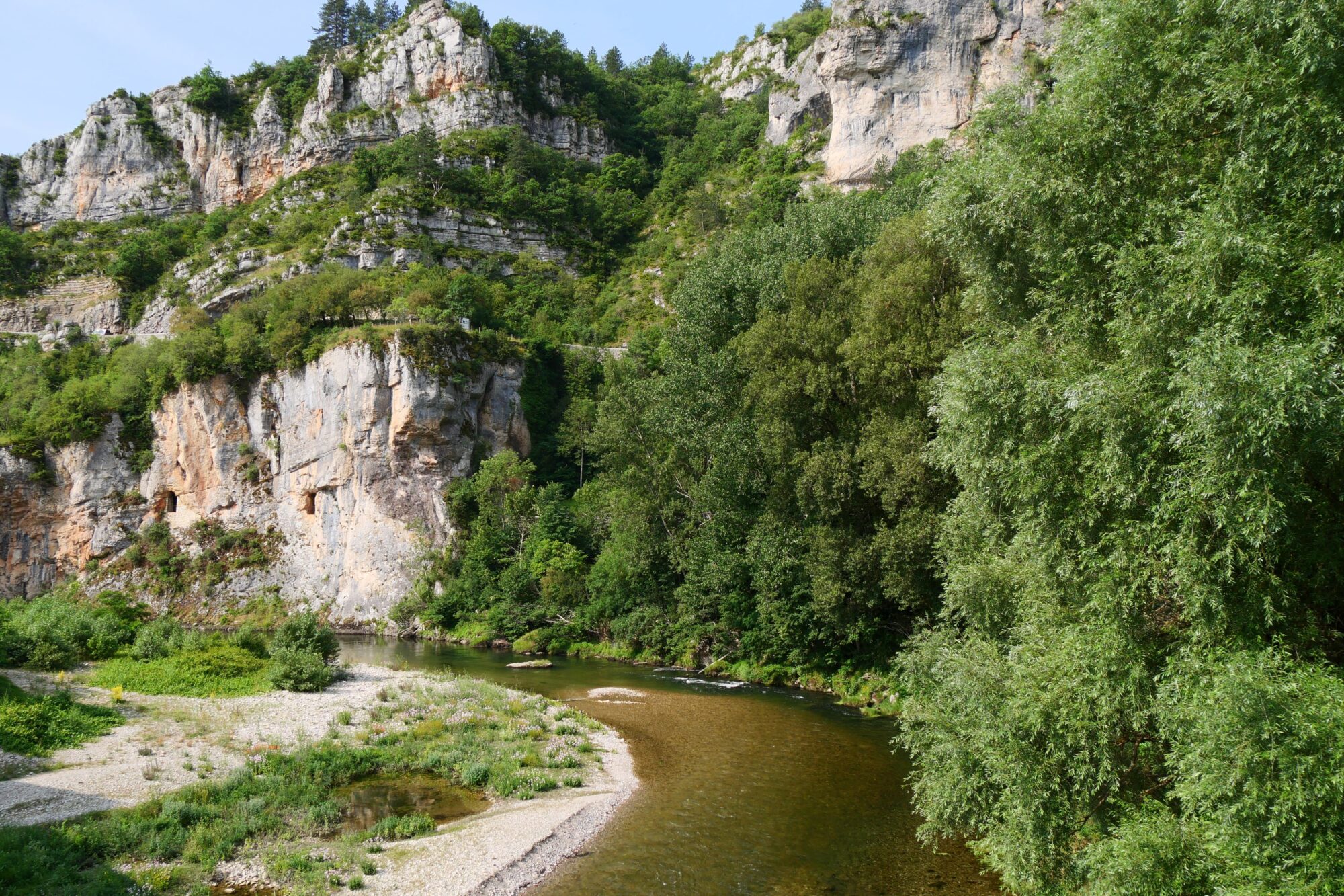
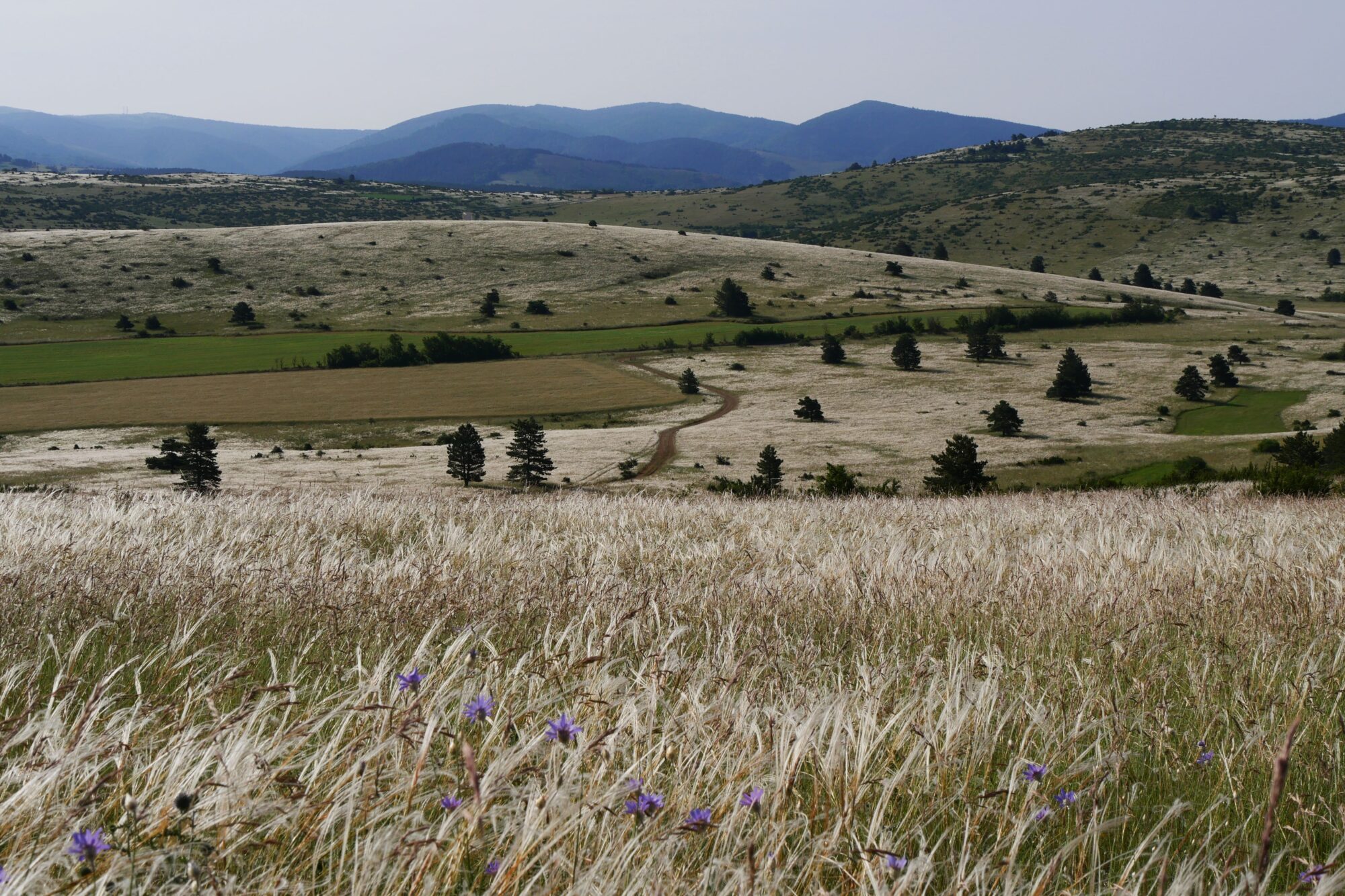
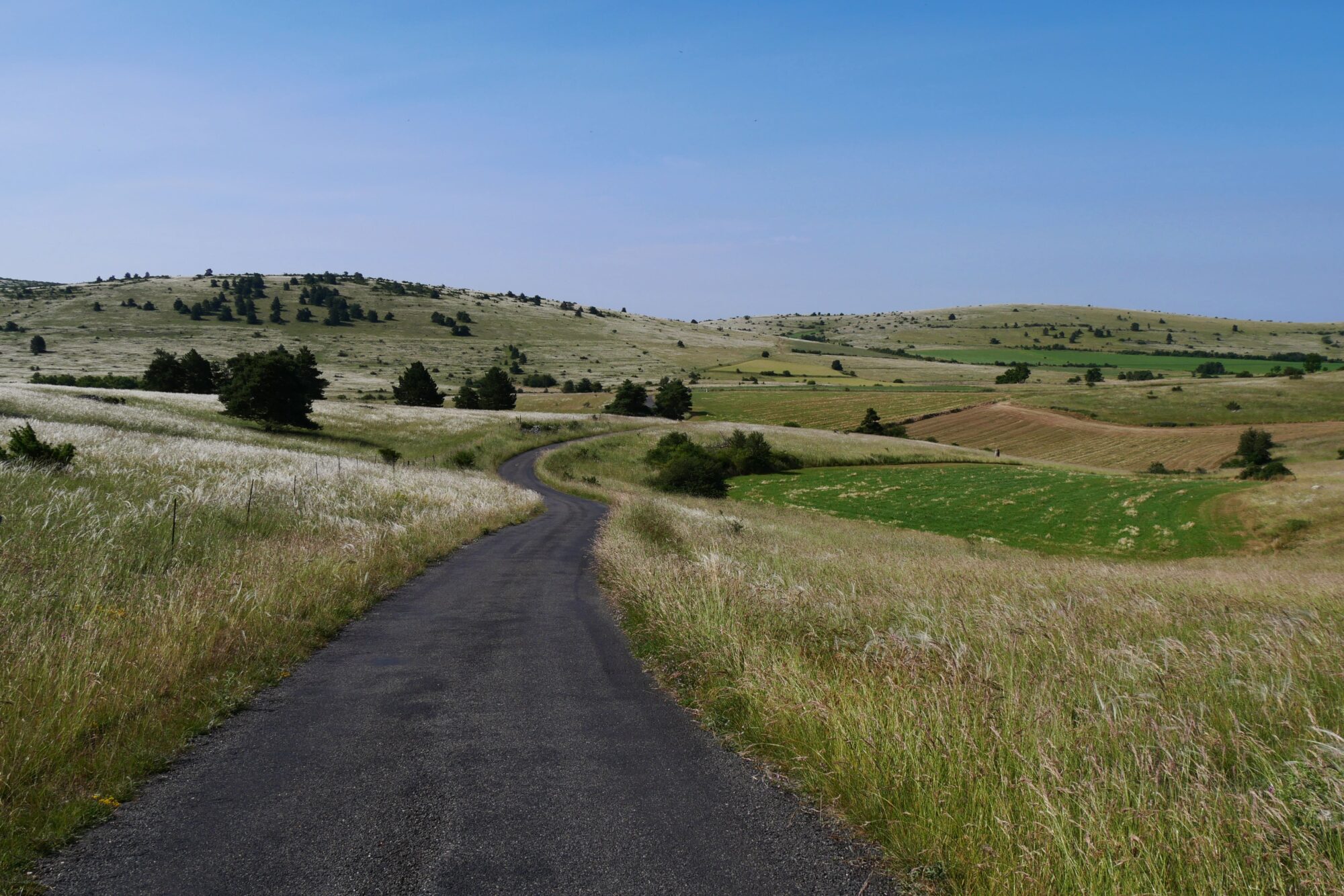
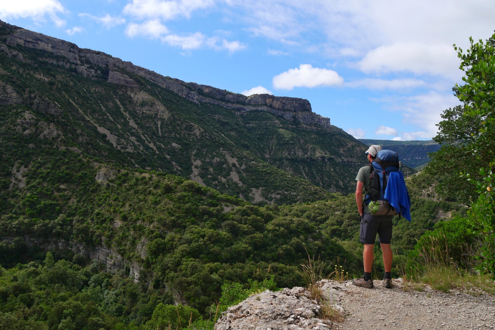
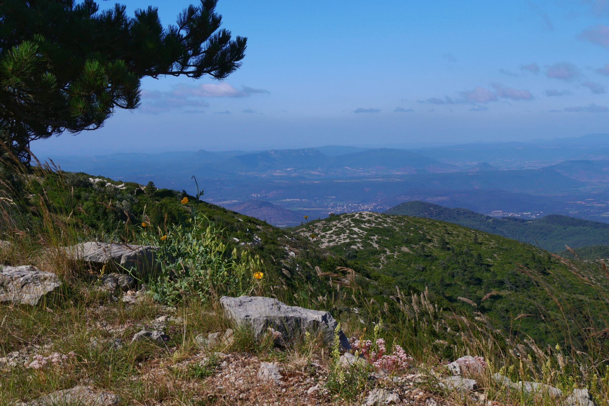
We continued on to the village of Drigas, where we were able to refuel at a fountain, and then arrived at what I’d been looking forward to most since the start of the trek, the Causse Méjéan.


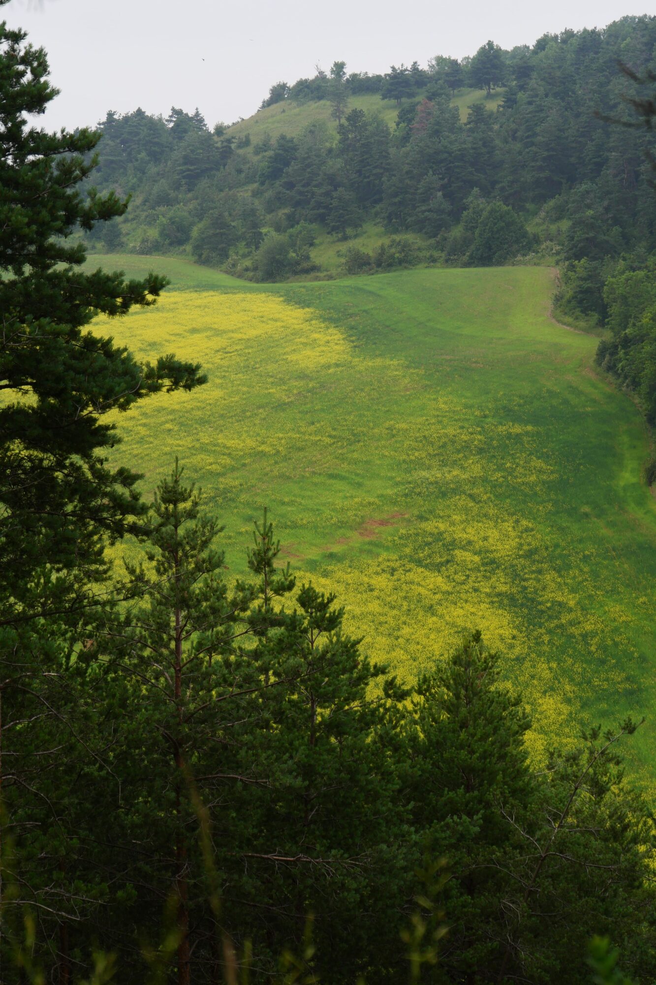
Suffice to say, I wasn’t disappointed. I was dazzled by the beauty of the landscape, rolling expanses as far as the eye could see, covered with fields of angel hair, a real sight for sore eyes!

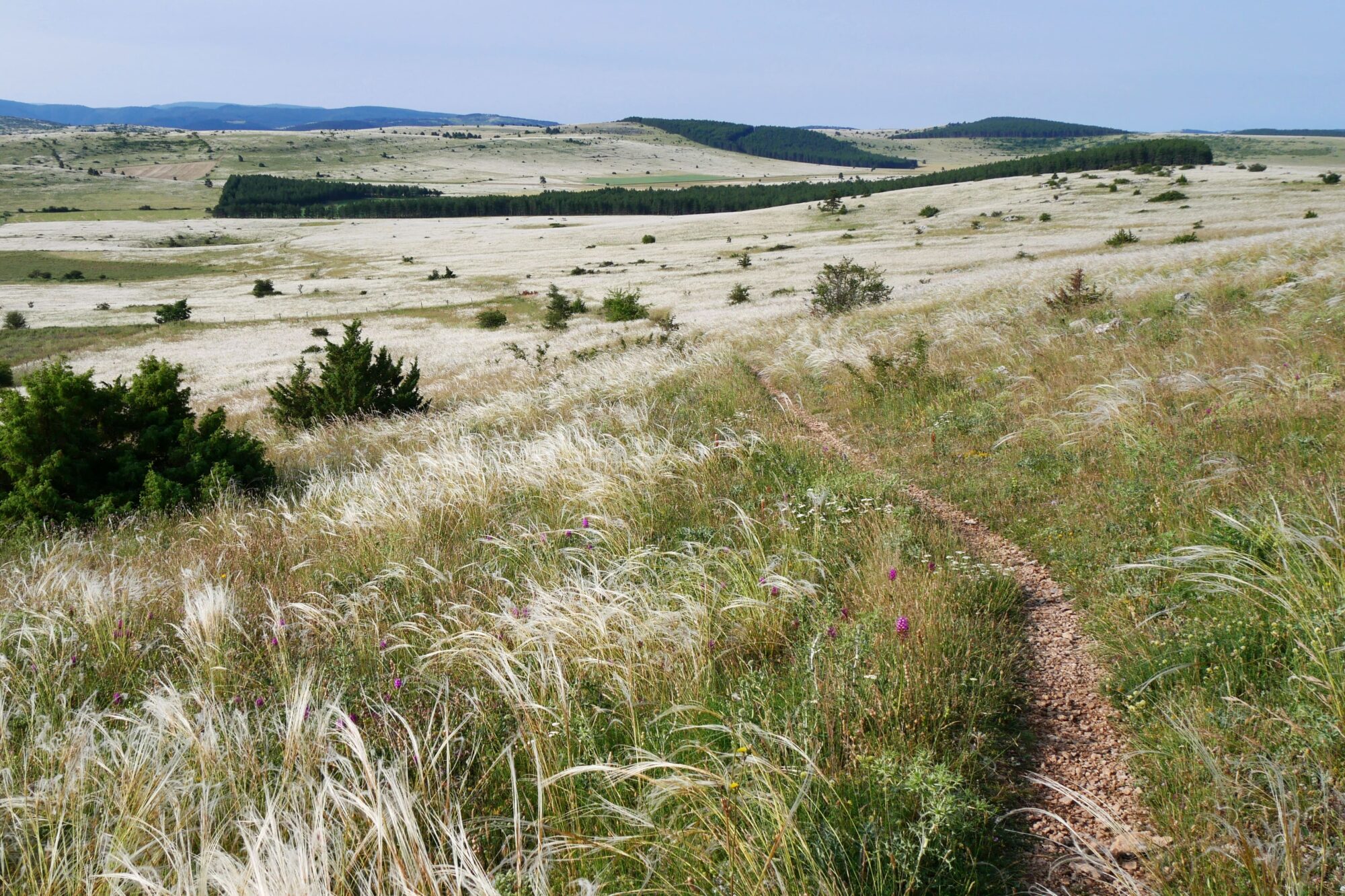
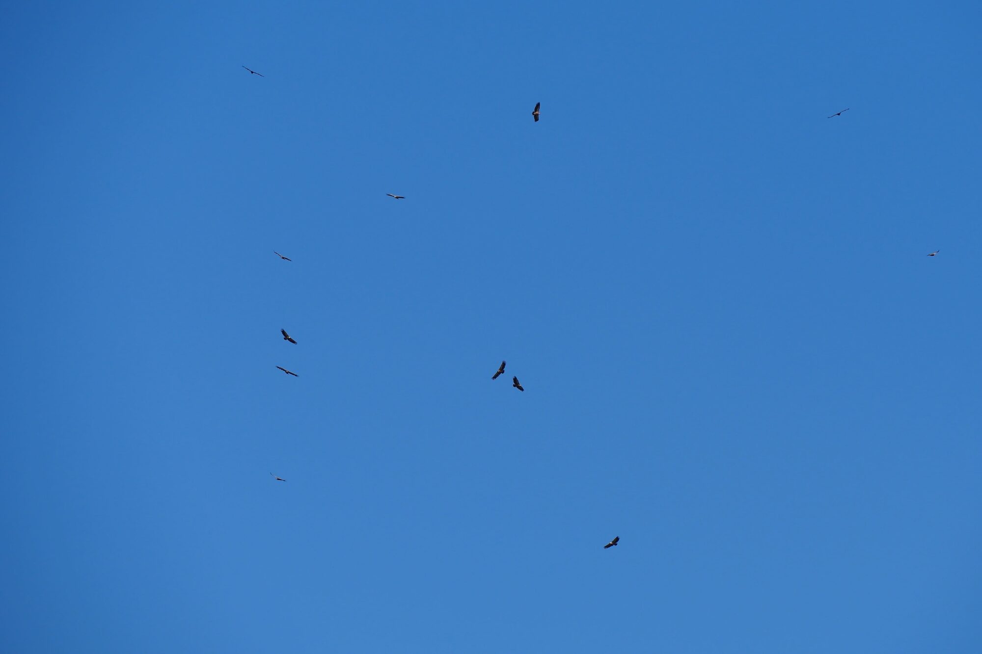
We crossed this landscape, alone in the world, for 5 km and after a short break to enjoy it and observe the vultures, we left the Causse for the last few miles towards Meyrueis.
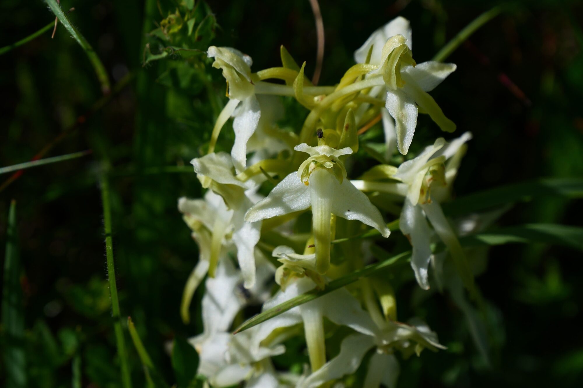
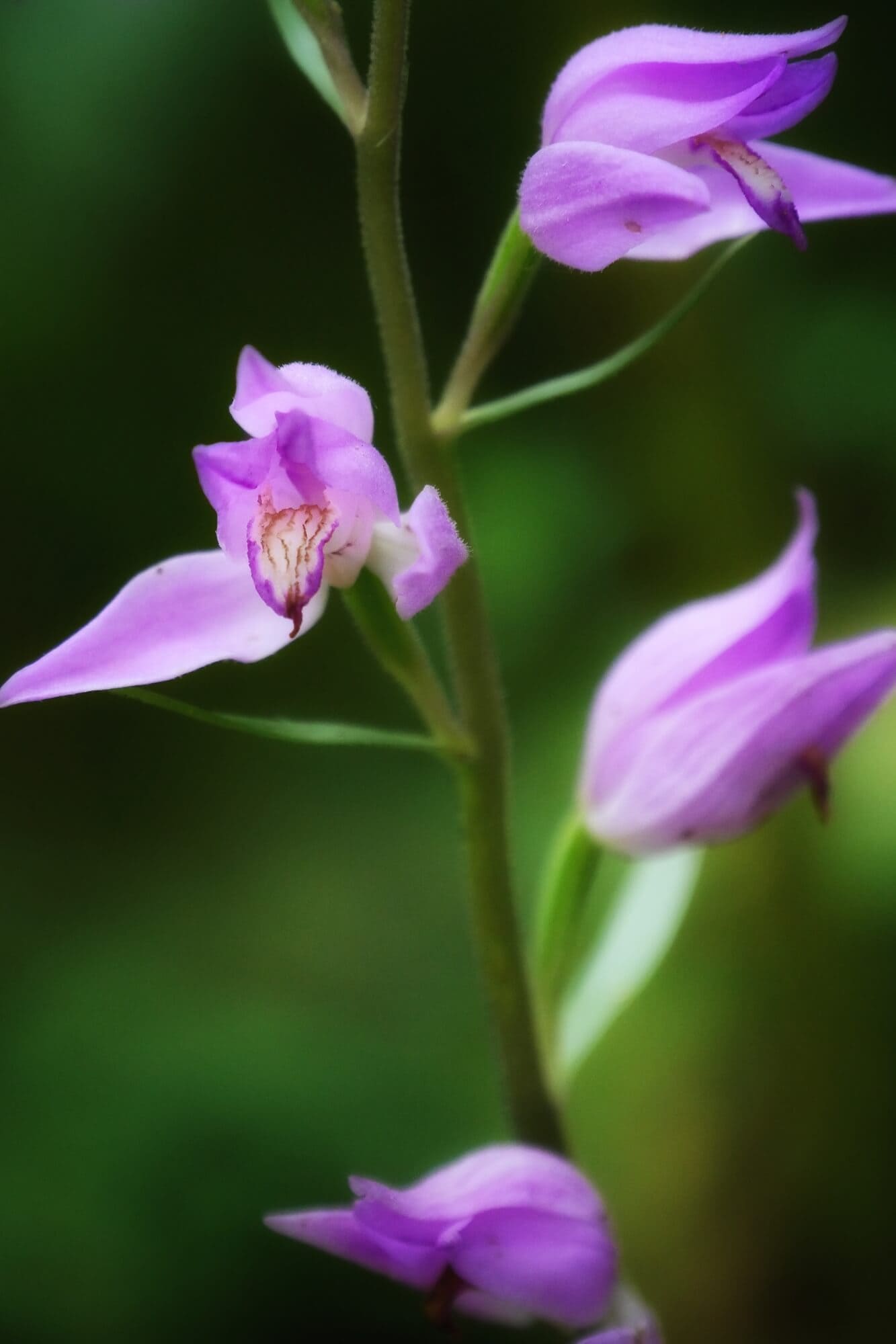
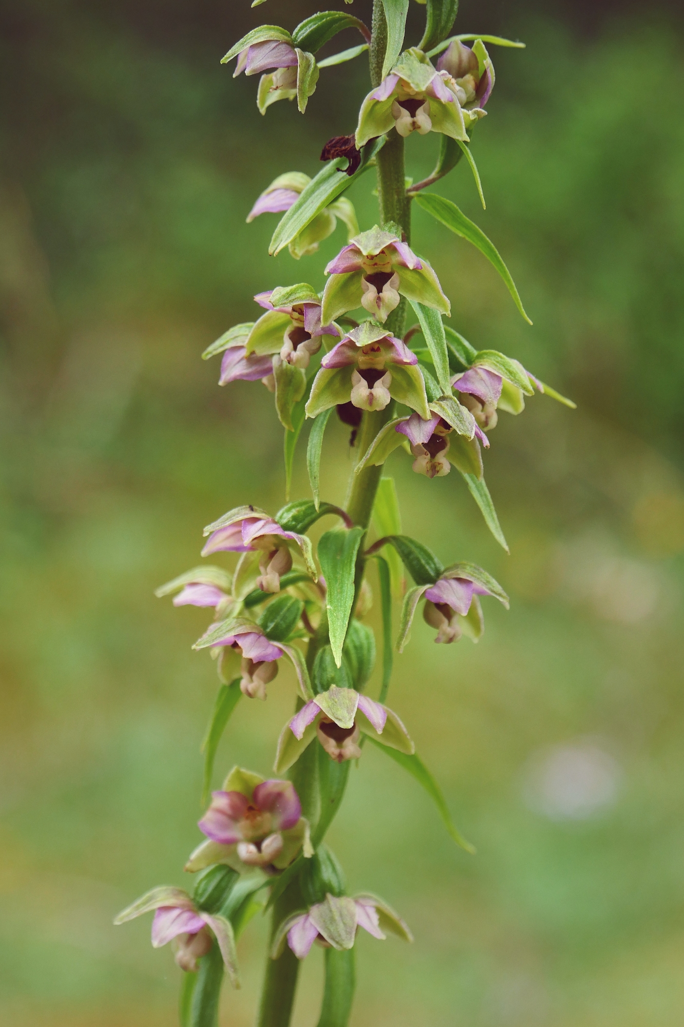
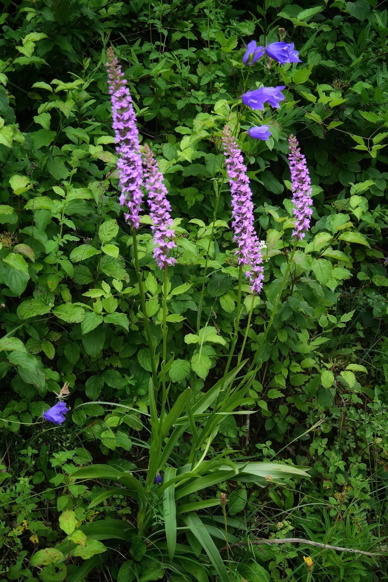
The rest of the trail was just as beautiful, as we hiked upwards with a fine view of Meyrueis below. This morning was once again rich in wild flowers and orchids, much to my delight (see article on Wild Orchids).


Now we had to start the steep descent to the village. During a break in the descent, we came across 2 new hikers from Saint-Guilhem, who caught our attention because one of them had one of her shoes wrapped in plaster. A few days later, we exchanged with her and learned the story of her shoes 😉! We hadn’t come across any hikers since our 3 fellow hikers in Sainte Enimie the day before. These encounters are important to us because they’re rare, which we appreciate, as they allow us to chat while remaining in our own bubble for the rest of the time.


As usual, it was the last few miles that made us suffer. The sun was beating down hard, and we had “only” 1 mile to go when we saw a Meyrueis 2,2 miles sign. A disaster for our morale, until we realized that it was if we followed the road, the GR taking us via a shortcut. But what a shortcut, a narrow, very steep and uneven path where you have to be vigilant to avoid a sprain. And then, finally, the Holy Grail 😉! We arrived in Meyrueis just before noon.

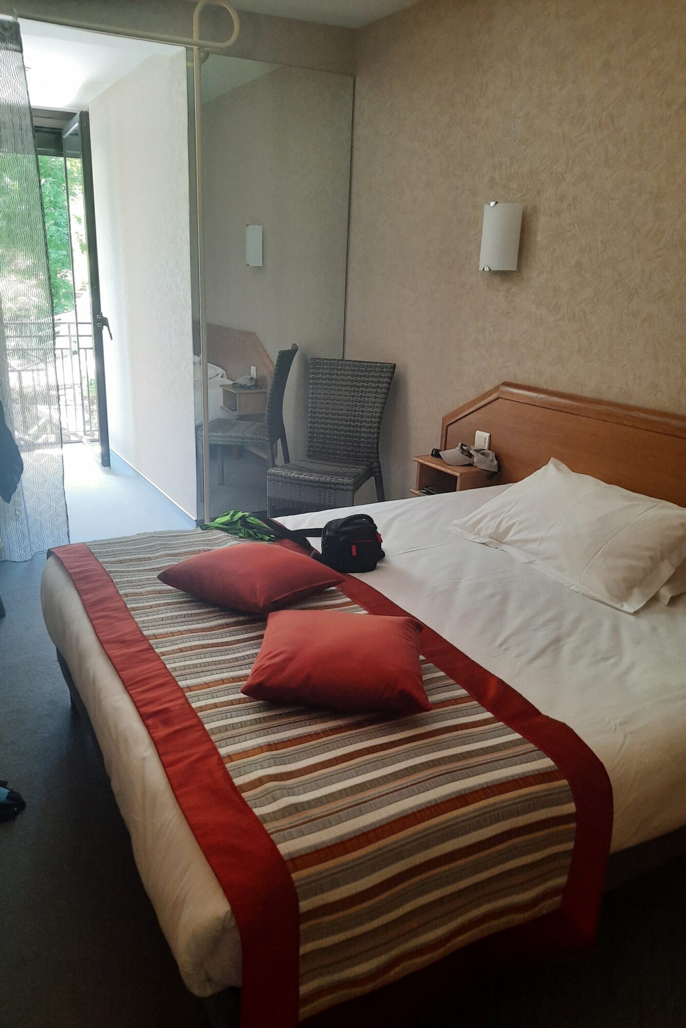
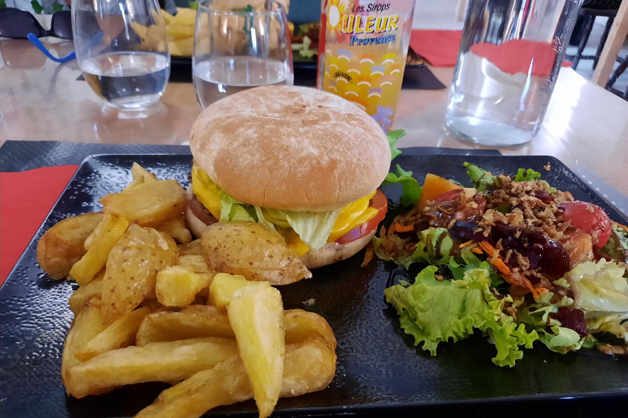
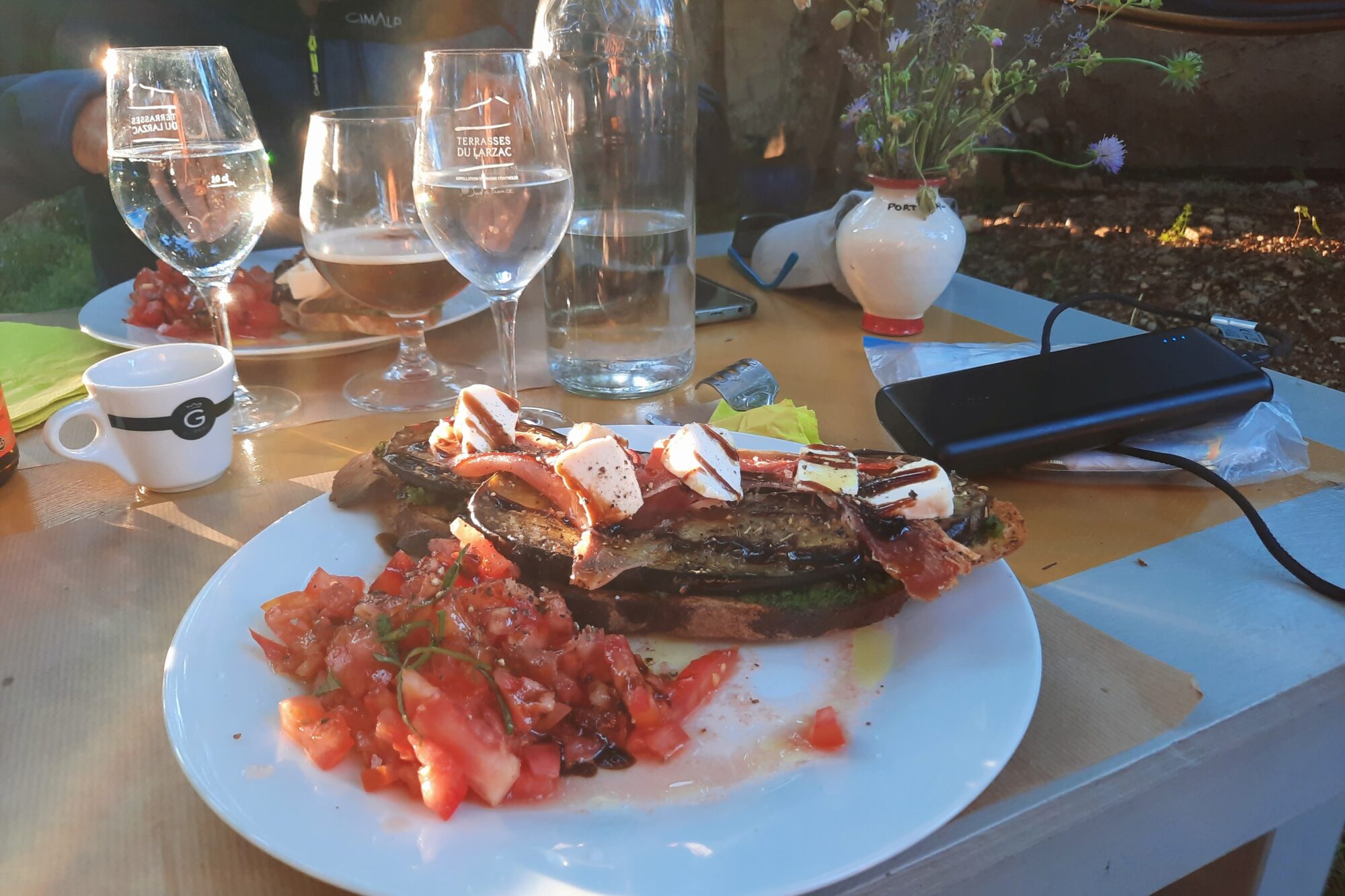
With enormous satisfaction, we found a nice riverside restaurant on the terrace and had a good burger and a succulent chocolate mousse for dessert. Just as we were sitting down to dinner, we saw the three hikers who had shared the gite with us arrive, completely exhausted and annoyed. They’d made a mistake which had lengthened their journey and, above all, they still had 7,5 miles to go to finish the day’s stage. They got ahead of us that day and we never saw them again. After lunch, we went straight to the hotel and checked into our super-large room. We took advantage of the bath, did a bit of laundry, had a little nap and headed back to the center of town to do some shopping for the days ahead and, above all, go to the chemist!
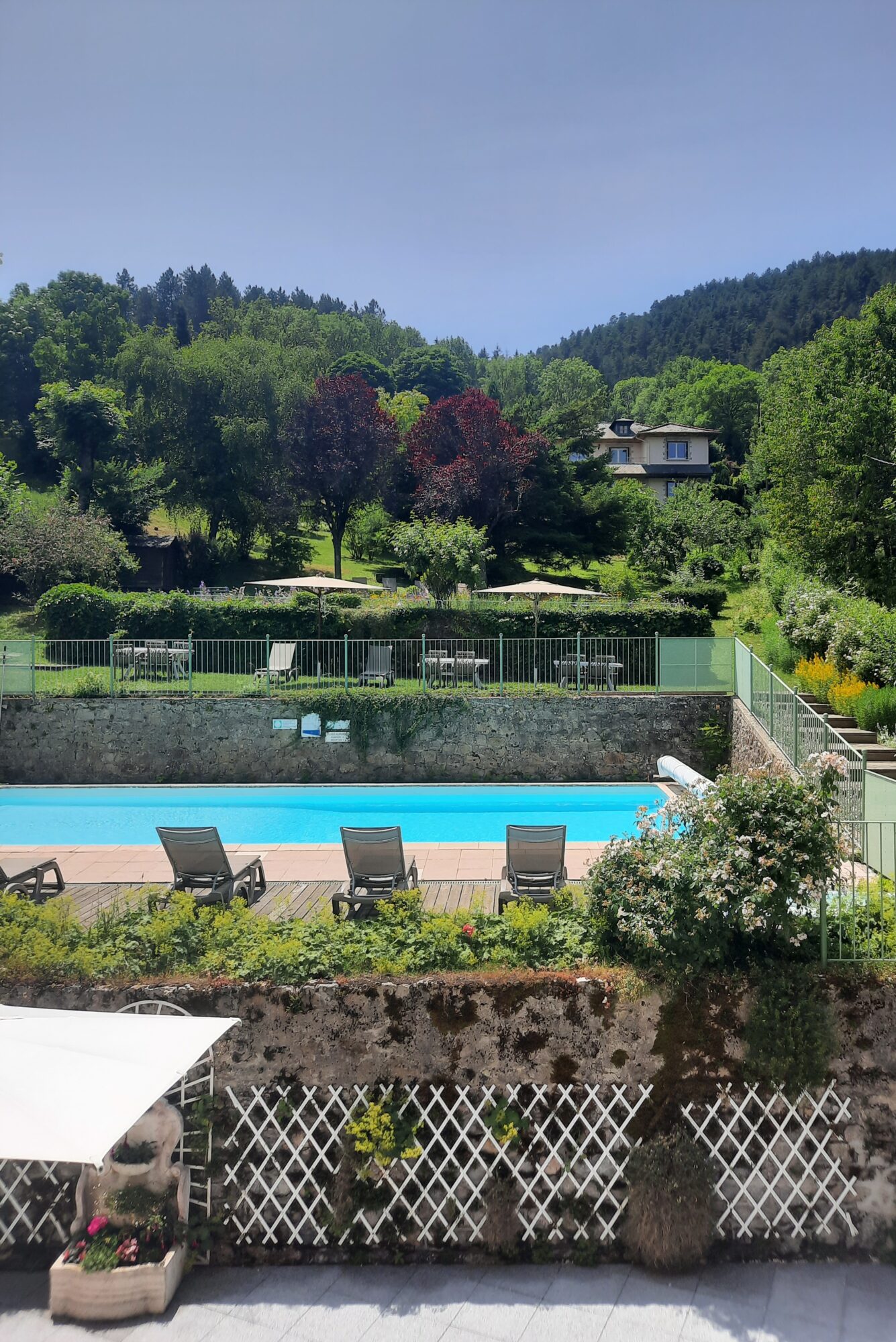
Indeed, we were looking forward to Meyrueis to buy sun cream and moisturizer, as the sun had burnt our necks and faces. We also restocked our ibuprofen supply for my tendinitis. I’ll put the contents of our first-aid kit in Practical Info. After that, we went for a nice ice-cream in the restaurant at lunchtime, which we enjoyed with our feet in the water, and then returned to the hotel to enjoy the pool – a real treat 😊 !! We ended the day at the same restaurant (three times in one day, a record broken 😉) and devoured some great pizzas! Food is a subject that comes up a lot, and I’ve noticed that when we tell our stories, we go into unusual detail about everything we buy and eat, the reason being simple: on a trek, you’re hungry, very hungry, all the time 😉 !!

Summary of the day: cuddly sheep, the stunning landscapes of the Causse Méjean, a short stage, first restaurant, a hotel, a pool, first ice cream, and some moisturizer 😉.
4h30 of hiking (2h30 of breaks), 9.3 miles, 738 feet elevation gain / 1,755 feet descent.
D7 Meyrueis – Espérou
Waking up after a great night, breakfast wasn’t served until 8am, so we had breakfast in our room with the products we’d bought the day before, and set off a little before 7am. We knew that the day would start with a steep climb, which I was dreading. Against all expectations, I didn’t suffer that much, as the climb was very gradual and through the forest.
We passed the two plaster hikers several times and then crossed the border between Lozère and Gard.
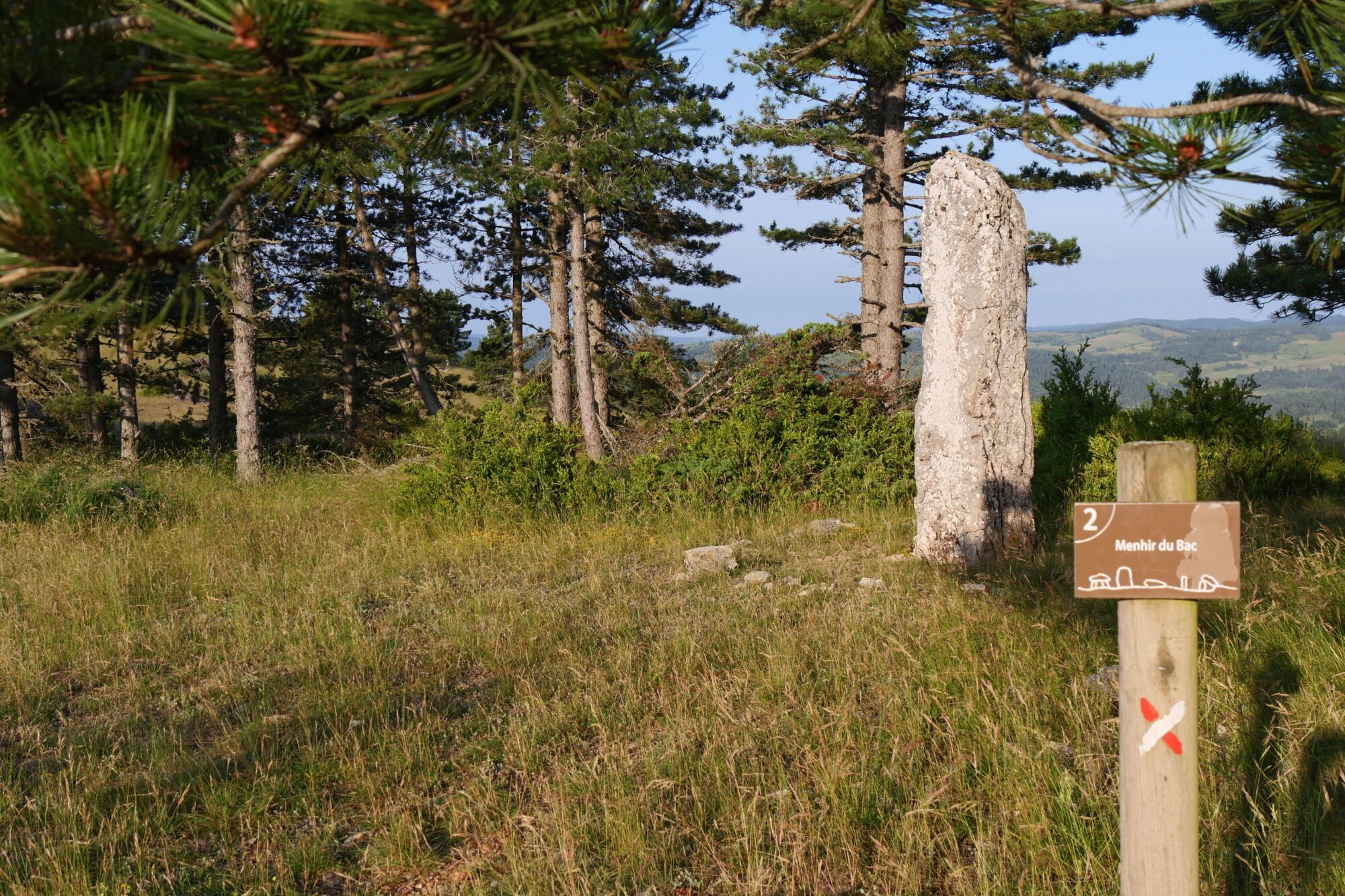
After that, we continued walking through a pine forest and took another morning break at the top, at the level of the planted stone.

After the break, we had 4 miles to go to the lake Bonheur (happiness lake), where we hoped to take our big lunch break. We set off again and just after we saw a sign for Camprieu, decided to follow this path (GR66A on the map) and then saw that we’d left the Chemin de Saint-Guilhem. This was a really great mistake 😉, as we continued to walk along the ridge with great views and avoided a steep descent.

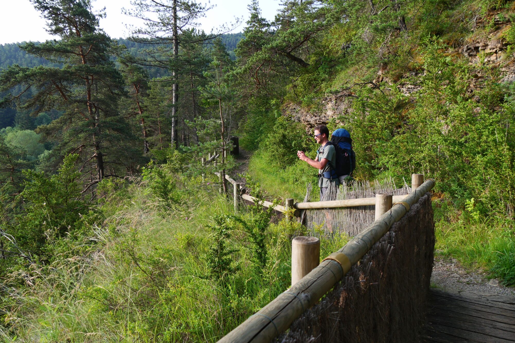
And then, as we reached the first houses, we were delighted to see another sign reading “Bonheur lake 2,9 feet”! Naturally 😉, we opted for this little path, which saved us 1 mile and a stretch of road. We soon arrived at the lake, which couldn’t have been more aptly named!

We spotted a small picnic table tucked away under the trees at the water’s edge, an idyllic spot for our lunch. We didn’t have much food left, so we were still very hungry by the end of the meal, and I started to get a headache. During our break (which lasted 5 h 😉), we took a little nap, had a little dip in the lake and took the opportunity to check the weather forecast again, which confirmed a risk of thunderstorms for the night. We don’t like sleeping in tents when it’s stormy, so I looked for accommodation at l’Espérou, but without success.
We set off again for the last 4,4 miles, keeping to our original plan of the Espérou municipal campground, and telling ourselves we’d see when we got there. We passed through the pretty Vallée du Bonheur (valley of happiness), and were warned at the farm to beware of the dog Milou. We were lucky not to run into him, but we’d learn later that he’d scared other hikers.

After the valley, we started a steep climb through the woods to reach the Col de la Serreyrède, which was a real struggle, especially as my head was still very sore.

At the top, we got a nice reward when we saw, out of nowhere, a producer’s store. We rushed inside and bought crackers, sausage, madeleines and sat directly on the picnic table in front of the store to have a big snack 😉! Which actually cured my headache! From there, all we had to do was the notoriously difficult last few kilometers to the Espérou campground.

We loved this huge, almost deserted campground in the middle of nowhere. Thanks to our treks, we’ve developed a real passion for municipal campgrounds 😉! The manager, a young and very cool guy, came by in the evening to make the payment, and then disaster struck: the stove gave out on us – no more gas in the bottle! We rehydrated our freeze-dried food with hot tap water, waiting to see if we could find a bottle the next day in the only “big” town on the trek.

We went to bed not reassured by the weather forecast, which didn’t stop my darling from falling like a lump 😉! As for me, I kept an eye on the rising storm and when the lightning became more violent, I woke him up in a panic so that we could go and sleep in the bathroom 😉. At the time, he wasn’t too happy 😉 to get up, but he kindly followed me and gave me the greatest gift of all, when he found me a small room with a lock, just big enough to put our two mattresses between the toilet and the shower! This allowed us to have a “little room” all to ourselves, sheltered from the storm, what happiness! After waiting a while for the lights to go out – all we had to do was press a button 😉- we fell asleep, lulled by the torrential rain.

Summary of the day: a new department, a lake of happiness, an empty gas bottle and a night in a toilet. 5h30 of hiking (7h of breaks), 13.7 miles, 2,618 feet elevation gain / 886 feet descent.
D8 Espérou – Avèze
We woke up very early, when the first people turned on the bathroom lights. Despite a difficult night, with a few aches and pains due to the hard ground, we were very happy to be able to get ready under cover of the rain, which was still falling hard. This day was to be typical of the unexpected on a trek 😉! After eating breakfast in our toilet 😉, we made the difficult decision of taking the bus straight down to Le Vigan. We hesitated a lot, disappointed to be skipping a big part of the stage, but we made this choice for several reasons. First of all, it was a stage with a reputation for difficulty, due to its steep negative gradient, and having weak knees on the descents, I was dreading it! What’s more, it was still raining, we hadn’t slept much and above all we needed time (and energy) to look for a bottle of gas in town. With some hesitation, we headed into the village to wait for the bus.

So tired, we fell asleep quickly and 1 hour later we were in Le Vigan. It was the first “big” town we’d been in for days, the cars, the crowds – in short, a difficult and unpleasant change. We tried a few stores for our gas bottle without success. As we still had 4 days to go without a stove, and mini-markets were going to be scarce, I went shopping to get something to eat for the coming evenings, always with the weight constraint. We decided to eat in a restaurant at lunchtime, but it wasn’t a very pleasant experience; we didn’t feel at all at ease in this town and quickly fled as soon as the meal was over.

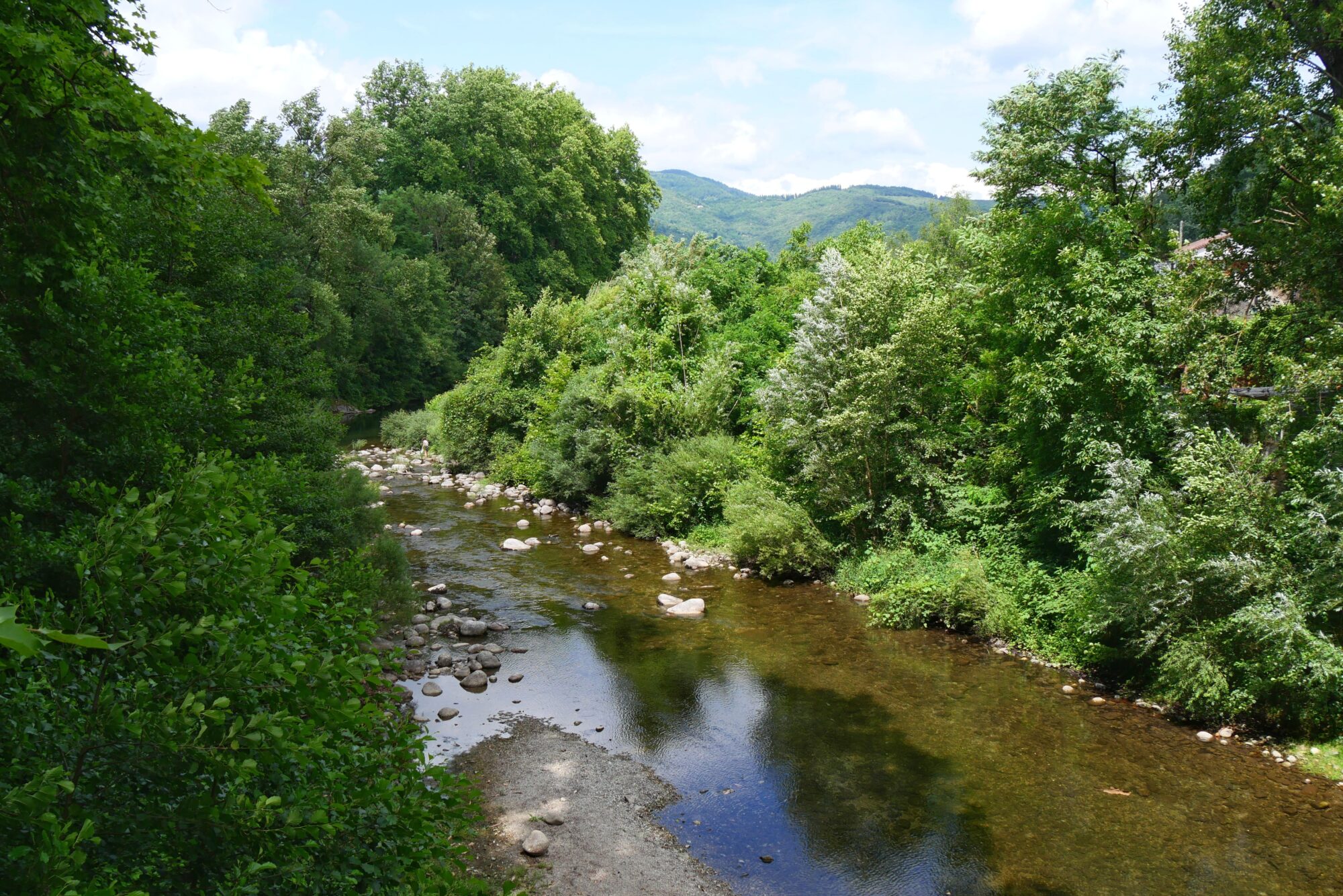
Fortunately, the road soon took us back to a very pretty path running alongside the Arre river. With plenty of time to make the 1;9 miles to Avèze (our stage finish), we took several breaks by the water to dry out the tent.

We passed some pretty waterfalls, found a very encouraging signpost 😉 and soon arrived in Avèze.


There we found that the municipal campground was indeed, as I’d feared, closed to tents. Which is a pity, because it’s in a good position… Once again, we were reluctant to continue on to the Montardier campground, but it was 4,3 miles away, with a very steep climb, so we decided to stop there, even though we felt our bodies were running out of miles 😊. So we opted for the only option: a nice inn, where we could still sleep in a good bed!

In the evening, we went for dinner at the guinguette we spotted on our way into Avèze, and had a great time! It’s an open-air restaurant, decorated with string lights. We ate very well (sausages/fries and crêpes for dessert), enjoyed a concert by the Absurd Heroes, thought we saw Mr Etchebest 😉 (for me it was a look-alike and for my darling it was 100% him, the mystery remains 😉) and above all, we celebrated our 93 miles!

Summary of the day: a bus ride, a stifling city, a great riverside bar, a concert, and a hostel. 1h30 of hiking, 3.7 miles.
D9 Avèze – Blandas
In the morning, the weather forecast was overcast, so we set off a little later and enjoyed the hostel’s excellent breakfast. At 8:30 am, we set off to tackle the famous climb, described by many as the hardest of the trek (1,312 feet of elevation gain over 1.2 miles).


In the end, it went well, no doubt because we’d prepared for it mentally and, above all, because it wasn’t too hot, thanks to the clouds!
It was at the top, while we were busy observing a caterpillar 😊 and dozens of “empty” insects, that we bumped into the two plaster-wearing hikers.
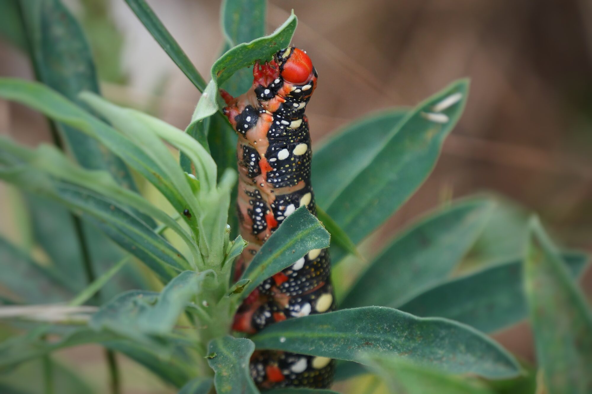
We chatted to them for the first time, two very nice ladies also doing the Saint-Guilhem, and the one with the plaster then explained that she was so happy with her shoes that she didn’t want to change them, hence the plaster to hold the sole, and she showed us her second shoe, the sole of which was hanging on by a thread too 😉! She also told us they’d probably turn them into flowerpots by the end of the trek. 😊, I thought that was a great idea! They left again, and we went back to observing our “insects”, and after some research we realized that they were the molts left by the cicadas after they’d hatched! It has to be said that we don’t see many cicadas in Charente 😉.

After 4,3 miles, we arrived in Montardier, filled up with water and my darling did some shopping at the mini-market and surprised me by bringing me back a snickers bar, some chocolate, happiness 😉 !! After that, we had another 9,3 miles to the Cirque de Navacelles, including 6,5 miles to the village of Blandas.
At the Planas dolmen, you can save 1,2 miles by taking the road straight on to the village, but we preferred to follow the GR.


It’s a good thing it was overcast, otherwise we’d have really struggled without shade! At the end of the slope, before turning off onto a path, we stopped by the roadside for a picnic. The two ladies reappeared at this point, but accompanied by an adorable doggie that I got to drink. They explained that it was a dog that had been following the hikers from Le Vigan, had started out following another group and then switched to them. I was worried about whether he’d find his family again, a matter to be followed 😉…

We resumed on a path that took us through some beautiful countryside, including our first lavender fields, as the Mediterranean drew closer 😊 !

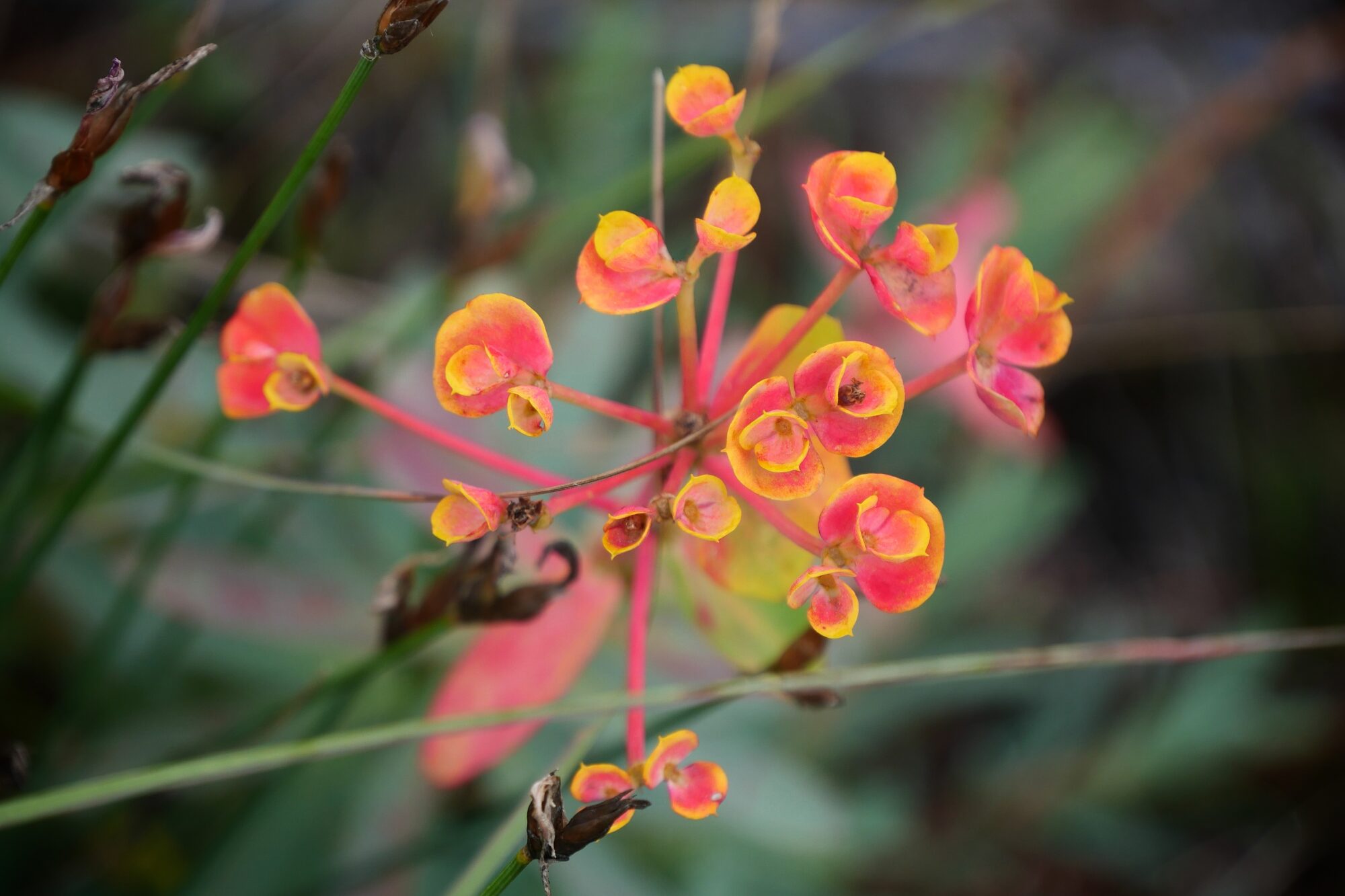
We were also dazzled by a magnificent field of poppies!


After these 1,9 miles, we arrived in Blandas, and decided to take a nice break, when we saw a nice shady spot with tables and a fountain. It was here that we made a last-minute change!

A group of three very nice hikers arrived and asked us where the campground was, then a few minutes later another hiker arrived and asked us the same question. That’s when we were tempted to stop our day’s hike and take advantage of this campground too 😉 ! The day before, I’d found a place to stay in Navacelles, but we weren’t keen on the idea of sleeping rough for our last few days of the trek. Even though we were going to have to do a big stage the next day, adding the remaining 2,8 miles, we stopped at the Blandas campground.

We met up with all the hikers we’d seen before, all doing the Saint-Guilhem. We also met a lone gentleman who was doing it the other way round. He’d “only” been out for two days, and we talked about where to sleep, the difficulties involved and, above all, where to find water. It was also thanks to him that we decided to take the other route to finish the trek. In fact, at the end of the Saint-Guilhem, there is a choice of 2 trails (see Before the trek). I’d chosen the one via Mas Aubert, but looking at the terrain we were beginning to doubt we’d find a bivouac area. He had just passed through La Vacquerie, and when he told us about the municipal campsite, we immediately changed our plans😉 ! Having made the mistake of not photographing the part of the book concerning this section, I contacted my little sister who sent me the necessary photos!

As we’d stopped our day early and done “only” 10,6 miles, we decided to go and check out the viewpoints over the Cirque de Navacelles, even though we were going to spend the next day there. We figured that without our bags, we’d get a lot more out of it, and we did. So we resumed walking for just over 1,2 miles, but without the bags it felt like flying 😉. We discovered the sublime view of the Cirque de Navacelles, completely on our own, as the large parking lots were completely empty! We were able to make the most of it, taking our time and seeing all the sights, which we certainly wouldn’t have done the next day.


Back at the campsite, with the lack of a stove and hearty food in sight, we booked a table at the only restaurant in the area. We had another great evening, the restaurant was very cute and run by lovely people, we ate very well, drank a little (a good homemade punch and a beer) and had a good laugh 😉!
Summary of the day: dozens of cicada shells, a dog, seven hikers, an improvised campsite, a short hike without backpacks, discovering the magnificent Cirque de Navacelles, and a great restaurant. 5h30 of hiking (3h of breaks), 13.7 miles, 2,093 feet elevation gain / 906 feet descent.
D10 Blandas – La Vacquerie
We got up very early at 4 a.m., in view of the long day’s walking ahead of us (over 15.5 miles) and the forecast heat wave. We quickly arrived at the viewpoint from the day before, and were extremely lucky to see the cirque under a rainbow 😊 !


We wasted a little time enjoying the show, and started the unpleasant, steep 1,2 miles descent to the village.
We entered the village, still asleep, and paused to refresh our feet in the river Vis.

We were still very lucky to discover this touristy village on our own.

We quickly got back on the road to tackle the day’s challenge, before the sun got too high. To reach the village of Sant-Maurice-Navacelles, 6,3 miles further on, we first skirted the Vis gorges on a narrow, tiring path, then had a little respite when we came to a wide path alongside the aqueduct, which allowed us to take a break.

Unfortunately, this was short-lived and we tackled the steep hairpin climb out of the gorge.

This was a tough one, as the sun was beating down and we arrived in the village quite tired. Strangely enough, despite the beautiful views over the gorge, we found this stretch rather strenuous, perhaps because of the fatigue.


After taking a break and refueling at the village fountain, we were about to set off again, when I had the good idea of exploring the village and…surprise, an open-air snack bar was open (note that it was a Sunday)! We jumped at the chance, as hunger grew with each passing day, and without a stove we naturally began to take advantage of all the places to eat.

In the little snack bar, we bumped into the lady who was looking for the campground and offered to share our table. We were impressed by this little granny, who was making her way to Saint-Guilhem alone in a tent, also making wild bivouacs, and who seemed to be struggling a lot less than we were 😉! After an excellent meal of sausages and French fries, she set off again, and we extended our break a little (a lot 😉) by enjoying an ice cream sitting under a tree, in the company of a cute bunny.

Despite the high temperature, we had to set off again for the 6,2 miles to La Vacquerie. A much easier section than the morning’s, with no major changes in altitude and beautiful scenery.

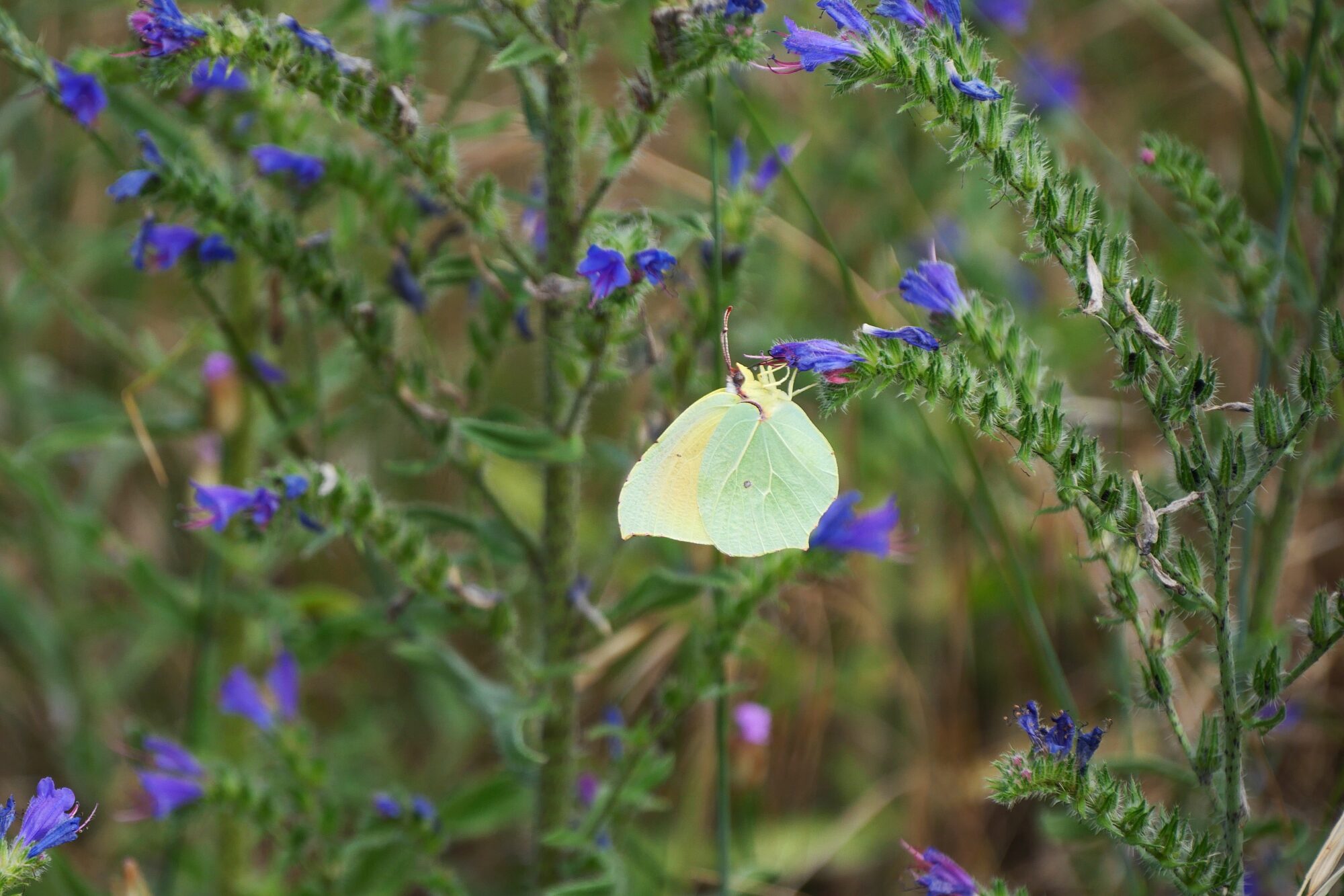
I had already been amazed for several days by the abundance of butterflies, but that day we experienced a magnificent moment, when we found ourselves walking surrounded by hundreds of them 😊.

The last 2,5 miles, on a very easy path: flat, wide and shaded, were a real nightmare for me! My feet were hurting more and more, and above all I had no energy left at all, as if I were literally drained! So it was in a bad way that we reached the village and collapsed in the campground 😉. A perfect campground for us, set in a large meadow and self-contained. In fact, all we had to do to pay was drop the money in the Town Hall letterbox. We didn’t have enough cash, so we sent them a check when we got back 😊.

We were both exhausted, and we knew we didn’t have much to eat, which didn’t help our morale! It was at this point that another trekking miracle took place 😊. Just a few meters further on, we discovered a lovely little restaurant in the woods just behind the campsite, which was already fully booked, but agreed to take us on. We were more than surprised to find a restaurant open on a Sunday evening in a tiny village just a stone’s throw from the campsite. The mood changed radically 😉 and we were delighted to enjoy their delicious toast! It was with nostalgia that we went to bed for our last night in a tent, knowing that tomorrow this incredible adventure would come to an end 😊.
Summary of the day: a rainbow, a steep climb, two restaurants, hundreds of butterflies, a tough end to the day, and a last night in a tent. 7 hours 30 minutes of hiking (4 hours 30 minutes of breaks), 15.8 miles, 2,047 feet elevation gain / 2,156 feet descent.
D11 (END) La Vacquerie – Saint-Guilhem-Le-Désert
Early wake-up call, frugal breakfast to the sound of wild boars having breakfast too 😊 ! Departure at 6 a.m. for our very last stage, sniff. First objective of the day, to reach Mont Saint-Baudille, 6,2 miles away, before the sun gets too hot.

We started with a short climb up a lovely path through the lavender fields in the light of the sunrise. It was a day of smells, starting in the morning with the incredible scent of honey coming from the linden trees in bloom, followed by lavender and thyme for the rest of the day – a real treat!

Then we arrived in a whole new, more Mediterranean landscape and even found ourselves walking on sand in a magnificent pine forest.


By 9 a.m., we were at the bottom of Mont Saint-Baudille, where we took a break and a bite to eat 😉 before starting the climb.

As my tendinitis was becoming more and more painful, we had to do what we had done on the Dordogne trek and swap shoes. It’s a relief for me, but difficult for my partner who has slightly larger feet, especially as my shoes were much less flexible this time!

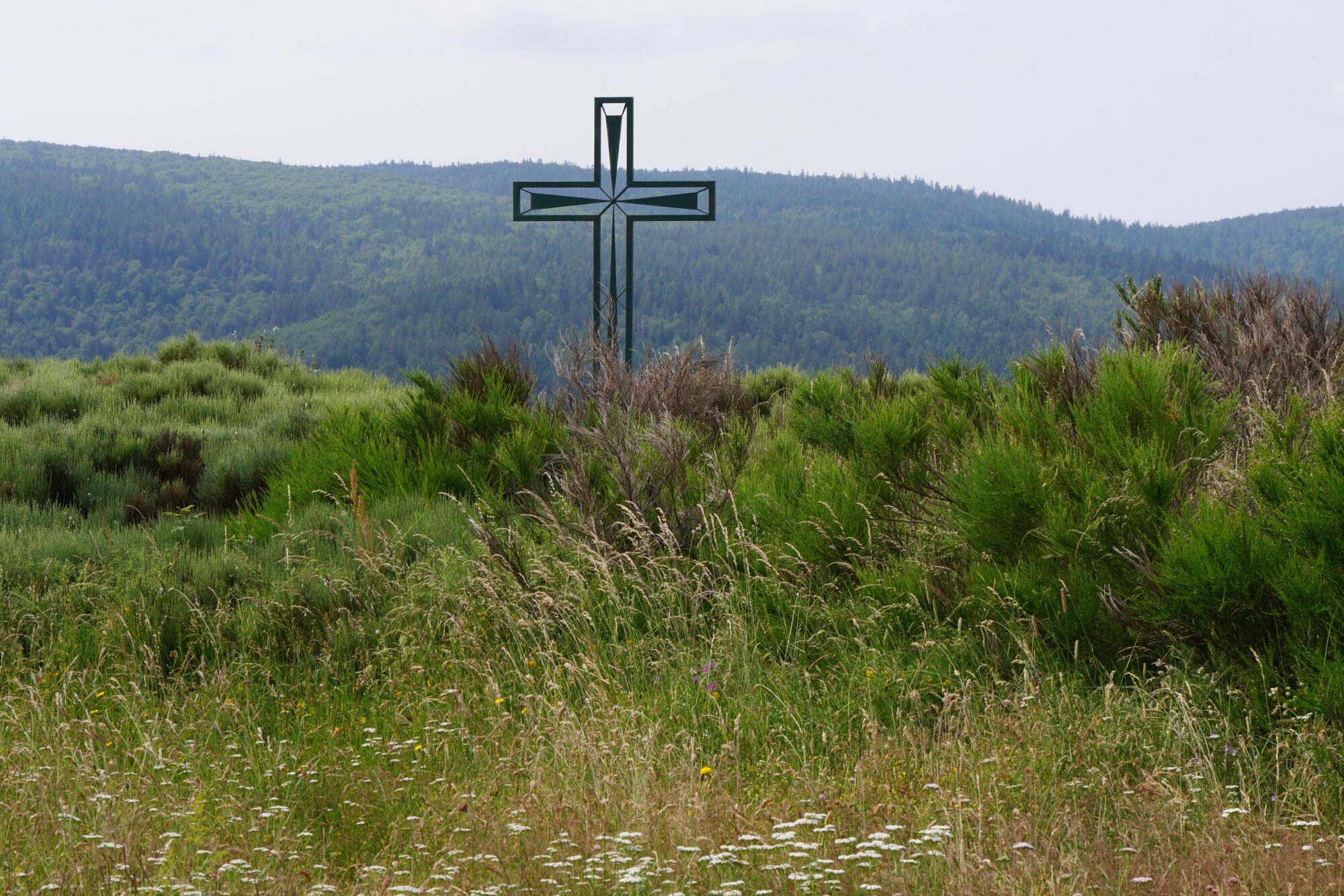
After a steep climb of around 1,2 miles, we reached the summit in a magnificent Mediterranean scrub landscape with incredible views and the song of the cicadas! You can even see the Mediterranean from here!

Still hungry, we took another food break 😉, then began the long 2,4 miles descent. First on a rugged path, then on a wider trail, always with spectacular views, especially of the Pic Saint-Loup.


The sun was beating down hard, but we were able to enjoy the shade of the holm oaks. When we reached the road, we had to walk 1 mile with difficulty, under a scorching sun and without any shade.
Then we took advantage of the path through the national forest of Saint-Guilhem-le-Désert (the end was drawing nearer, yippee) to take a final break, where we devoured all the edibles we had left, which was not much left at all 😉 !
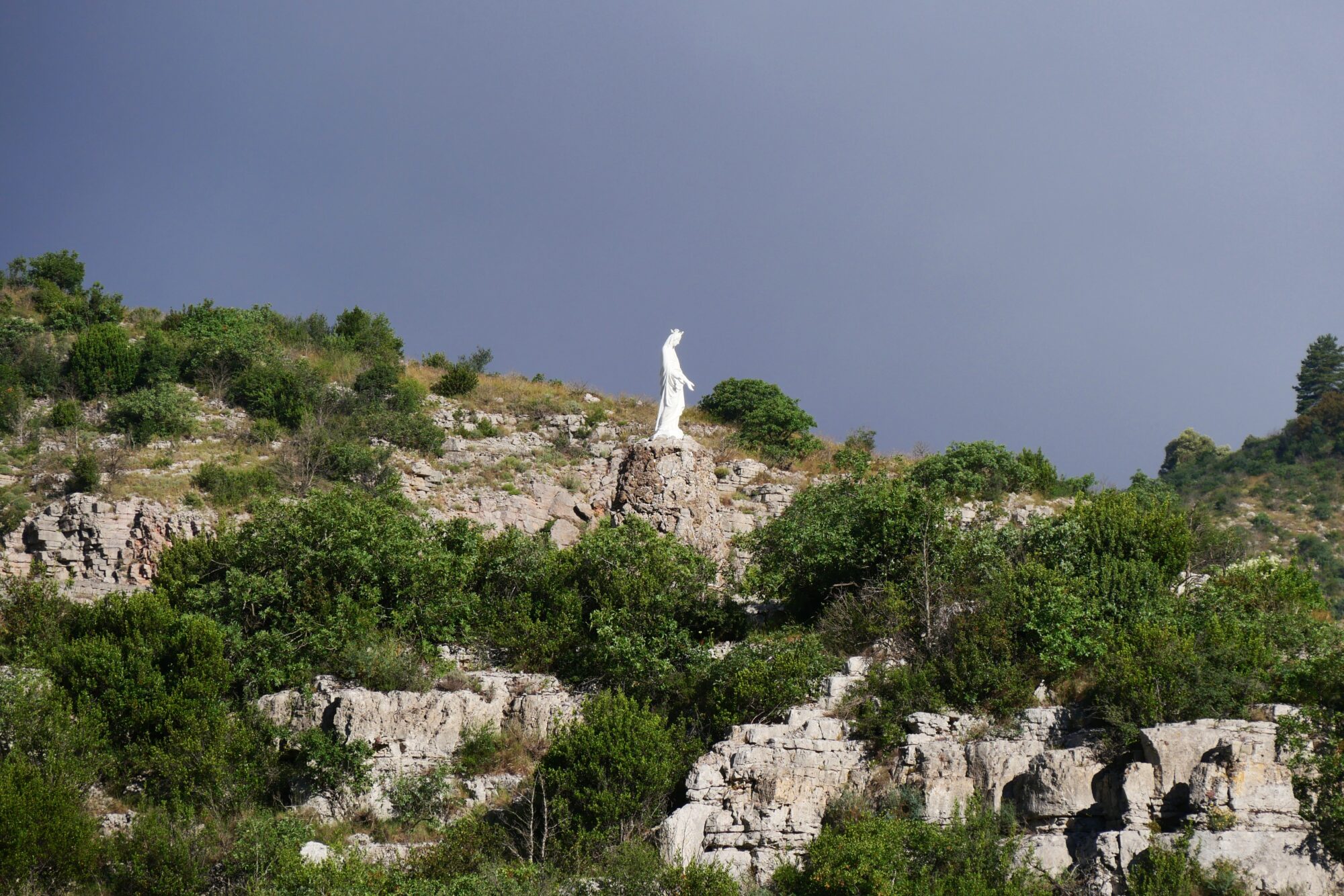
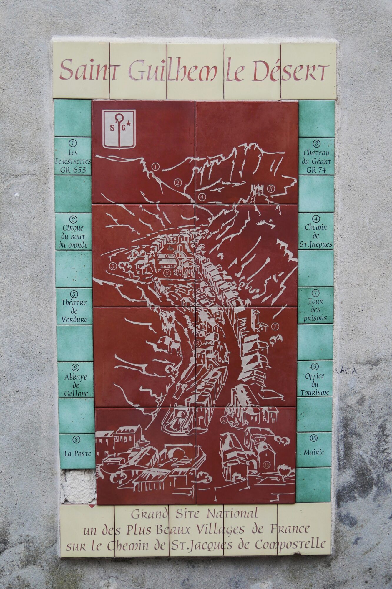
We set off again for our last three miles, which were just magnificent. The path was quite shady and we climbed to the pass overlooking the magnificent Infernet cirque, with the village of Saint-Guilhem-le-Désert below.

After that, all we had to do was descend to the village along the majestic Fenestrettes trail. For this last, truly breathtaking section alone, we were glad we’d chosen this route to end our trek in style.

We let our joy explode when we came across a sign reading “Saint-Guilhem-le-Désert 1 mile”. I took off my shoes at that point, so that my darling could enjoy his arrival with his feet free 😉 ! We returned to the village exhausted, but so happy!
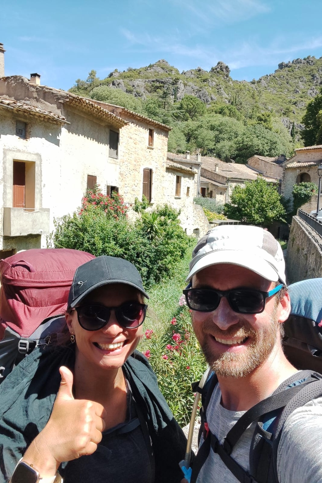
The first thing we did was to buy ourselves something to celebrate our arrival, pain au chocolat and cold drinks, then we headed straight to our guesthouse for the evening to take an ice-cold shower, eat our snack and take a little nap, real happiness 😉.
We went out again in the evening, the heat being really stifling, and found a store with some souvenirs for the Saint-Guilhem hikers, ate an ice-cream and above all discovered this magnificent village of Saint-Guilhem-le-Désert. In fact, it was in the church that we met up with our little granny, who had also just finished!

In the evening, we celebrated our journey in a crêperie in the main square, at the foot of the King of the Plane Trees, a splendid tree planted in 1855!

As we set off, we bumped into the group of hikers we’d met in Blandas, and we all debriefed together about the trek, our favorite landscapes, the weight of our packs, etc. That’s also how we got news of the other hikers, how we found out that the dog following the ladies had been reunited with its family 😊 and many other anecdotes! We felt very close, even though we knew nothing about each other, but connected by the magic of the trek! It was a lovely moment, and a fitting end to this fabulous adventure!

Summary of the day: the scents of the south, stifling heat, cicadas, a spectacular end to the stage, the village of Saint-Guilhem, and a completed trek. 7 hours of hiking (2 hours 30 minutes of breaks), 15.5 miles, 1,740 feet elevation gain / 3,435 feet descent.
How was the trek?
143 miles, 62 hours of hiking, 18,163 feet elevation gain / 18,083 feet descent, and 4 French departments crossed.
It was a truly wonderful trek, for me the best yet! I loved the variety and beauty of the landscapes, the multitude of flowers, the people I met and the magnificent villages! It was truly magical to start out in the green expanses of Aubrac surrounded by cows and end up in the Mediterranean scrub amidst the cicadas! In terms of difficulty, as you’ll have gathered, it was mainly the heat and lack of water on certain sections that forced us to overload with water.

We haven’t done many “wild” bivouacs either, which we like very much, but the terrain is indeed not often suitable, water is scarce and above all we don’t feel comfortable pitching the tent when we’re not sure we’re allowed to. For the first time, I slept quite well in the tent, and the only advantage of the heat was that we had pleasant nights without having to wrap ourselves in down 😉! On the health front, my tendinitis flared up and I got my usual blisters 😊. My darling’s feet were quite sore and we burned quite badly for the first few days. On the other hand, our backs and shoulders didn’t really suffer, apart from the “normal” discomfort of carrying a big bag. Food-wise, I think we were a bit short of calories on some days, but on the whole, apart from the incident with the gas bottle, we were happy with the food we took with us and especially with our energy drinks, which really helped. In any case, with every trek, we learn something and improve for the next one!

The return journey was really difficult, as your body gets used to walking so much and you feel a great lack of it for the first few days. But there’s something even harder to miss: the unique feeling of well-being you get on a trek (probably amplified by the dose of endorphins secreted during the effort 😉). On a trek, all our energy is focused on the essentials: walking, eating, drinking and sleeping. Everything else becomes secondary, and the brain is emptied of thoughts. Barriers come down, shyness disappears, and we realize how much we’re changing – or rather, how much we’re simply becoming ourselves 😊! We don’t worry about how others look at us, we wash in our underwear in streams, we spread our clothes everywhere, we go into stores badly dressed and not really fresh, and we don’t mind at all 😉!
Practical information
EQUIPMENT
Clothing, bivouac gear, first-aid kit… this is our equipment for this trek. We used almost everything we’d packed, with the fortunate exception of the contents of our emergency kit.
Clothing:
- Waterproof parka
- Waterproof pants
- Warm merino jacket
- 3 merino T-shirts (two for the day and one for the night)
- 2 pairs of pants (one for hiking and one for the night)
- Short
- 3 pairs of socks (two for the day and one for the night)
- 3 panties (two for the day and one for the night)
- 2 bras
- Pair of merino gloves
- Neckband
- Swimsuit
- Cap
- Walking shoes
- Tap shoes
Equipment:
- Backpack + waterproof bag cover
- Walking poles
- Tent
- Sleeping bag
- Pillow
- Headlamp
- Microfiber towel
- Small waterproof bag
- External battery
- Camel bag
- Filtered water bottle
- Stove + saucepan + lighter
- Knife + spoon

First-aid and emergency kit:
- Medication (paracetamol, ibuprofen, antispasmodic, antibiotics and corticoids)
- Small tubes of creams (burn cream and anti-inflammatory)
- Micropur tablets
- Mosquito repellent
- Sterile saline solution
- Disinfectant
- Tweezers
- Scissors
- Dressings
- Ahesive strips and strapping
- Survival blanket
- Tourniquet
Hygiene:
- Toothbrush + toothpaste
- Deodorant
- Biodegradable soap
- Individual wipes
- Moisturizing cream sample
- Microfiber glove
- Cotton buds
- Pocket mirror
- Pampers
- Toilet paper
- Earplugs
- Handkerchief
Miscellaneous:
- Repair kit: thread, needle, safety pin, cord
- Sunglasses
- Garbage bags (one large and two small)
- Cards (identity, bank, etc.), cash
- Pen
- Phone
- Appareil photo et accessoires
- Small card game 😉
FOOD
We left with food for 3 breakfasts, 3 lunches and 8 dinners (freeze-dried food being impossible to find in mini-markets). We each had around 3.5 kg of food at the start.

Morning:
- BelVita-type cakes
- Freeze-dried scrambled eggs or freeze-dried compotes (purchased from Lyophilise & Co)
- Tea
- Real On The Go peach energy drink (also bought on Lyophilise & Co). We love the taste, and it’s easy to prepare.
Lunchtime:
- Grain bread, stored in an airtight bag.
- Hard cheese
- Sausage
- Chips
Breaks:
- Seed packets and dried fruit. We each make our own mix with what we prefer, and it’s clearly what we enjoy eating most during breaks.
- Cereal bars or Ovaltine bars
- Peach energy drink or electrolyte drink
Evening:
- Freeze-dried dishes (purchased from Lyophilise & Co). MX3, Real Turmat and Adventure Menu are the most popular brands. We were pleasantly surprised by the quality: it’s simple to prepare, tasty, very high in calories, and above all very light to carry (around 150 g per bag). We prefer the pasta-based ones.
The only problem is the price (around €10 per sachet), and you have to be careful: some dishes are really spicy 😉. - Freeze-dried desserts: on every trek, I take a single bag (weight obliges, sniff 😉) of freeze-dried chocolate mousse, our little gourmet tradition. We love the Trek’n Eat brand!
ACCOMMODATION
1st night: Wild bivouac.
2nd night: Wild bivouac.
3rd night: Campground of La Mothe in Banassac-Canilhac
→ Very large campsite, outdated sanitary facilities but perfect for an overnight hike. Free parking. 12 € (payment in cash only, no credit cards)
4th night: Hostel Les Dolmens in Champerboux
→ Hostel for hikers with shared kitchen and communal rooms.
Very warm welcome from Sophie, the owner. Large common room with everything you need, nickel bedroom, and a large garden to relax in. 20 per person (breakfast: €8 per person)
5th night: Wild bivouac.
6th night: Logis Le Mont Aigoual Hotel in Meyrueis
→ Great hotel with large room and pool! Breakfast available. 95 € per night (without breakfast)

7th night: Municipal campground of l’Espérou
→ Very large campsite, self-guided arrival and free placement. 13 € (payment only in cash, no credit card)
8th night: Hostel Cocagne in Avèze
→ Charming inn with very spacious room and excellent breakfast. €72 per night (breakfast: €8.50 per person)
9th night: Campground Le Crom in Blandas
→ Very clean little campsite, pitches a little small but with table. 24 € for two people
10th night: Municipal campground of La-Vacquerie-et-Saint-Martin-de-Castries
→ Camping in a meadow with rudimentary sanitary facilities. Self-catering and free placement. 12 € for two (payment to be deposited in the town hall letterbox)
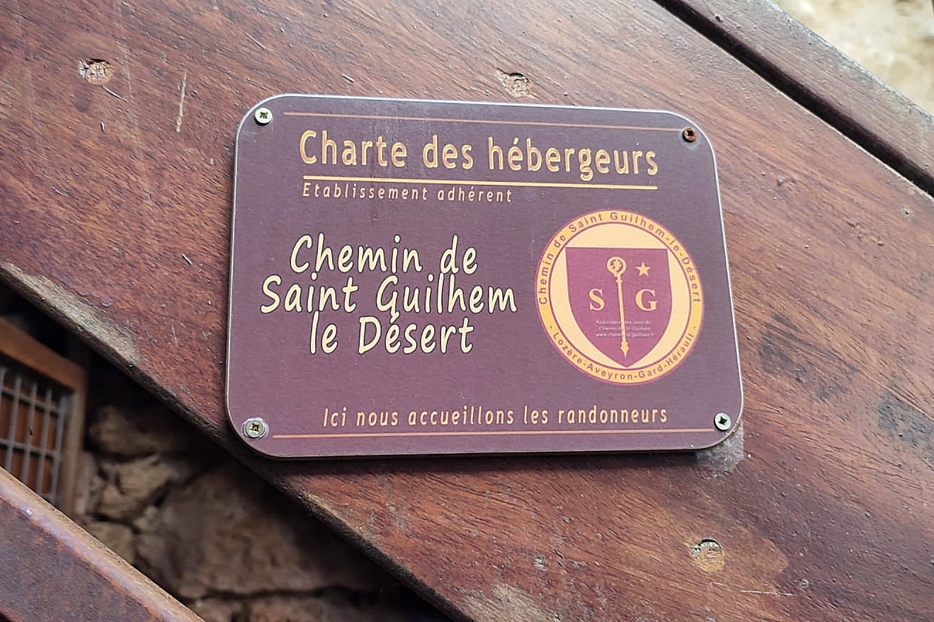
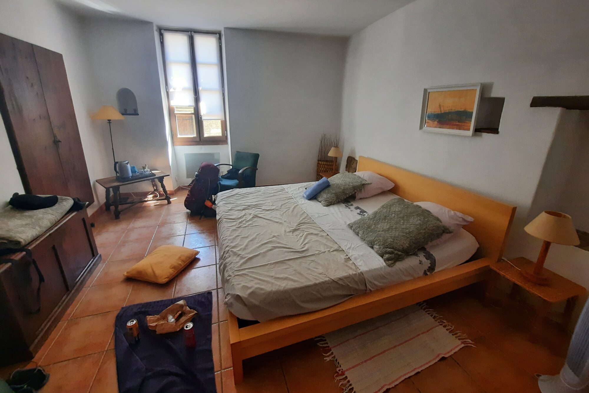
11th night: Guesthouse of la Tour in Saint-Guilhem-le-Désert
→ Nice hostel with large bedroom, self-catering and good breakfast. 85 € per night (breakfast: 10 € per person)
PARKING AND SHUTTLE
We arrived in Aumont-Aubrac by car, and it is possible to leave it free of charge for the duration of the hike in the SNCF station parking lot, which is what we did.
For the return to the car, we opted for the Malle Postale service. This transport service is designed for both hikers and luggage, for those who prefer to travel light. I made the reservation two days before the end of the trek, and they picked us up in Saint-Guilhem-le-Désert the day after our arrival, at 10:30 am. We arrived quietly three hours later in Aumont-Aubrac.
Price: 116 euros for two.

Many thanks to Chemin de Saint-Guilhem for this incredible adventure ❤️!